Street view manufacturing method and system

A production method and production system technology, applied in the field of street view production methods and systems, can solve problems such as unpredictability, lack of overall planning and coordination, and inability to guarantee user accuracy, and achieve the effect of improving accuracy and improving real-time performance.

Inactive Publication Date: 2017-11-10
SHANGHAI YUDE TECH CO LTD
View PDF5 Cites 7 Cited by
  • Summary
  • Abstract
  • Description
  • Claims
  • Application Information

AI Technical Summary

Problems solved by technology

But the disadvantage is that personal behavior is relatively random, unpredictable, and lacks overall planning and coordination. In this way, the information of points of interest is sometimes prone to mislabeling, especially in the touch screen mobile phones currently used. The accuracy of the map cannot be guaranteed. If the user makes a prank mark, the operator will not be able to verify its authenticity. Once the map is drawn based on forged information, it is easy to cause some mistakes, which greatly reduces the user experience.

Method used


Image

  • Street view manufacturing method and system
  • Street view manufacturing method and system
  • Street view manufacturing method and system

Examples


Embodiment 2

[0068] On the other hand, an embodiment of the present invention further provides a street view production system, wherein:

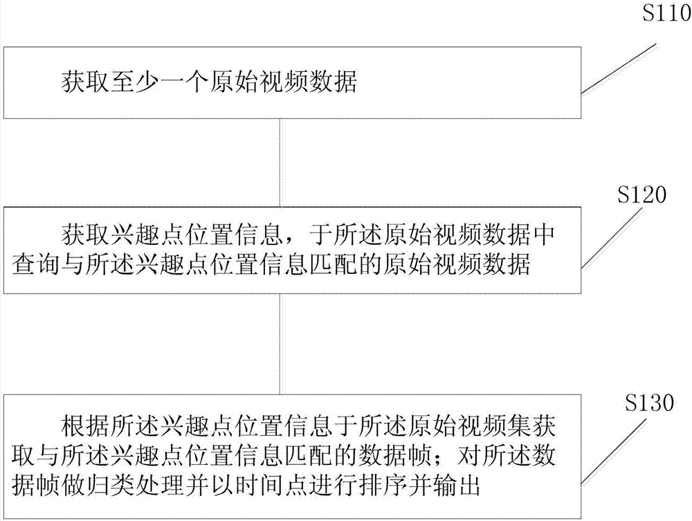
[0069] A reading module, used to obtain at least one original video data;

[0070] The original video data forming module obtains the position information of the point of interest, and queries the original video data matching the position information of the point of interest in the original video data;

[0071] A sorting module, according to the position information of the point of interest, obtains data frames matching the position information of the point of interest in the original video set; classifies the data frames and sorts them by time points and outputs them.

[0072] As a further preferred implementation, the above-mentioned street view production system, wherein the reading module includes;

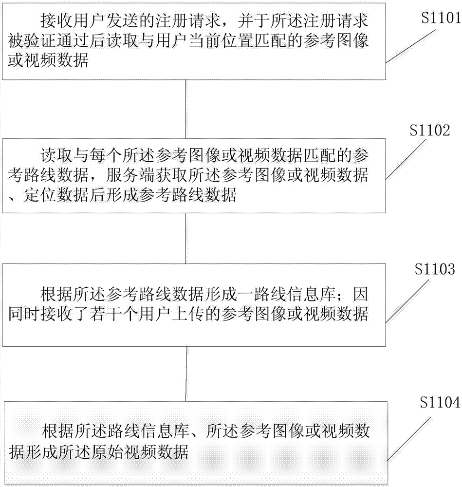
[0073] The registration unit is used to receive the registration request sent by the user, and read the reference image or video data matching the use...


PUM


Abstract

Embodiments of the invention relate to the field of map display, in particular to a street view manufacturing method and system. The street view manufacturing method comprises the following steps of obtaining at least one piece of original video data; obtaining interest point location information and querying original video data matched with the interest point location information from the original video data; obtaining a data frame matched with the interest point location information from an original video set according to the interest point location information; and carrying out classification processing on the data frame and sorting and outputting according to the time. Through the original video data uploaded by a plurality of users, street view images are spliced based on the original video data, on the one hand, the real-time performance of an electronic map is improved, and on the other hand, the accuracy of the electronic map is also improved. Meanwhile, a monitoring function can be also realized.

Description

technical field [0001] Embodiments of the present invention relate to the field of map display, and in particular, to a method and system for creating a street view view. Background technique [0002] Street View is a reality map service that provides users with 360-degree panoramic images of cities, streets, or other environments. Through the street view map, users only need to sit in front of the computer to see the high-definition scene on the street, and get an immersive map browsing experience. [0003] In the prior art, there are mainly two ways to realize the electronic map. One way is that professional organizations with surveying and mapping qualifications use professional equipment to regularly collect pictures related to map routes on the spot, and then perform post-processing. The processing is mainly to splice the pictures taken at a certain place into a complete street view image using seamless splicing technology, and upload the complete street view image to ...

Claims


Application Information

Patent Timeline
Patent Type & Authority Applications(China)
IPC IPC(8): G06F17/30G06T3/40G01C21/36
CPCG01C21/3673G06F16/29G06T3/4038
Inventor 王文斌李承敏叶巧莉包振毅
Owner SHANGHAI YUDE TECH CO LTD
Why Eureka
Try Eureka