
Method and device for constructing motion model of framework site of geocentric coordinate system
A geocentric coordinate system and motion model technology, applied in 3D modeling, complex mathematical operations, structured data retrieval, etc., can solve problems that are difficult to meet accuracy and real-time performance, ignore nonlinear motion, and reduce geocentric coordinate system frame sites Problems such as motion model accuracy
Patent Information
- Authority / Receiving Office
- CN · China
- Current Assignee / Owner
- Publication Date
- 2017-12-15
Smart Images
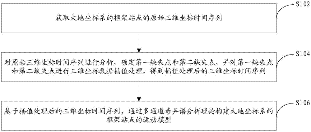
Figure 1 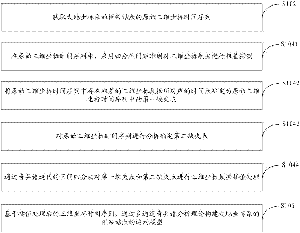
Figure 2 
Figure 3
Abstract
Description
technical field
[0001] The invention relates to the technical field of geocentric coordinate frame and geodetic datum maintenance, in particular to a method and device for constructing a geocentric coordinate frame site motion model. Background technique
[0002] my country launched the China Geocentric Coordinate System CGCS2000 and the corresponding coordinate reference frame on July 1, 2008. In view of the impact of the earth's rotation on the surface mass load, establishing an accurate geocentric coordinate system frame site motion model is the key to maintaining the geocentric An important basis for the accuracy and stability of the coordinate system frame. The establishment of the motion model of the frame site in the geocentric coordinate system needs to analyze the coordinate time series of the frame site and study the noise characteristics and other characteristics of the frame site.
[0003] At present, in the process of establishing the geocentric coordinate syste...
Examples
Embodiment 1
[0069] An embodiment of the present invention provides a method for constructing a geocentric coordinate system frame site motion model, such as figure 1 shown, including:
[0070] Step S102, obtaining the original three-dimensional coordinate time series of the framework site in the geodetic coordinate system, wherein the original three-dimensional coordinate time series includes three-dimensional coordinate data of the framework site at different times, and one three-dimensional coordinate data corresponds to one time point.
[0071] Step S104, analyze the original three-dimensional coordinate time series, determine the first missing point and the second missing point, and perform three-dimensional coordinate data interpolation processing on the first missing point and the second missing point, and obtain the interpolated three-dimensional coordinate time series , where the first missing point is the time point corresponding to the three-dimensional coordinate data with gros...
Embodiment 2
[0111] An embodiment of the present invention provides a device for constructing a geocentric coordinate system frame site motion model, such as Figure 4 shown, including:
[0112] The obtaining module 100 is used to obtain the original three-dimensional coordinate time series of the frame site in the geodetic coordinate system, wherein the original three-dimensional coordinate time series includes the three-dimensional coordinate data of the frame site at different times, and one three-dimensional coordinate data corresponds to one time point;
[0113] The interpolation processing module 200 is used to analyze the original three-dimensional coordinate time series, determine the first missing point and the second missing point, and perform three-dimensional coordinate data interpolation processing on the first missing point and the second missing point, and obtain the interpolated A three-dimensional coordinate time series, wherein the first missing point is the time point co...
Embodiment 3
[0138] An embodiment of the present invention provides a computer program product of a method and device for constructing a geocentric coordinate system frame station motion model, including a computer-readable storage medium storing program codes, and the instructions included in the program codes are used to execute the first embodiment. For the method of constructing the motion model of the frame site in the geocentric coordinate system, the specific implementation may refer to the method embodiment, and will not be repeated here.
[0139] In the embodiment of the present invention, the program code instructions stored in the computer-readable storage medium are used to execute the method for constructing the geocentric coordinate system frame site motion model in the first embodiment, specifically, the first deletion of the original three-dimensional coordinate time series point and the second missing point are subjected to three-dimensional coordinate data interpolation pr...