
Navigation method, terminal and computer readable medium

A navigation method and navigation map technology, applied in the field of navigation, can solve the problem of inaccurate navigation position, achieve the effect of intuitive navigation mode, improve accuracy, and quickly locate and find the target position

Inactive Publication Date: 2018-02-23
SHENZHEN GIONEE COMM EQUIP
View PDF0 Cites 8 Cited by
  • Summary
  • Abstract
  • Description
  • Claims
  • Application Information

AI Technical Summary

Problems solved by technology

[0002] In the existing navigation process, due to the positioning technology (such as Global Positioning System (GPS), Assisted Global Positioning System, AGPS), etc.) have a certain accuracy range, and because the detailed level of the map cannot be exactly the same as the real environment, there will be a certain degree of deviation when the coordinates of the positioning and the coordinates in the map are converted, etc., the navigation software used There are also certain errors in the navigation map, so there is a problem that the navigation position is not accurate enough

Method used


Image

  • Navigation method, terminal and computer readable medium
  • Navigation method, terminal and computer readable medium
  • Navigation method, terminal and computer readable medium

Examples


Embodiment Construction

[0021] The technical solutions in the embodiments of the present invention will be clearly and completely described below with reference to the accompanying drawings in the embodiments of the present invention. Obviously, the described embodiments are part of the embodiments of the present invention, but not all of the embodiments. Based on the embodiments of the present invention, all other embodiments obtained by those of ordinary skill in the art without creative efforts shall fall within the protection scope of the present invention.

[0022] It is to be understood that, when used in this specification and the appended claims, the term "comprising" indicates the presence of the described feature, integer, step, operation, element and / or component, but does not exclude one or more other features , whole, step, operation, element, component and / or the presence or addition of a collection thereof.

[0023] It is also to be understood that the terminology used in this specific...


PUM


Abstract

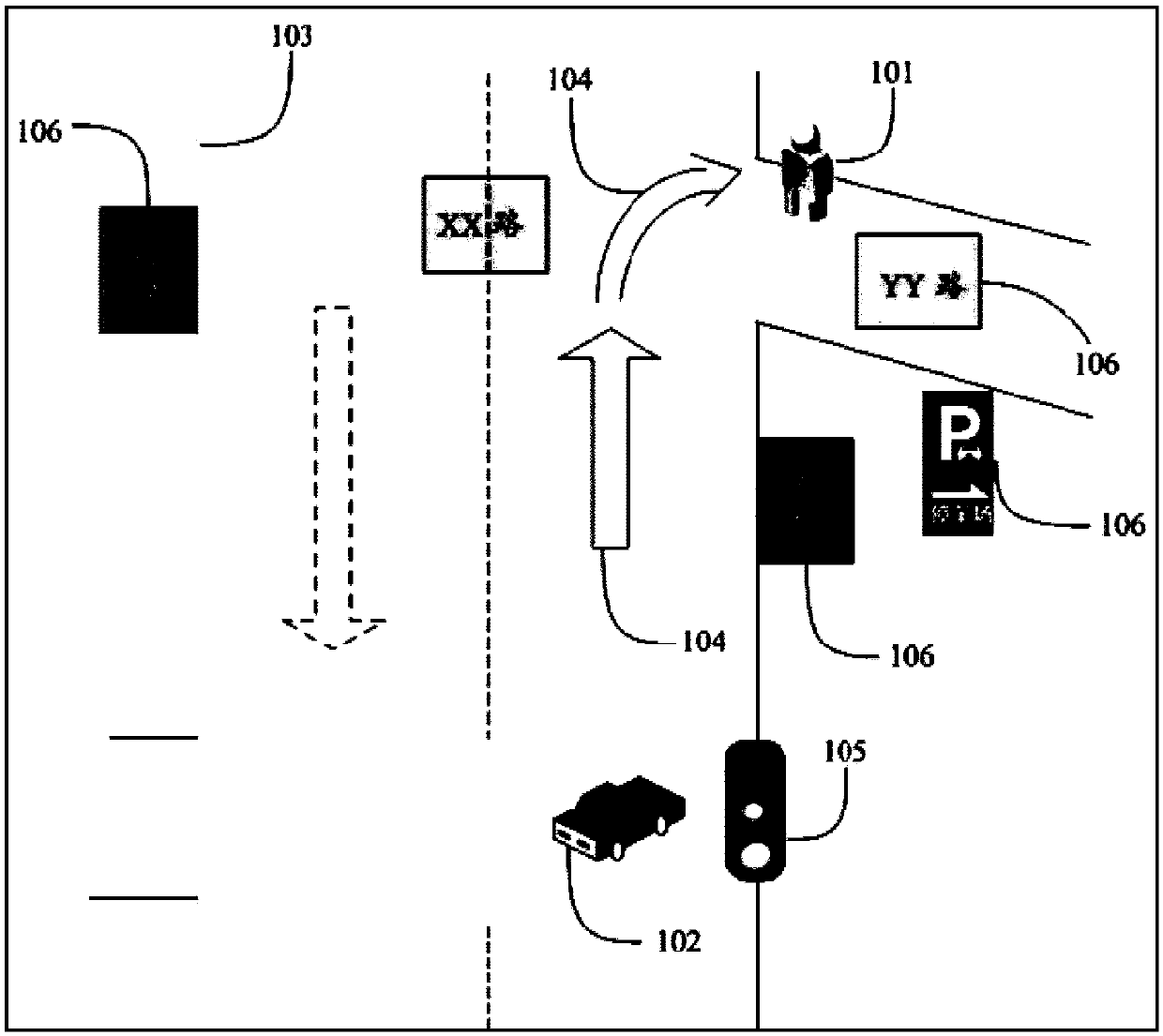
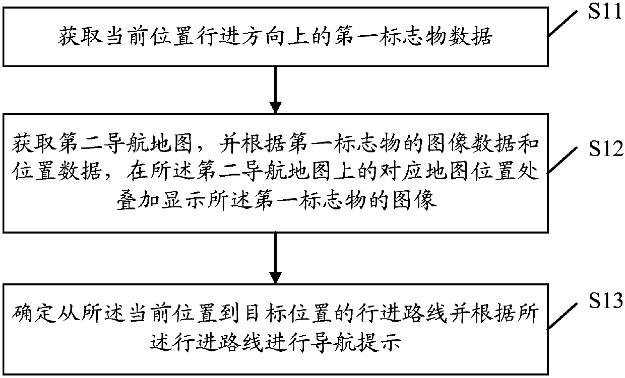
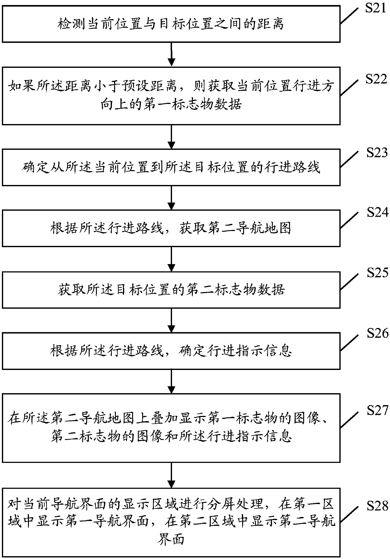
The embodiment of the present invention discloses a navigation method, a terminal, and a computer-readable medium, wherein the method includes: acquiring first marker data in the traveling direction of the current position, the first marker data including image data of the first marker and Position data; acquire the second navigation map, and superimpose and display the image of the first marker at the corresponding map position on the second navigation map according to the image data and position data of the first marker; determine from the current The traveling route from the position to the target position is provided with a navigation prompt according to the traveling route, and the traveling route includes the position of the first marker indicated by the position data of the first marker. In the embodiment of the present invention, a more comprehensive and intuitive navigation method can be provided by superimposing and displaying images of landmarks on a navigation map.

Description

technical field [0001] The present invention relates to the technical field of navigation, and in particular, to a navigation method, a terminal and a computer-readable medium. Background technique [0002] In the existing navigation process, due to the positioning technology (such as Global Positioning System (GPS), Assisted Global Positioning System (Assisted Global Positioning System, Assisted Global Positioning System) adopted by mobile terminals (such as mobile phones, tablet computers, etc.) or vehicle-mounted terminals AGPS), etc.) have a certain range of accuracy, and because the detailed level of the map cannot be exactly the same as the real environment, there will be a certain degree of deviation when the coordinates that are located and the coordinates in the map are converted. The navigation map also has certain errors, so the navigation position is not accurate enough. How to more comprehensively remind the user of the navigation location has become a research...

Claims


Application Information

Patent Timeline
IPC IPC(8): G01C21/30G01C21/36
CPCG01C21/30G01C21/3626
Inventor 黄儒鸿熊林
Owner SHENZHEN GIONEE COMM EQUIP
Learn More