
Rule-library-based multi-source map vector tile rendering system

A rendering system and rule technology, applied in the field of rendering system, can solve the problem of lack of compatibility with multiple map data formats at the same time, geographic data integration and sharing, etc.

Active Publication Date: 2018-05-08
NO 32 RES INST OF CHINA ELECTRONICS TECH GRP
View PDF5 Cites 9 Cited by
  • Summary
  • Abstract
  • Description
  • Claims
  • Application Information

AI Technical Summary

Problems solved by technology

Lack of a unified algorithm and framework for spatial data access and visualization, cannot provide lightweight real-time map rendering support for embedded navigation application systems, and cannot be compatible with multiple map data formats and geographic data in multi-source map data Integrate and share

Method used


Image

  • Rule-library-based multi-source map vector tile rendering system

Examples


Embodiment Construction

[0026] The preferred embodiments of the present invention are given below in conjunction with the accompanying drawings to describe the technical solution of the present invention in detail.

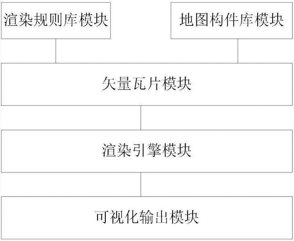
[0027] Such as figure 1 As shown, the multi-source map vector tile rendering system based on the rule base of the present invention includes:

[0028] Rendering rule library module, which includes two parts: metadata set and rule set, which are used to extract and assemble rendering styles. Rendering styles are expressed by a series of rules describing styles. These style rules are modularly organized into style blocks. Act on various feature objects on the map; each style block is composed of several rules, and the style block has its corresponding scope;

[0029] Map component library module, which is used to shield the differences in organizational structure and access interface of multi-source data, and provide a unified resource access interface, including three parts: data preproc...


PUM


Abstract

The invention discloses a rule-library-based multi-source map vector tile rendering system, comprising: a rendering rule library module that includes a data set and a rule set and is used for extracting and assembling a rendering style, wherein the rendering style is expressed via a series of descriptive style rules, these style rules are modularly organized into style blocks that act on various element objects on a map, each style block is composed of a plurality of rules, and each style block has its corresponding scope; and other modules. The system of the invention can establish a component-based map data visualization frame and allow plug and play for components on a domain framework.

Description

technical field [0001] The invention relates to a rendering system, in particular to a multi-source map vector tile rendering system based on a rule base. Background technique [0002] The navigation electronic map application based on the second-generation satellite navigation system faces the characteristics of complex structure, multi-scale and large data volume of traditional geographic data. Lack of a unified algorithm and framework for spatial data access and visualization, cannot provide lightweight real-time map rendering support for embedded navigation application systems, and cannot be compatible with multiple map data formats and geographic data in multi-source map data Integrate and share. Contents of the invention [0003] The technical problem to be solved by the present invention is to provide a multi-source map vector tile rendering system based on a rule base, which can establish a componentized map data visualization framework and realize plug-and-play o...

Claims


Application Information

Patent Timeline
IPC IPC(8): G06F17/30G06T17/05
CPCG06T17/05G06F16/29
Inventor 陈景刘爱龙姚霄飞陈涛姜婷婷徐鑫朋孙哲
Owner NO 32 RES INST OF CHINA ELECTRONICS TECH GRP
Learn More