
Geosteering method for extended-reach horizontal wells in shale gas while drilling based on two-dimensional seismic data

A seismic data and geosteering technology, applied in drilling equipment and methods, directional drilling, earthwork drilling and production, etc., can solve the problems of poor horizontal wellbore trajectory travel and other problems, and achieve accurate and reliable analysis results, simple application, and rigorous thinking Effect

Active Publication Date: 2020-05-05
SINOPEC JIANGHAN OILFIELD SERVICE CORP +1
View PDF5 Cites 0 Cited by
  • Summary
  • Abstract
  • Description
  • Claims
  • Application Information

AI Technical Summary

Problems solved by technology

At present, domestic and foreign geosteering technology while drilling has a good application effect in 3D seismic exploration areas, but for low-level exploration areas where only 2D seismic lines are deployed, the horizontal wellbore trajectory travels poorly

Method used


Image

  • Geosteering method for extended-reach horizontal wells in shale gas while drilling based on two-dimensional seismic data
  • Geosteering method for extended-reach horizontal wells in shale gas while drilling based on two-dimensional seismic data
  • Geosteering method for extended-reach horizontal wells in shale gas while drilling based on two-dimensional seismic data

Examples


Embodiment Construction

[0031] In order to have a clearer understanding of the technical features, purposes and effects of the present invention, the specific implementation manners of the present invention will now be described in detail with reference to the accompanying drawings.

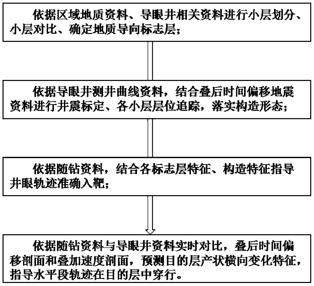
[0032] Such as figure 1 As shown, the shale gas extended-reach horizontal well geosteering method while drilling based on two-dimensional seismic data of the present invention comprises the following steps:

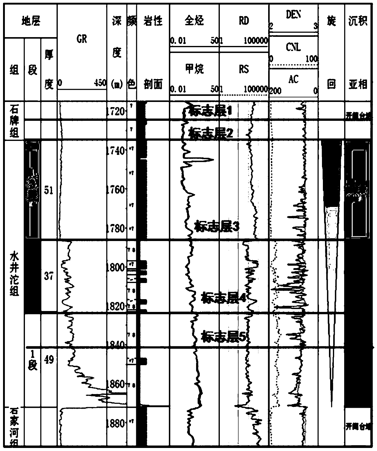
[0033] Step (1), carrying out stratigraphic division and comparing the identification of marker layers: combining regional geological data, pilot well lithology, and electrical characteristics, the target layer of Well XX is divided into three sections, namely S1, S2, and S3, of which The main shale formation is distributed in the S1 member, with a thickness of 49m. On the basis of segmentation, the main target layer is further subdivided into 5 sublayers according to the characteristics of the logging curve of th...


PUM


Abstract

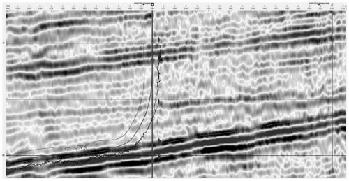
The invention discloses a while-drilling geosteering method of a shale gas large displacement horizontal well based on two-dimensional seismic data. The while-drilling geosteering method comprises thefollowing steps that the drilling data and regional geological data of a pilot well and related design data of a horizontal well are combined to perform detailed classification on a drilling stratumand a main traversing target stratum, and marker beds of all stages are determined; and based on the data of a two-dimensional post-stack time profile and stacking velocity, a Discovery integrated geological interpretation system is used for detailed interpretation, the target stratum is subjected to fine tracking and comparison, the structure form of a target area is mastered, and the borehole trajectory is adjusted to realize the horizontal section geosteering. The while-drilling geosteering method of the shale gas large displacement horizontal well based on the two-dimensional seismic datahas the characteristics of method innovation, rigorous thinking, simple application and accurate and reliable analysis results.

Description

technical field [0001] The present invention relates to shale gas development technology, more specifically, relates to a shale gas large-displacement horizontal well drilling-while-drilling geosteering method based on two-dimensional seismic data. Background technique [0002] The development of shale reservoirs mainly adopts long horizontal section multi-stage perforation and fracturing technology. The penetration effect of horizontal wellbore trajectory in the reservoir is the basic condition for increasing single well production, while geosteering technology is to ensure the horizontal wellbore trajectory. The only means of walking through the effect. At present, domestic and foreign geosteering technologies while drilling are effective in 3D seismic exploration areas, but for low exploration areas where only 2D seismic lines are deployed, the horizontal wellbore trajectory travels poorly. Contents of the invention [0003] The technical problem to be solved by the pr...

Claims


Application Information

Patent Timeline
Patent Type & Authority Patents(China)
IPC IPC(8): E21B7/04E21B47/00G06Q50/02
CPCE21B7/046E21B47/00G06Q50/02
Inventor 陈孝红袁发勇崔云海张寅胡力
Owner SINOPEC JIANGHAN OILFIELD SERVICE CORP
Learn More