

Slanted image positioning method and system of unmanned aerial vehicle, medium and device
A technology of oblique image and positioning method, applied in the field of remote sensing, can solve the problems of inability to meet the positioning requirements of UAV oblique image, high measurement cost, etc., and achieve the effect of reducing measurement cost and accurate position coordinates
- Summary
- Abstract
- Description
- Claims
- Application Information
AI Technical Summary
Problems solved by technology
Method used
Image

Examples
Embodiment Construction
[0044] The following will clearly and completely describe the technical solutions in the embodiments of the present invention with reference to the accompanying drawings in the embodiments of the present invention. Obviously, the described embodiments are only some, not all, embodiments of the present invention. Based on the embodiments of the present invention, all other embodiments obtained by persons of ordinary skill in the art without making creative efforts belong to the protection scope of the present invention.
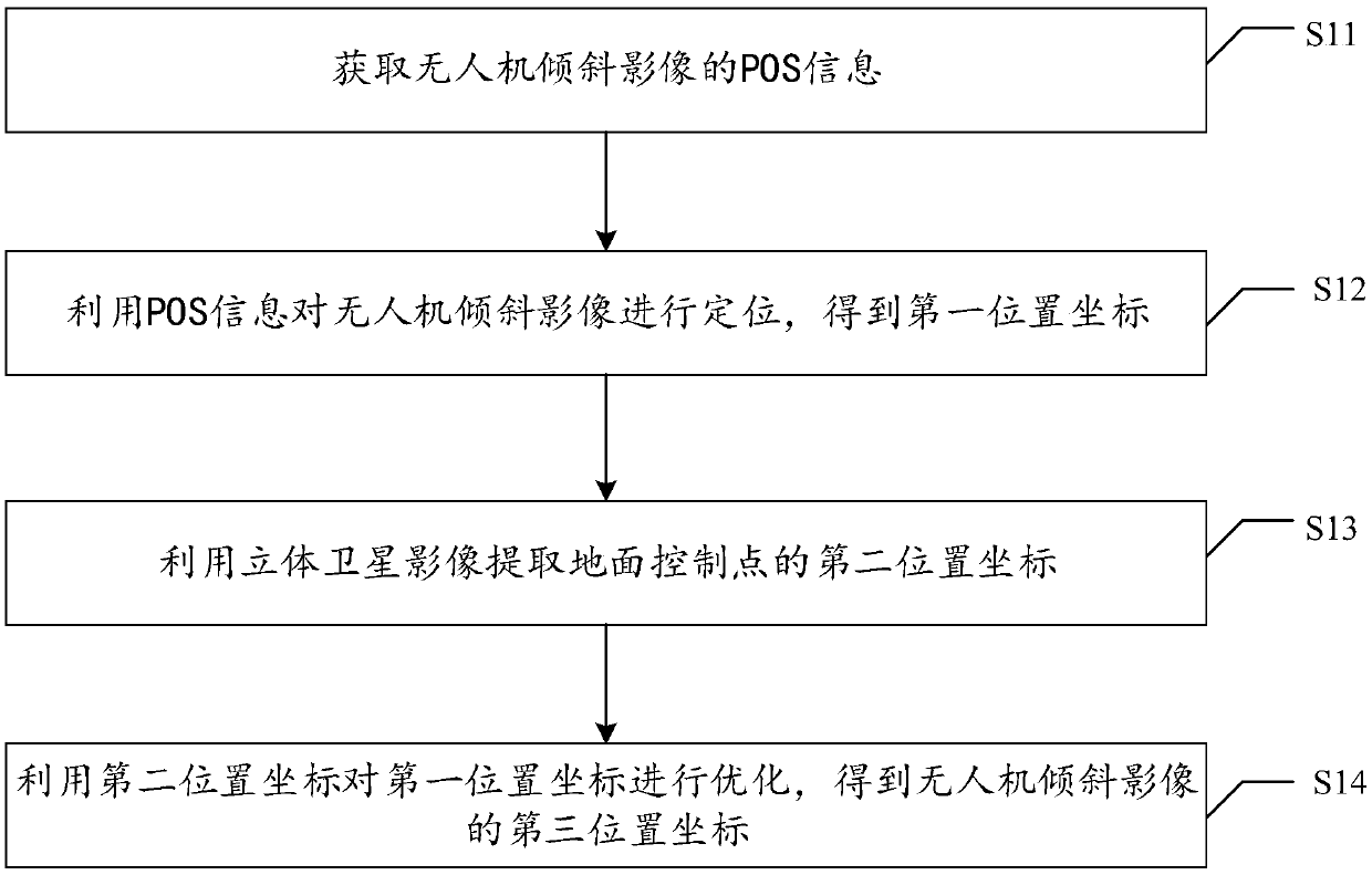
[0045] The embodiment of the present invention discloses a UAV oblique image positioning method, such as figure 1 As shown, the method includes:
[0046] Step S11: Obtain the POS information of the oblique image of the drone;
[0047] It is understandable that in order to locate the oblique image of the UAV, it is first necessary to obtain the POS information of the oblique image of the UAV, because the POS information contains the position coordinates and va...
PUM
 Abstract
Description
Claims
Application Information