

Method for realizing data superposition display based on matrix coordinate conversion
A technology of coordinate conversion and superimposed display, applied in the field of urban transportation, can solve the problems of inability to sense the real-time speed of vehicles in a timely manner, and the real-time monitoring video has no computing function, and achieve the effect of simplifying the difficulty of law enforcement
- Summary
- Abstract
- Description
- Claims
- Application Information
AI Technical Summary
Problems solved by technology
Method used
Image

Examples
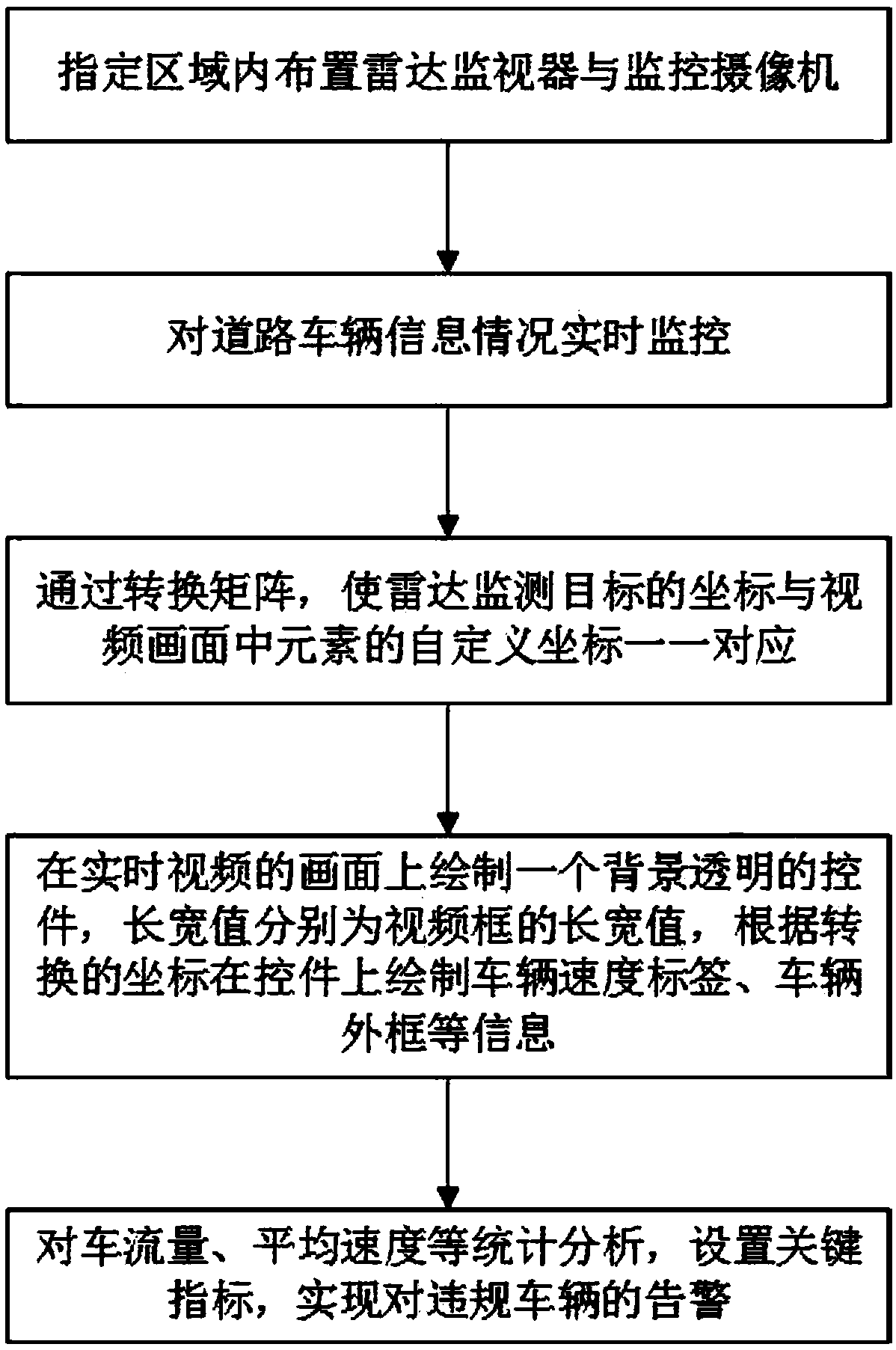
Embodiment 1
[0042] Experimental location: the intersection of Xiangzhang Avenue and Ginkgo Road in Hefei High-tech Development Zone;
[0043] Experimental steps:
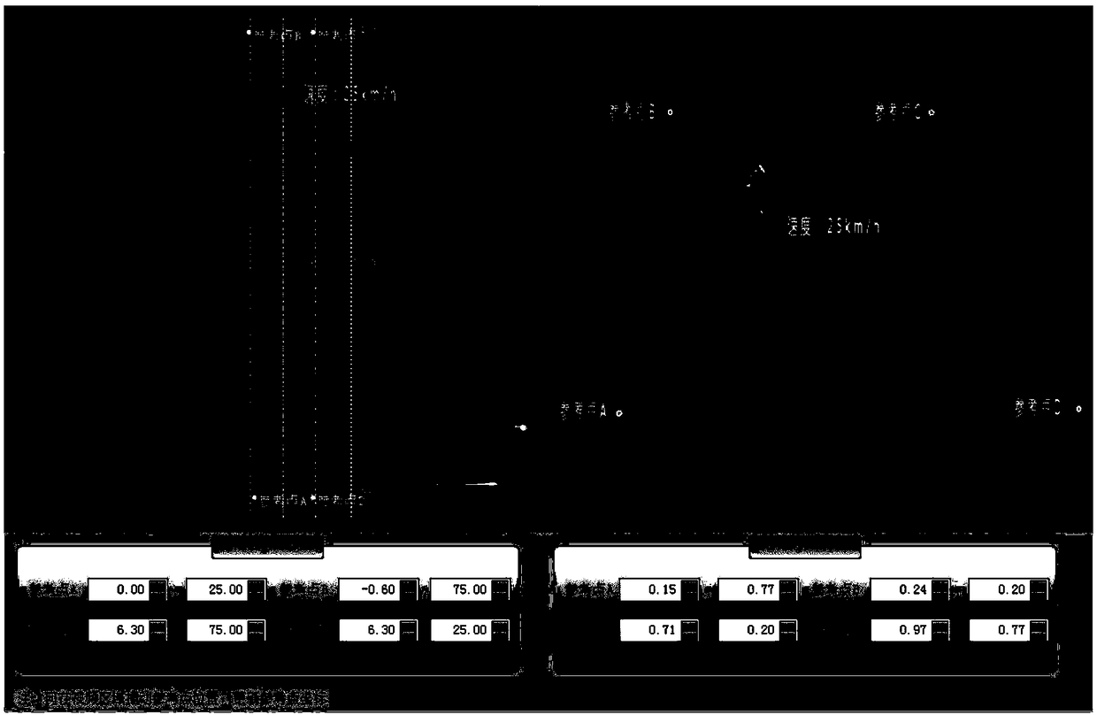
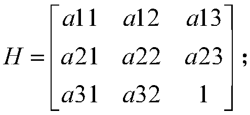
[0044] 1), figure 2 The picture on the left is a planar coordinate system drawn in real space. The coordinate origin is the intersection of three thin lines that gradually diverge from bottom to top in the screen. Set four reference points A, B, C, and D in the plane coordinate system, and drag them to the four positions shown in the figure, and obtain the coordinates as follows:
[0045] A: (0.00, 25.00), B: (-0.60, 75.00), C: (6.30, 75.00), D: (6.30, 25.00).
[0046] 2), figure 2 On the right is the real-time video surveillance picture of the real space. The coordinate origin is the lower left corner of the monitoring screen. Similarly, set four reference points A, B, C, and D in the video monitoring screen, and drag the positions shown in the figure respectively. At this point, please ensure that the four reference ...
PUM
 Abstract
Description
Claims
Application Information