

A satellite image super-resolution method based on adversarial network and aerial image a priori
A satellite image and aerial image technology, applied in the field of image super-resolution, can solve problems such as non-paired nature
- Summary
- Abstract
- Description
- Claims
- Application Information
AI Technical Summary
Problems solved by technology
Method used
Image

Examples
Embodiment Construction
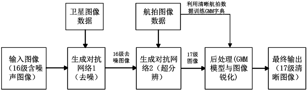
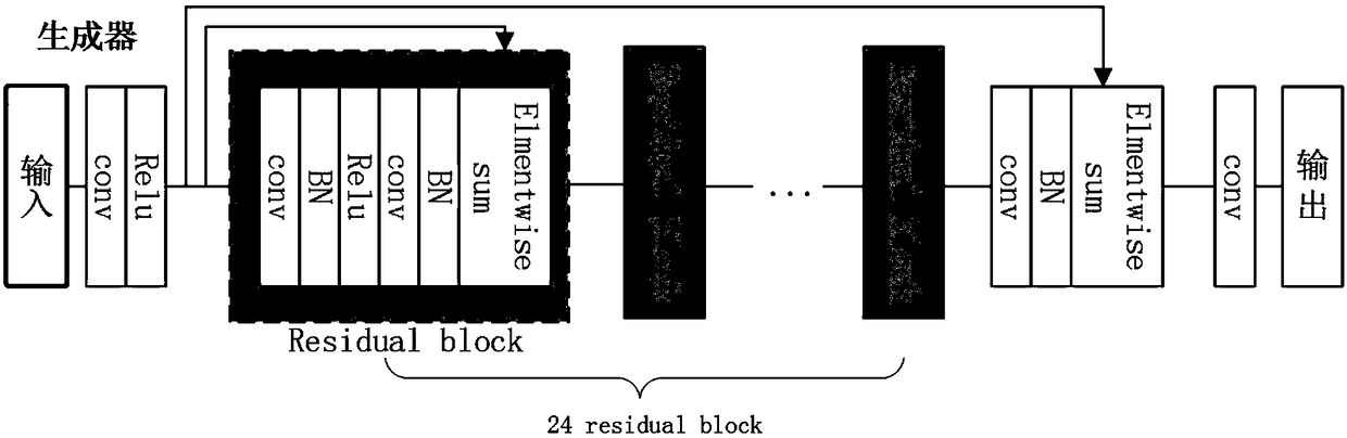
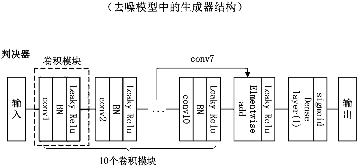
[0074] The present invention provides a satellite image super-resolution method based on multi-scale perceptual loss and generative confrontation network combined with aerial image prior. Noise model, and then use clear aerial data to train image super-resolution model. Since there is no pair of satellite images and aerial images, when post-processing the generated super-resolution images, the clear aerial images are used to construct the external prior dictionary of the GMM model, and thus guide the internal unclear satellite images to be reconstructed . After reconstruction, in order to further improve the image quality, the Gaussian filter is used for image sharpening. Finally, the high-resolution image of the original satellite image is obtained, and the visual quality of the image is improved based on the original satellite image. The effectiveness of this scheme can also be seen from the experimental link. It provides an effective idea to solve the satellite image sup...
PUM
 Abstract
Description
Claims
Application Information