Phase filtering method and height measuring method of spaceborne interference imaging altimeter

A technology of interference imaging and phase filtering, which is applied in radio wave measurement systems, measurement devices, radio wave reflection/re-radiation, etc., can solve the problems of unevenness of height error along the cross-track direction and reduction of height measurement accuracy

Active Publication Date: 2019-01-01
NAT SPACE SCI CENT CAS
View PDF2 Cites 11 Cited by
  • Summary
  • Abstract
  • Description
  • Claims
  • Application Information

AI Technical Summary

Problems solved by technology

The traditional radar interferometric phase filtering method is designed for large-angle interference synthetic aperture radar. In the case of small-angle interference, there will be a problem of uneven altitude error along the cross-track direction, which will reduce the accuracy of altitude measurement.

Method used


Image

  • Phase filtering method and height measuring method of spaceborne interference imaging altimeter
  • Phase filtering method and height measuring method of spaceborne interference imaging altimeter
  • Phase filtering method and height measuring method of spaceborne interference imaging altimeter

Examples


Embodiment Construction

[0065] In order to better understand the technical solutions of the present invention, the implementation manners of the present invention will be further described below in conjunction with the accompanying drawings.

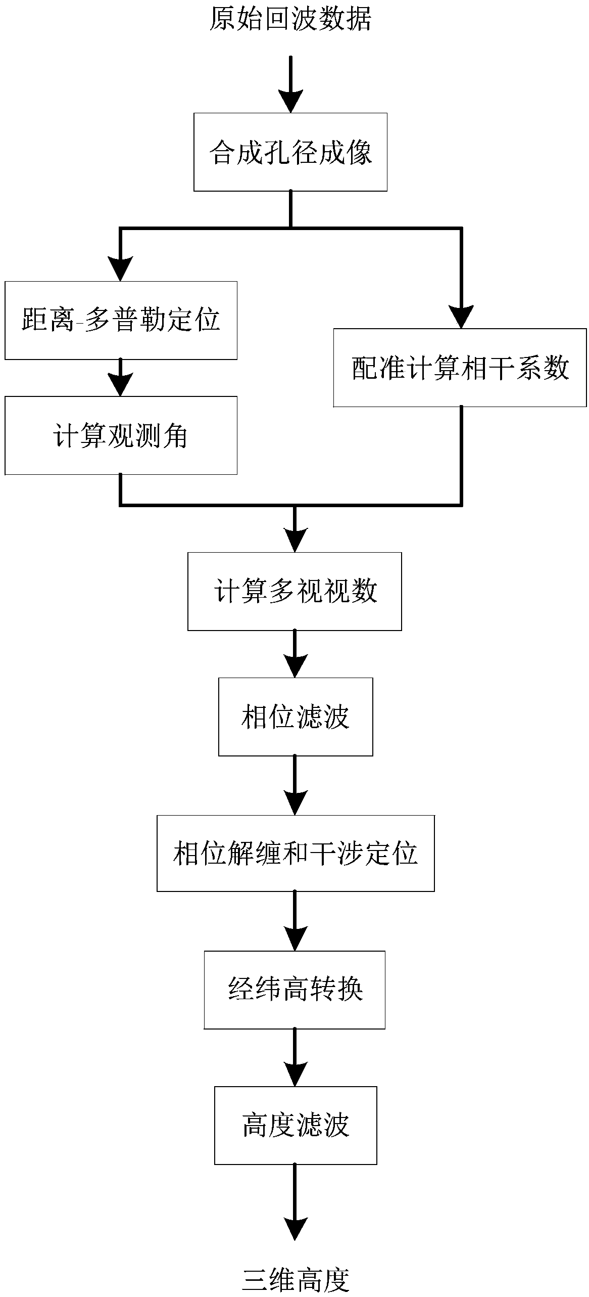
[0066] like figure 1 As shown, the height measurement method of a kind of interferometric radar altimeter that the present invention proposes, the specific steps of this method comprise:

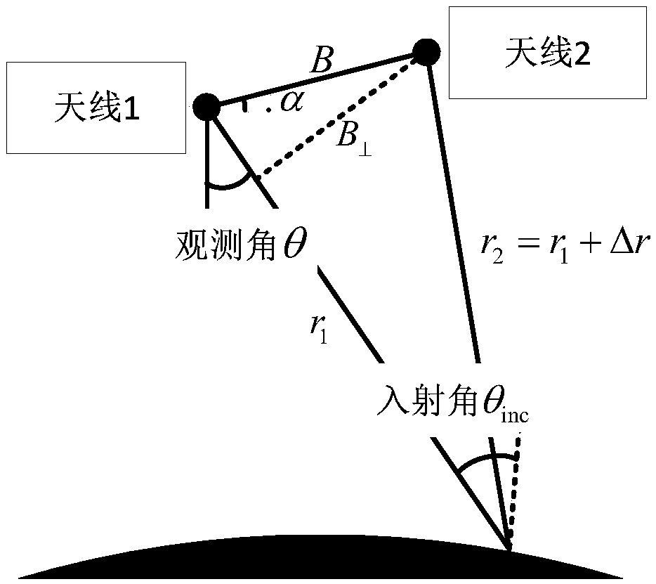
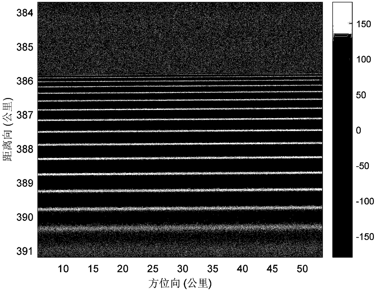
[0067] Step 1) Perform synthetic aperture imaging processing on the data of the two receiving channels of the spaceborne interferometric imaging altimeter to obtain two complex images s 1 (n a ,n r ) and s 2 (n a ,n r ), where n r and n a The serial numbers of the horizontal and vertical coordinates of the two image pixels, in the form of s 1 (n a ,n r ) as a reference to register the two complex images, and then calculate the coherence coefficient γ(n a ,n r ):

[0068]

[0069] Among them, Π a (n a ) is the effective interval of the azimuth slow time, Π r...


PUM


Abstract

The invention discloses the phase filtering method and the height measuring method of a spaceborne interference imaging altimeter. The phase filtering method comprises the following steps of carryingout synthetic aperture imaging processing on the data of the two receiving channels of the spaceborne interference imaging altimeter to obtain two complex images, taking one of the images as a benchmark to register the two complex images, and calculating the coherence coefficient of the two registered images; successively calculating the geometric position, the observation angle, and the multi-view number of each pixel in the images; determining the azimuth filtering window size and the distance filter window size of each pixel, and determining the azimuth filtering interval and the distance filtering interval of each pixel; and carrying out conjugate multiplication on the two complex images, simultaneously removing a horizon phase, then, filtering each pixel in the azimuth filtering interval and the distance filtering interval, and finally acquiring the filtered interference phase. Based on the above phase filtering method, the invention also provides the height measuring method of the spaceborne interference imaging altimeter.

Description

technical field [0001] The invention relates to the technical field of radar signal processing, in particular to a phase filtering method and an altitude measurement method of a spaceborne interferometric imaging altimeter. Background technique [0002] The space-borne interferometric imaging altimeter is a device that uses short baseline and small-angle interferometric technology to measure the height of the sea surface and land. The space-borne interferometric imaging altimeter observes the earth's surface by deviating from the zenith, and simultaneously receives the radar echoes reflected by the earth's surface through two receiving antennas. wave, after processing, the phase difference of the observation images of the two antennas is obtained, also known as the interferometric phase, combined with the position of the phase center of the radar altimeter antenna to obtain the height of the earth’s surface (literature [1]: Y. Zhang, J. Jiang, H. Zhang, and D. Zhang, "Spaceb...

Claims


Application Information

Patent Timeline
Patent Type & Authority Applications(China)
IPC IPC(8): G01S7/41G01S13/90
CPCG01S7/41G01S13/9023G01S13/882
Inventor 董晓张云华翟文帅
Owner NAT SPACE SCI CENT CAS
Why Eureka
Try Eureka