

Ground operation control network system for space-based global real-time continuous monitoring
A network system and ground technology, applied in closed-circuit television systems, transmission systems, radio transmission systems, etc., can solve problems such as high cost, immature geostationary high-resolution satellite technology, and lack of real-time video observation capabilities, etc., to reduce cost, expand system performance and timeliness, and improve the effect of development and production efficiency
- Summary
- Abstract
- Description
- Claims
- Application Information
AI Technical Summary
Problems solved by technology
Method used
Image

Examples
Embodiment Construction
[0020] The ground operation and control network system suitable for space-based global real-time continuous monitoring proposed by the present invention will be further described in detail below in conjunction with the accompanying drawings and specific embodiments.
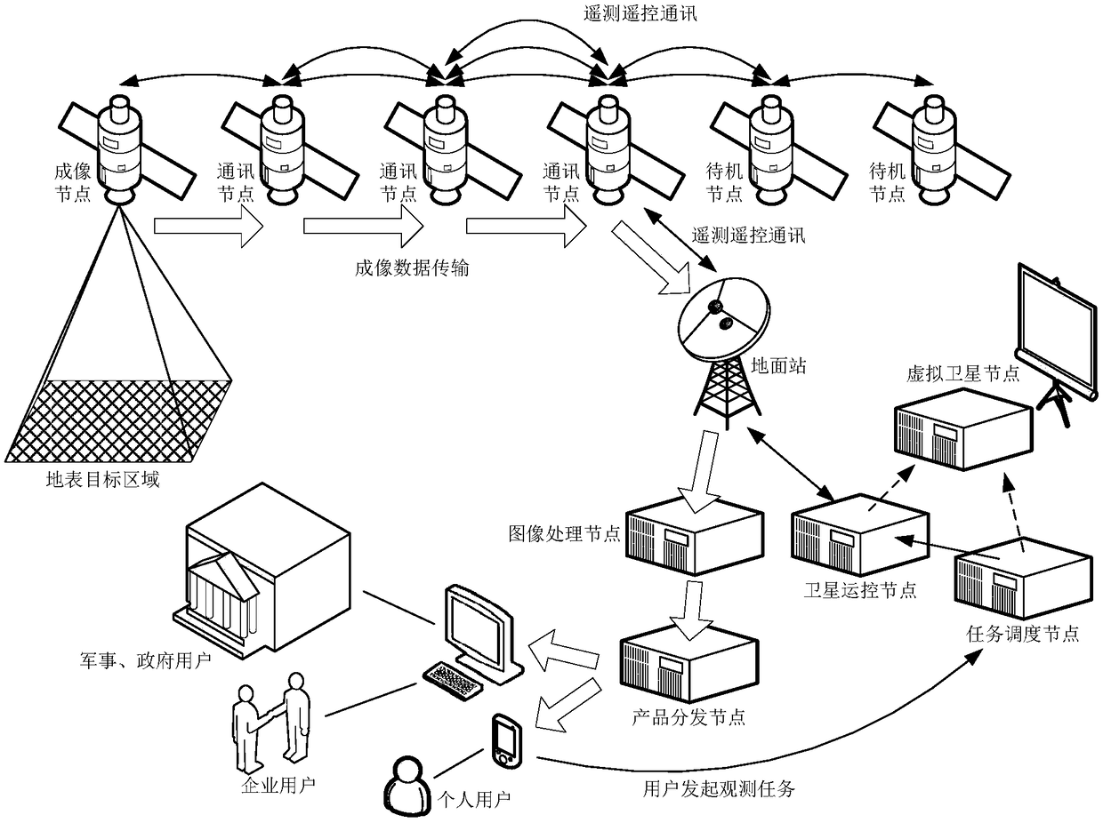
[0021] Such as figure 1 As shown, the embodiment of the present invention provides a ground operation and control network system suitable for space-based global real-time continuous monitoring. Carry out online real-time remote measurement and control of the entire network, receive and process remote sensing data, and distribute them to users in real time through the Internet; including satellite operation and control nodes, which are used to receive status parameter telemetry data of satellite nodes in the entire network in real time, and monitor the working status of each satellite node Real-time evaluation; send satellite control commands according to the working status of various satellite nodes, space enviro...
PUM
 Abstract
Description
Claims
Application Information