
A Monitoring Method of GBAS Ionospheric Spatial Gradient Based on Pseudolites

A space gradient and pseudolite technology, applied in satellite radio beacon positioning systems, radio wave measurement systems, measurement devices, etc., can solve the problems of mutual influence of monitoring results and high complexity of monitoring algorithms, so as to improve monitoring accuracy and eliminate The effect of mutual interference

Active Publication Date: 2020-06-30
NO 54 INST OF CHINA ELECTRONICS SCI & TECH GRP
View PDF4 Cites 0 Cited by
  • Summary
  • Abstract
  • Description
  • Claims
  • Application Information

AI Technical Summary

Problems solved by technology

[0008] The purpose of the present invention is to propose a monitoring method of ionospheric spatial gradient based on pseudolites in order to overcome the existing GBAS ionospheric storm monitoring algorithm different satellite ionospheric gradient monitoring results mutual influence, monitoring algorithm complexity is high

Method used


Image

  • A Monitoring Method of GBAS Ionospheric Spatial Gradient Based on Pseudolites
  • A Monitoring Method of GBAS Ionospheric Spatial Gradient Based on Pseudolites
  • A Monitoring Method of GBAS Ionospheric Spatial Gradient Based on Pseudolites

Examples


Embodiment Construction

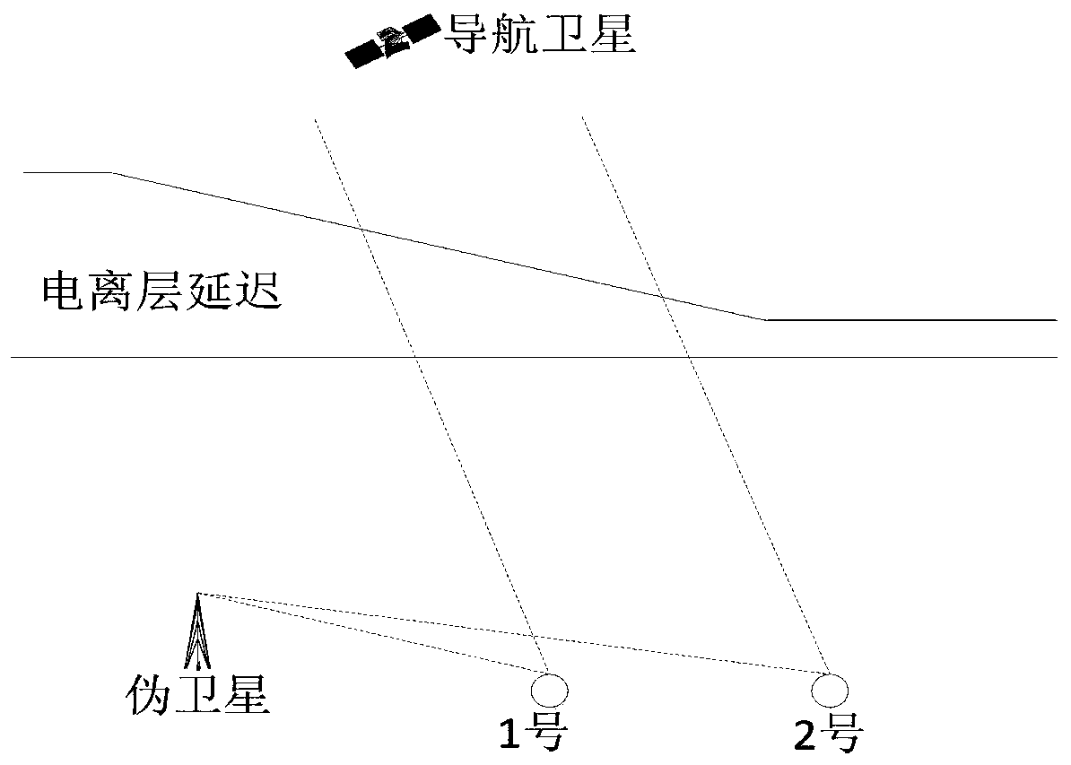
[0034] In order to better illustrate the purpose and advantages of the present invention, below in conjunction with the attached Figure 1-2 And embodiment technical scheme of the present invention is described further. In this specific implementation manner, a typical GBAS system enhanced by a pseudolite will be used as an example for description. The monitoring equipment in the present invention includes: 1 set of pseudolites and no less than 3 reference receivers. Schematic such as figure 1 shown;

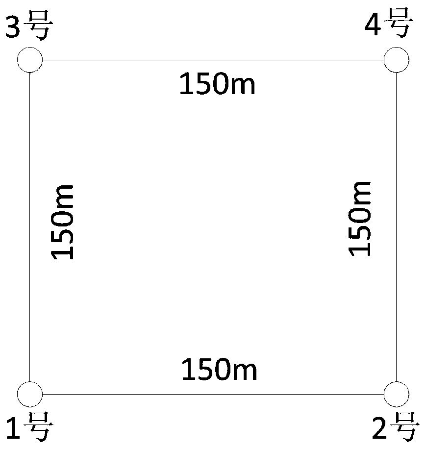
[0035] For the convenience of describing the algorithm, the scale of the problem is further reduced, such as figure 2 Four reference stations are deployed. In this paper, it is assumed that the frequency point is GPS L1, and the four monitoring receivers are distributed in a square with a side length of 150m. That is, receiver No. 2 is located 150m east of receiver No. 1, and receiver No. No. 1 receiver is 150m due north, No. 4 receiver is located 150m due east of No. 3 rec...


PUM


Abstract

The invention discloses a pseudolite-based GBAS ionospheric spatial gradient monitoring method, which is mainly used for satellite navigation Ground Based Augmentation System (Ground Based Augmentation System, GBAS) ionospheric storm monitoring and related application fields, and it uses pseudolite observations Introduced into the monitoring algorithm, it overcomes the problems of the existing GBAS ionospheric storm monitoring algorithm, the mutual influence of different satellite ionospheric gradient monitoring results, and the high complexity of the fault isolation algorithm, and realizes the isolation monitoring of a single satellite ionospheric storm; at the same time, it proposes the GBAS monitoring The station does not account for the characteristics of high monitoring accuracy and flexible and simple implementation.

Description

technical field [0001] The invention relates to a monitoring method of GBAS ionospheric space gradient based on pseudolite, and belongs to the technical field of integrity monitoring in satellite navigation. Background technique [0002] GBAS can support the full-stage permission requirements of military and civil aviation aircraft for precision approach, landing, departure, and surface surveillance. Compared with traditional land-based instrument landing systems, it can support curved operations, low site requirements, and a single system can meet multiple runways. The characteristics of high precision, high efficiency and low cost are the development needs of future airport navigation equipment. GBAS mainly uses multiple monitoring receivers distributed on the ground to collect the original observation data in real time and send them to the ground information processing equipment. The ground information processing equipment receives and processes the difference and integri...

Claims


Application Information

Patent Timeline
Patent Type & Authority Patents(China)
IPC IPC(8): G01S19/27G01S19/29
CPCG01S19/27G01S19/29
Inventor 赵精博任鸿飞王垚郝硕邢兆栋王振华惠沈盈
Owner NO 54 INST OF CHINA ELECTRONICS SCI & TECH GRP
Learn More