A tide level measurement uncertainty evaluation method based on a GNSS ocean buoy
A technique for measuring uncertainty and standard uncertainty, used in special data processing applications, instruments, electrical digital data processing, etc.
- Summary
- Abstract
- Description
- Claims
- Application Information
AI Technical Summary
Problems solved by technology
Method used
Image
Examples
Embodiment Construction
[0085] The following will clearly and completely describe the technical solutions in the embodiments of the present invention with reference to the drawings in the embodiments of the present invention.
[0086] The invention provides a method for evaluating the uncertainty of tide level measurement based on GNSS marine buoys, the specific embodiments are as follows:
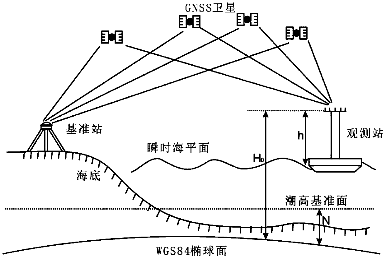
[0087] Such as figure 1 The tide level measurement principle of the GNSS marine buoy shown is an example of a certain type of GNSS tide measurement buoy being tested at the Changzhou Island Wharf of the Guangzhou Nanhai Sub-bureau, and the tide level data is calculated according to the following method.
[0088] 1) The calculation of GNSS antenna phase center elevation adopts dynamic post-processing technology. The basic process is: use the precise ephemeris and clock error files provided by the International GNSS Service (IGS), and combine the IGS stations around the reference station to solve the coordinates o...
PUM
 Abstract
Description
Claims
Application Information
 - R&D
- Intellectual Property
- Life Sciences
- Materials
- Tech Scout
- Unparalleled Data Quality
- Higher Quality Content
- 60% Fewer Hallucinations
Browse by: Latest US Patents, China's latest patents, Technical Efficacy Thesaurus, Application Domain, Technology Topic, Popular Technical Reports.
© 2025 PatSnap. All rights reserved.Legal|Privacy policy|Modern Slavery Act Transparency Statement|Sitemap|About US| Contact US: help@patsnap.com


