A Synchronous Correlation Method for Distributed Multi-sensor Space Targets
A space target, multi-sensor technology, applied in the field of distributed multi-sensor space target synchronization association, can solve problems such as inapplicable target association problems, and achieve the effect of good robustness and good real-time performance.
- Summary
- Abstract
- Description
- Claims
- Application Information
AI Technical Summary
Problems solved by technology
Method used
Image

Examples
Embodiment 1
[0055] Such as Figure 6 As shown, Embodiment 1 of the present invention provides a method for synchronous association of distributed multi-sensor space targets, which is characterized in that it includes:
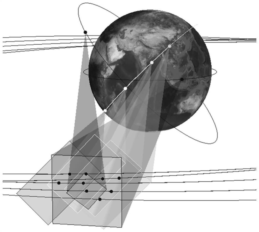
[0056] Step 1. Obtain a set of star maps that are captured synchronously by multiple sensors, overlapping fields of view, and extracting space objects;
[0057] Step 2, saving the pixel coordinates of the centroids of all space objects in the group of star maps in each star map;
[0058] Step 3. Splicing any two star maps in the set of star maps to obtain all combinations;
[0059] Step 4, according to the orbit data and attitude data of the satellite where the sensor where the star map is taken and the internal and external parameters of the sensor camera are calculated, the basic matrix between the two stitched star maps is calculated based on the basic matrix formula;
[0060] Step 5. In each star map of the two spliced star maps, take the pixel coordinates of the c...
Embodiment 2
[0085] Embodiment 2: Synchronous association of distributed multi-sensor space targets under the background of star map:
[0086] 1) Construction of epipolar geometry
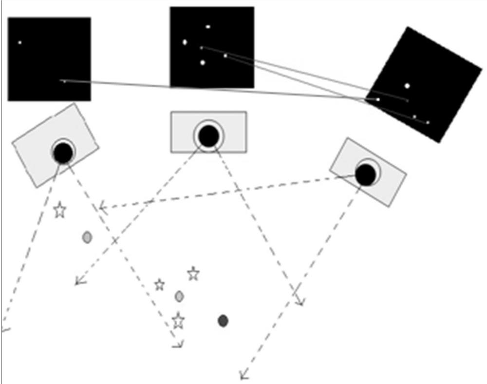
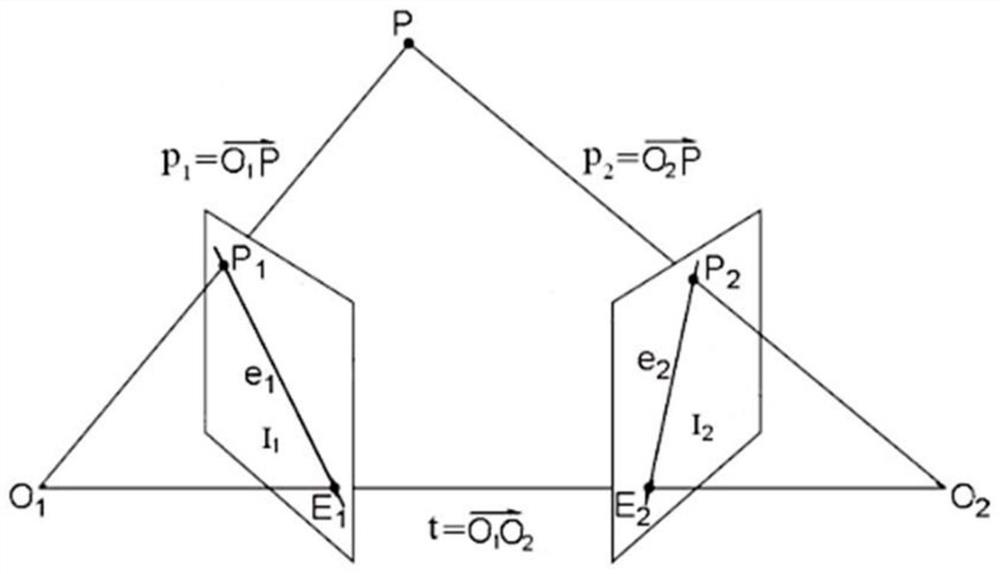
[0087] Epipolar Geometry is a geometry that studies the positional relationship between corresponding points of two images. It has nothing to do with the geometric structure of the scene and only depends on the internal and external parameters of the camera. It can be applied to image matching and 3D reconstruction. Such as figure 1 Shown is a schematic diagram of space object association under the background of a star map, which shows the basic geometric relationship of stars, space objects, and star sensors with overlapping fields of view, objects in space, cameras with overlapping fields of view, and objects under the camera. The formed image can constitute the epipolar geometry, and the schematic diagram of the epipolar geometry is as follows figure 2 shown.
[0088] P is a point in space, O 1 and O 2...
Embodiment example 3
[0144] Implementation Case 3: Correlation of Weak and Small Infrared Targets
[0145] The present invention can not only be used for target association among star maps, but also can realize target association for small targets photographed by long-distance infrared sensors with similar imaging effects. The execution operation is similar to the above case.
[0146] The station uses two or more infrared sensors to detect suspicious targets in suspicious areas. Using the present invention, it is possible to associate targets under multiple infrared sensors, realize the cataloging of each target, and then determine the spatial orientation of each target and Track the trajectory of each target. Compared with the existing target association method of continuously tracking and determining the target trajectory through sensors, the present invention has more real-time performance, and in the process of realizing cross-sensor target association, the accuracy rate of target association...
PUM
 Abstract
Description
Claims
Application Information
 - R&D Engineer
- R&D Manager
- IP Professional
- Industry Leading Data Capabilities
- Powerful AI technology
- Patent DNA Extraction
Browse by: Latest US Patents, China's latest patents, Technical Efficacy Thesaurus, Application Domain, Technology Topic.
© 2024 PatSnap. All rights reserved.Legal|Privacy policy|Modern Slavery Act Transparency Statement|Sitemap