Radar remote sensing image scene feature description and classification method

A remote sensing image and feature description technology, applied in the field of remote sensing image interpretation, can solve problems such as polarization feature confusion

Inactive Publication Date: 2019-07-19
HANGZHOU SHIPING INFORMATION & TECH
View PDF1 Cites 5 Cited by
  • Summary
  • Abstract
  • Description
  • Claims
  • Application Information

AI Technical Summary

Problems solved by technology

However, since the HV scattering produced by natural objects and artificial buildings is described by a single volume scattering model, the polarization characteristics of the two objects are confused

Method used


Image

  • Radar remote sensing image scene feature description and classification method
  • Radar remote sensing image scene feature description and classification method
  • Radar remote sensing image scene feature description and classification method

Examples


Embodiment

[0155] The experimental design is as follows:

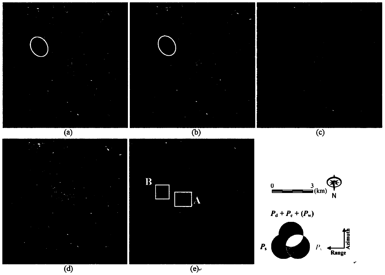
[0156]The invention uses the L-band polarimetric SAR data obtained by the ALOS PALSAR system to carry out scene feature description and classification experiments. The imaged area is located in the city of Rome, Italy, and includes numerous buildings, forest vegetation, and bodies of water. The resolutions of the single-view data in the azimuth and range directions are 3.79 meters and 22.36 meters, respectively, and the average of 6 views in the azimuth direction is used to obtain an image size of 380×400.

[0157] The experimental process is as follows:

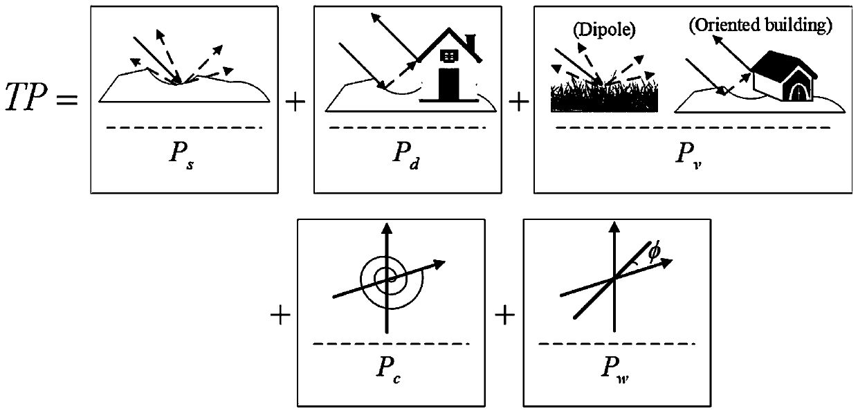
[0158] Aiming at the scene polarization feature description of radar remote sensing images, the present invention and four kinds of polarization target decomposition methods are respectively used for comparative experiment verification, including the original multi-component decomposition method (MCSM), multi-component decomposition after polarization azimuth compensation met...


PUM


Abstract

The invention discloses a radar remote sensing image scene feature description and classification method, which comprises the following steps of: 1, constructing a polarization covariance matrix and apolarization coherence matrix of a polarization SAR image, constructing a volume scattering model of the polarization SAR image for HV scattering of a natural ground object, and calculating a geometric orientation azimuth angle of a building in the polarization SAR image; 2, constructing a cross scattering model based on the geometric orientation azimuth angle of the building; 3, importing the volume scattering model of the natural ground object obtained in the step 1 and the cross scattering model of the building obtained in the step 2 into a multi-component polarized target decomposition expression, and further solving to obtain polarized scattering power; and 4, forming a feature vector by using the polarization scattering power of each pixel, and importing the feature vector into an SVM classifier to obtain a pixel type. The scene feature description capability and the image classification precision of the radar remote sensing image can be effectively improved.

Description

technical field [0001] The invention belongs to the field of remote sensing image interpretation, in particular to a radar remote sensing image scene feature description and classification method, which can provide important category attribute information for radar image content analysis and scene classification. Background technique [0002] Scene feature expression and scene classification in polarimetric synthetic aperture radar (SAR) images are the most important research contents in remote sensing image interpretation, which are of great significance to image scene target detection and recognition, urban construction planning, remote sensing monitoring and crop yield estimation. Polarimetric target decomposition is one of the most fundamental means to describe the characteristics of radar image target scattering mechanism, and it is also an important theoretical basis for polarimetric SAR image interpretation. The scattering power of each target obtained by polarization...

Claims


Application Information

Patent Timeline
Patent Type & Authority Applications(China)
IPC IPC(8): G06K9/00G06K9/62
CPCG06V20/176G06F18/2411
Inventor 项德良王世晞张亮徐建忠
Owner HANGZHOU SHIPING INFORMATION & TECH
Why Eureka
Try Eureka