Geographical indication product navigation method, information acquisition method and navigation system

A geographical indication and navigation method technology, which is applied in navigation, surveying and mapping, road network navigator, etc., can solve the problem of inconvenient access to geographical indication product information, and achieve the effect of improving user satisfaction and increasing fun

Active Publication Date: 2019-08-13
NAVINFO
View PDF8 Cites 4 Cited by
  • Summary
  • Abstract
  • Description
  • Claims
  • Application Information

AI Technical Summary

Problems solved by technology

[0003] Therefore, the present invention provides a geographical indication product navigation, information acquisition method and navigation system, which overcomes the disadvantages in the prior art that it is inconvenient for users to obtain geographical indication product information on the electronic map in time when traveling.

Method used


Image

  • Geographical indication product navigation method, information acquisition method and navigation system
  • Geographical indication product navigation method, information acquisition method and navigation system
  • Geographical indication product navigation method, information acquisition method and navigation system

Examples


Embodiment 1

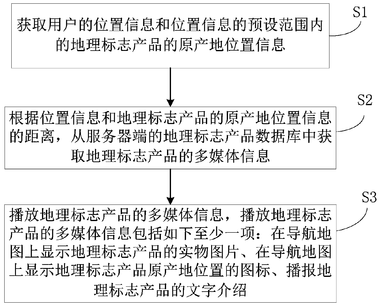
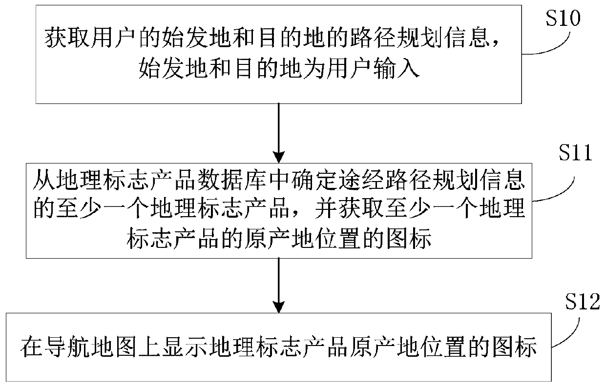
[0028] This embodiment provides a geographical indication product navigation method, which can be applied to a navigation terminal to display relevant information of geographical indication products on an electronic map to provide users with navigation services, such as figure 1 As shown, the method includes the following steps:

[0029] Step S1: Obtain the location information of the user and the origin location information of the geographical indication products within the preset range of the location information.

[0030] In the embodiment of the present invention, the user's location information can be the real-time location information of the user obtained from positioning devices such as GPS and Beidou, or it can be the location information specified by the user. For example, when the user uses the navigation terminal while driving, the real-time location information of the user can be obtained. When the user needs to search around the geographical indication product acc...

Embodiment 2

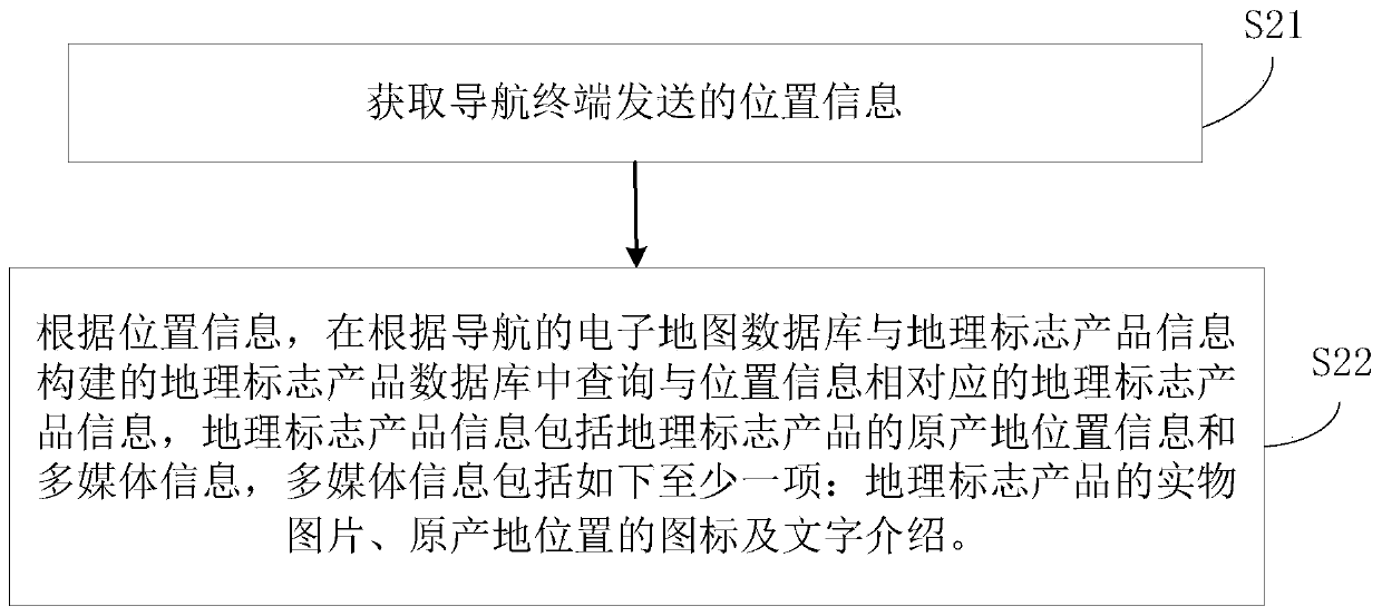
[0047] The embodiment of the present invention provides a method for obtaining geographical indication product information, which can be applied to the server corresponding to the navigation terminal, and is used to send the corresponding geographical indication product information for the navigation terminal, such as image 3 shown, including the following steps:

[0048] Step S21: Obtain the location information sent by the navigation terminal.

[0049] When the present invention is implemented, the server can receive real-time location information or designated location information sent by the navigation terminal.

[0050] Step S22: According to the position information, query the geographical indication product information corresponding to the position information in the geographical indication product database constructed according to the electronic map database of the navigation and the geographical indication product information, the geographical indication product info...

Embodiment 3

[0063] An embodiment of the present invention provides a navigation terminal, such as Figure 5As shown, it includes: an input device 710 , a memory 720 and a processor 730 . Those skilled in the art will appreciate that the navigation device may also include other components, such as those commonly found in computers. The input device 710, the memory 720 and the processor 730 communicate with each other, the input device 710 is used to obtain the instruction input by the user, the memory 720 is used to store the instruction input by the user and the computer instruction, and the computer instruction makes the navigation terminal when the processor 730 executes it. Execute the geographical indication product navigation method described in Embodiment 1.

[0064] Specifically, the navigation terminal obtains the location information of the user and the location information of the origin of the geographical indication product within the preset range of the location information, ...


PUM


Abstract

The invention provides a navigation indication product navigation method, an information acquisition method and a navigation system. According to the geographical indication product navigation method,the location information of a user and the origin location information of a geographical indication product in a preset range of the location information are obtained; multimedia information of the geographical indication product is obtained from a geographical indication product database of a server according to a distance between the location information and the original location of the geographical indication product; and the multimedia information of the geographical indication product is played. According to the geographical indication product navigation method and the information acquisition method, a function of carrying out displaying, querying and voice introduction on geographical indication product information is provided for users on electronic maps, so that the users can conveniently and rapidly know the geographical indication product information in time, thereby increasing the trip joy of the users and improving the satisfaction of the users.

Description

technical field [0001] The invention relates to the field of geographical information application, in particular to a geographical indication product navigation, an information acquisition method and a navigation system. Background technique [0002] Geographical indication products are the crown of local specialties. They are produced in a specific region, and their quality, reputation or other characteristics are essentially determined by the natural and human factors of the place of origin. They are approved to be named after the geographical name. Navigation electronic map is the cornerstone of travel services and various location-based services, with a wide range of users and a complete industrial chain. The existing geographic indication product map and navigation electronic map specifications are self-contained, making it inconvenient for users to obtain geographical indication product information on the electronic map in a timely manner when traveling. Contents of ...

Claims


Application Information

Patent Timeline
Patent Type & Authority Applications(China)
IPC IPC(8): G01C21/34G01C21/36
CPCG01C21/3697G01C21/3461
Inventor 代薇
Owner NAVINFO
Why Eureka
Try Eureka