Position information acquisition method and device, terminal and storage medium
A technology for location information and acquisition method, applied in the computer field, can solve the problem of large computational load and high complexity in identifying geographical location, and achieve the effect of reducing the data computational load
- Summary
- Abstract
- Description
- Claims
- Application Information
AI Technical Summary
Problems solved by technology
Method used
Image

Examples
Embodiment 1
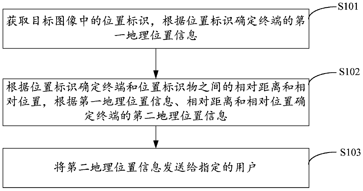
[0043] figure 1 The implementation process of the location information acquisition method provided by Embodiment 1 of the present invention is shown. For the convenience of description, only the parts related to the embodiment of the present invention are shown, and the details are as follows:
[0044] In step S101, a location identifier in the target image is acquired, and first geographic location information of the terminal is determined according to the location identifier.
[0045] The embodiment of the present invention is applicable to a terminal, such as a mobile phone, a watch, a tablet computer, a notebook computer, smart glasses, etc. The terminal should have a camera function, and the location information acquisition method provided in this embodiment can be implemented based on various scenarios, for example, Taking photos, video recordings or video calls, etc., this location acquisition method can be completed by the terminal, or by a third-party server. When the...
Embodiment 2
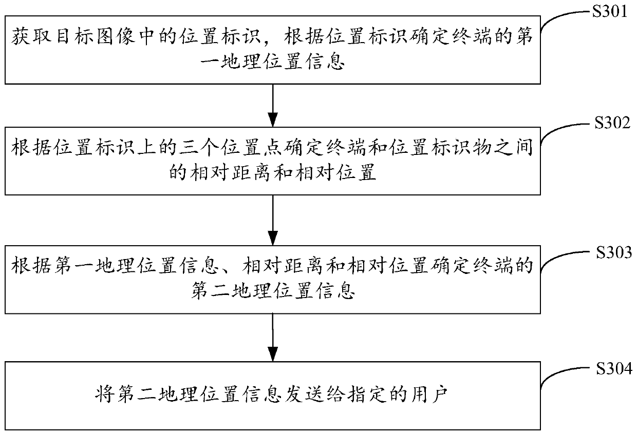
[0059] image 3 The implementation flow of the location information acquisition method provided by the second embodiment of the present invention is shown. For the convenience of description, only the parts related to the embodiment of the present invention are shown, and the details are as follows:
[0060] In step S301, the location identifier in the target image is acquired, and the first geographic location information of the terminal is determined according to the location identifier.
[0061] In this embodiment of the present invention, for the implementation of step S301, reference may be made to the description of step S101 in the first embodiment above, and details are not repeated here.
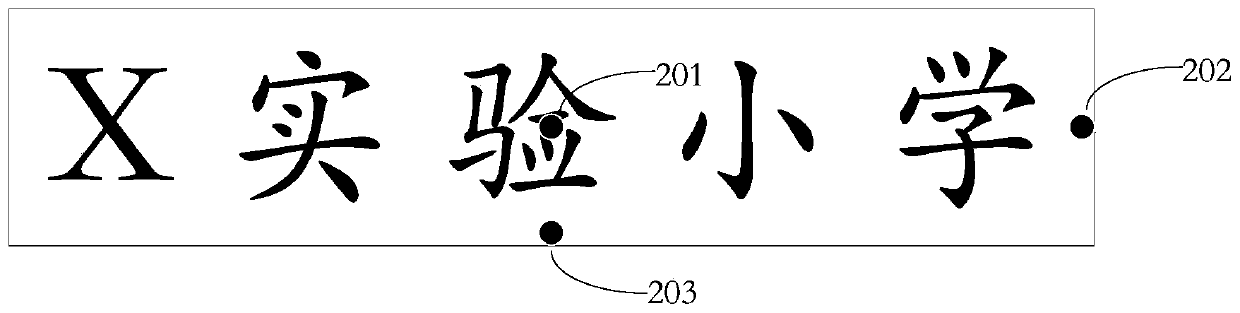
[0062] In step S302, the relative distance and relative position between the terminal and the location marker are determined according to the three location points on the location marker.
[0063] In the embodiment of the present invention, the location is identified as figure 2 ...
Embodiment 3
[0080] Figure 5 The implementation flow of the location information acquisition method provided by the third embodiment of the present invention is shown. For the convenience of description, only the parts related to the embodiment of the present invention are shown, and the details are as follows:
[0081] In step S501, the location identifier in the target image is acquired, and the first geographic location information of the terminal is determined according to the location identifier.
[0082] In this embodiment of the present invention, for the implementation manner of step S501, reference may be made to the description of step S101 in the first embodiment above, and details are not repeated here.
[0083] In step S502, the relative distance and relative position between the terminal and the location marker are determined according to the two location points on the location marker and the tilt angle of the terminal.
[0084] In the embodiment of the present invention, t...
PUM
 Abstract
Description
Claims
Application Information
 - Generate Ideas
- Intellectual Property
- Life Sciences
- Materials
- Tech Scout
- Unparalleled Data Quality
- Higher Quality Content
- 60% Fewer Hallucinations
Browse by: Latest US Patents, China's latest patents, Technical Efficacy Thesaurus, Application Domain, Technology Topic, Popular Technical Reports.
© 2025 PatSnap. All rights reserved.Legal|Privacy policy|Modern Slavery Act Transparency Statement|Sitemap|About US| Contact US: help@patsnap.com