UAV-based aerial photography monitoring system
A monitoring system and UAV technology, applied in the field of UAV aerial photography, to achieve the effect of ensuring battery life, normal use, and clear image collection
- Summary
- Abstract
- Description
- Claims
- Application Information
AI Technical Summary
Problems solved by technology
Method used
Image
Examples
Embodiment
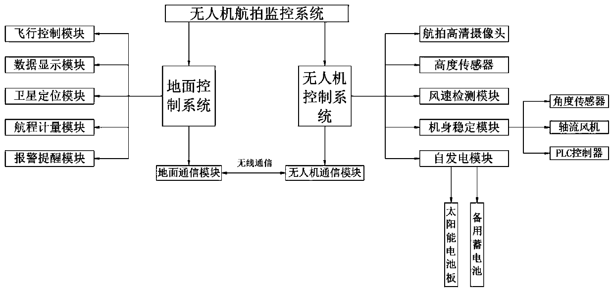
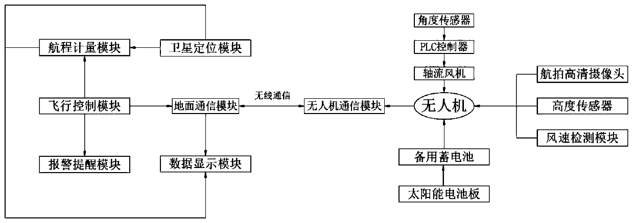
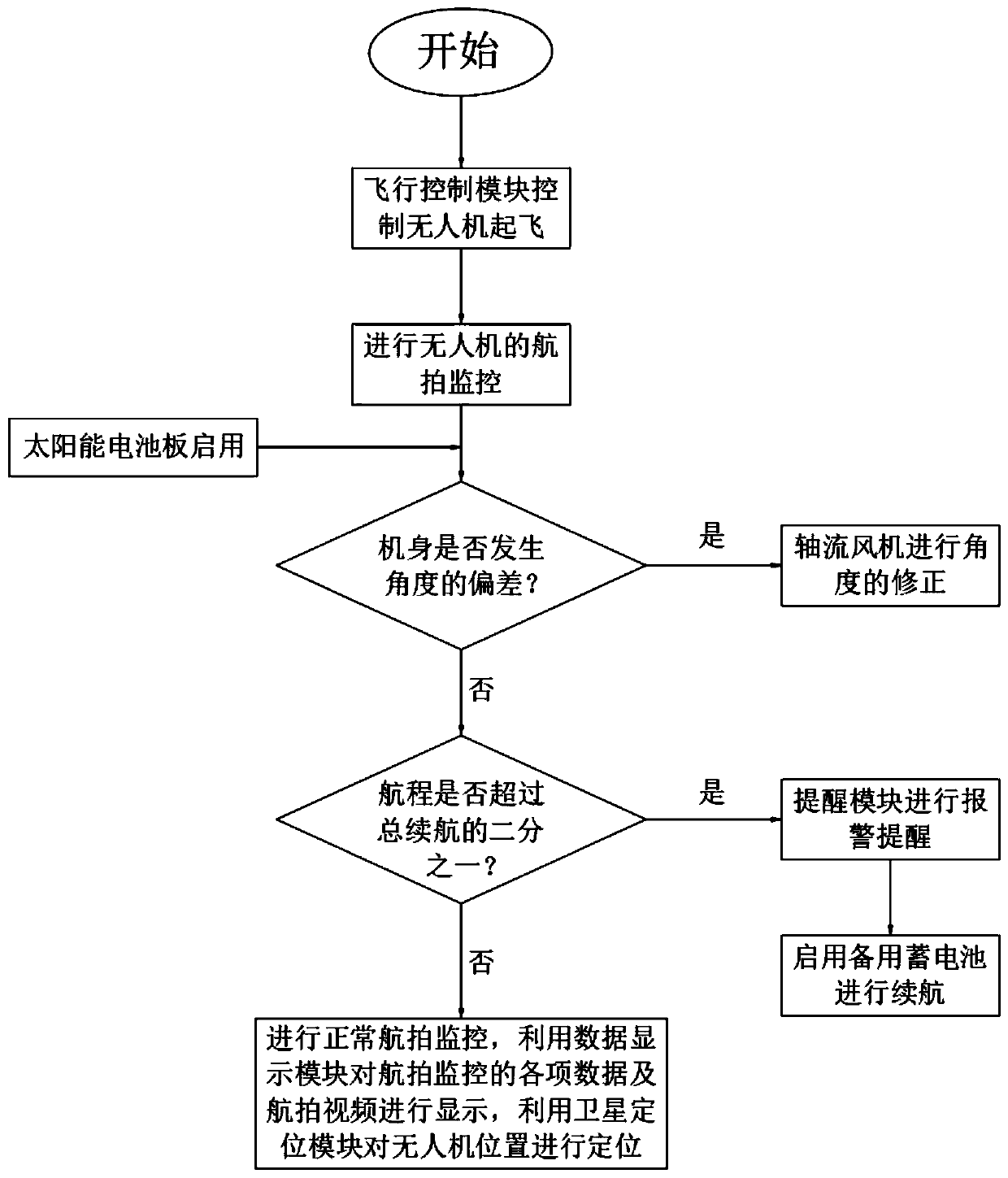
[0029] Example: such as Figure 1-3 As shown, the present invention provides a technical solution, a drone-based aerial monitoring system, characterized in that: the aerial monitoring system includes a ground control system and a drone control system;
[0030] The ground control system controls the flight attitude and flight distance of the UAV through human manipulation, and processes and displays the video images taken by the UAV. The UAV control system is used to monitor the attitude of the UAV during the aerial photography process. , to correct the attitude of the UAV during aerial photography;
[0031] The ground control system and the UAV control system transmit information through the wireless communication between the ground communication module and the UAV communication module.
[0032] The ground control system includes flight control module, data display module, satellite positioning module, voyage measurement module and alarm reminder module;
[0033] The output ...
PUM
 Abstract
Description
Claims
Application Information
 - R&D
- Intellectual Property
- Life Sciences
- Materials
- Tech Scout
- Unparalleled Data Quality
- Higher Quality Content
- 60% Fewer Hallucinations
Browse by: Latest US Patents, China's latest patents, Technical Efficacy Thesaurus, Application Domain, Technology Topic, Popular Technical Reports.
© 2025 PatSnap. All rights reserved.Legal|Privacy policy|Modern Slavery Act Transparency Statement|Sitemap|About US| Contact US: help@patsnap.com


