On-orbit satellite remote sensing image ship detection method

A remote sensing image and satellite remote sensing technology, which is applied in the direction of instruments, character and pattern recognition, scene recognition, etc., to achieve accurate detection, satisfactory algorithm operation efficiency, and optimal performance

Active Publication Date: 2019-11-05
XIDIAN UNIV
View PDF3 Cites 6 Cited by
  • Summary
  • Abstract
  • Description
  • Claims
  • Application Information

AI Technical Summary

Problems solved by technology

Therefore, the real-time target detection of on-orbit satellites at this stage needs to be solved urgently. The problem of high-resolution remote sensing image target detection under the dual constraints of detection accuracy and computational (time) complexity

Method used


Image

  • On-orbit satellite remote sensing image ship detection method
  • On-orbit satellite remote sensing image ship detection method
  • On-orbit satellite remote sensing image ship detection method

Examples


Embodiment 1

[0044] (1) In this embodiment, the high-resolution remote sensing image to be detected ( figure 1 Shown) is down-sampled, and the remote sensing image after down-sampling is obtained through down-sampling;

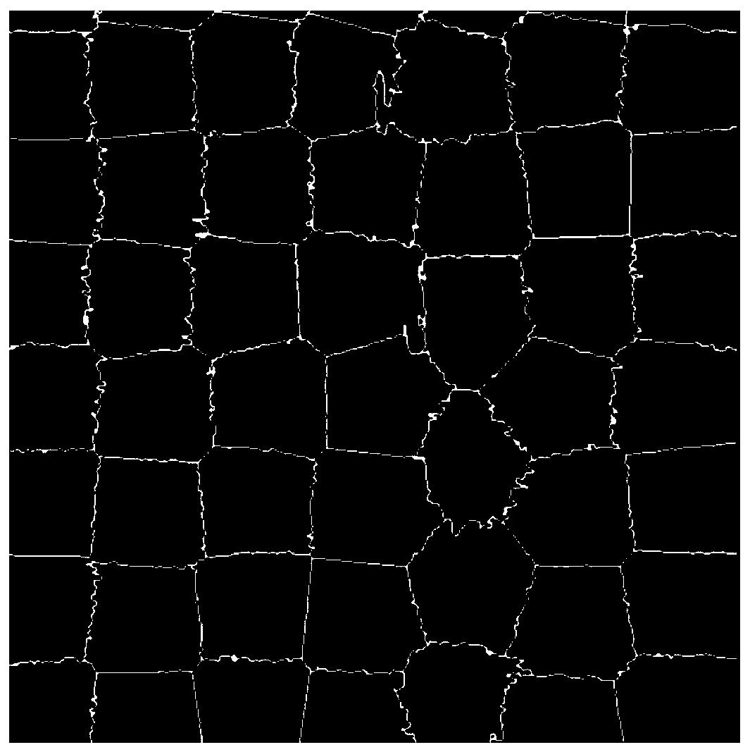
[0045] (2) This embodiment uses the accelerated SNIC superpixel segmentation algorithm to perform superpixel segmentation on the down-sampled remote sensing image to obtain the segmented superpixel remote sensing image, and the superpixel segmented image is a superpixel with extended range, and the edges overlap each other , figure 2 shown;

[0046] (3) Traversing all superpixel remote sensing images, looking for superpixel images that may have ships of interest; this embodiment adopts the brightness value and threshold range of superpixel images as 50-80, uses brightness information and uses brightness-based fast filtering to filter each The superpixels are filtered, and the pixels that meet the brightness characteristics are selected and counted. When the number of qu...

Embodiment 2

[0049] This embodiment provides a Figure 4 The on-orbit satellite remote sensing image ship detection system shown. According to the illustrated contents, the system includes a processing module, a data storage module and a user interface module;

[0050] The processing module includes a segmentation module, an auxiliary module and a matching module;

[0051] The processing module includes: a segmentation module, an auxiliary module and a matching module;

[0052] The segmentation module further includes a downsampling module and a superpixel segmentation module, which are respectively used for: downsampling the remote sensing image to be detected; performing superpixel segmentation on the downsampled remote sensing image to obtain the segmented remote sensing image;

[0053] The auxiliary module further includes a fast filtering module and a mapping module, which are respectively used to: perform brightness filtering on each superpixel region of the remote sensing image af...


PUM


Abstract

The invention discloses an on-orbit satellite remote sensing image ship detection method. According to the method, a high-resolution remote sensing image is segmented and target pre-positioning is realized by using super pixels on the premise of ensuring the integrity of a target, and a target detection algorithm is realized by using local features and variable threshold neighbor check in a pre-positioning area. Under the performance constraint and real-time performance requirements of a satellite-borne platform, the operation efficiency of the algorithm can meet the real-time detection requirements of the satellite-borne platform, and a large ship target in a high-resolution remote sensing image can be accurately detected.

Description

technical field [0001] The invention relates to the technical field of remote sensing and computer vision, in particular to a ship detection method based on local features in satellite remote sensing images in orbit. Background technique [0002] With the evolution of remote sensing technology and the gradual improvement of my country's high-resolution remote sensing satellite system, the spatial resolution of remote sensing images is gradually improving. Remote sensing images acquired by higher-resolution remote sensing satellites contain richer object edge information, features, and texture details, making it more possible to detect and identify specific targets in the image. Remote sensing satellites are not restricted by terrain, traffic, airspace, and national boundaries, and can quickly and timely obtain high-precision target information, which has great military strategic significance and important civilian value. However, the increase in resolution has also brought ...

Claims


Application Information

Patent Timeline
Patent Type & Authority Applications(China)
IPC IPC(8): G06K9/00G06K9/32G06K9/34G06K9/46
CPCG06V20/13G06V10/267G06V10/25G06V10/462
Inventor 苗启广宋建锋权义宁王琛超武越戚玉涛刘如意盛立杰刘向增谢琨
Owner XIDIAN UNIV
Why Eureka
Try Eureka