Virtual polar region method based on transverse geographic coordinate system

A geographical coordinate system and horizontal technology, applied in the direction of electrical digital data processing, special data processing applications, complex mathematical operations, etc., can solve problems such as poor applicability, achieve the effect of improving modeling accuracy and expanding the applicable area

Active Publication Date: 2019-11-15
NORTHWESTERN POLYTECHNICAL UNIV
View PDF10 Cites 12 Cited by
  • Summary
  • Abstract
  • Description
  • Claims
  • Application Information

AI Technical Summary

Problems solved by technology

[0004] In order to overcome the shortcomings of poor applicability of the existing virtual polar region method, the present invention provides a virtual polar region method based on the horizontal geographic coordinate system

Method used


Image

  • Virtual polar region method based on transverse geographic coordinate system
  • Virtual polar region method based on transverse geographic coordinate system
  • Virtual polar region method based on transverse geographic coordinate system

Examples


Embodiment Construction

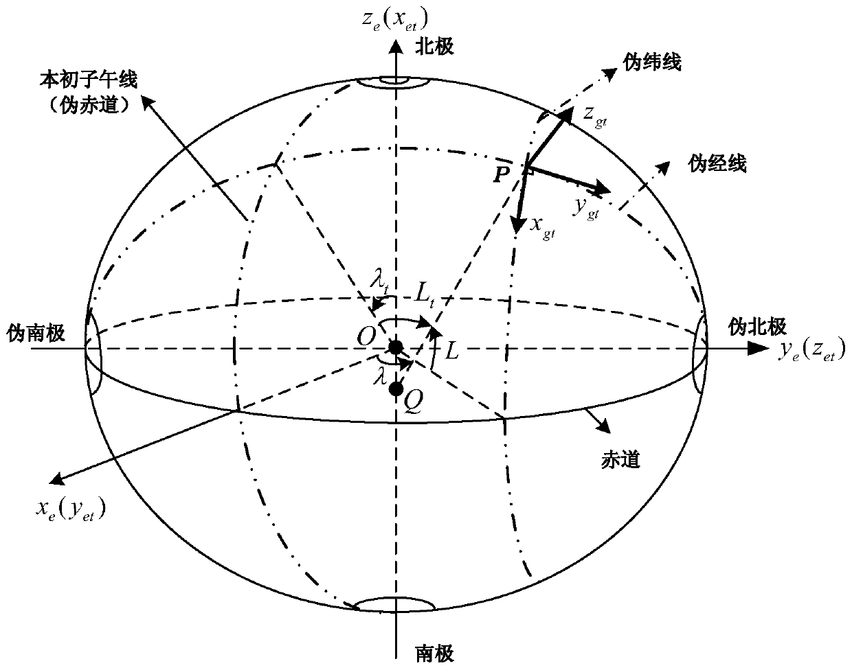
[0030] refer to Figure 1-3 . The specific steps of the virtual polar region method based on the horizontal geographical coordinate system of the present invention are as follows:

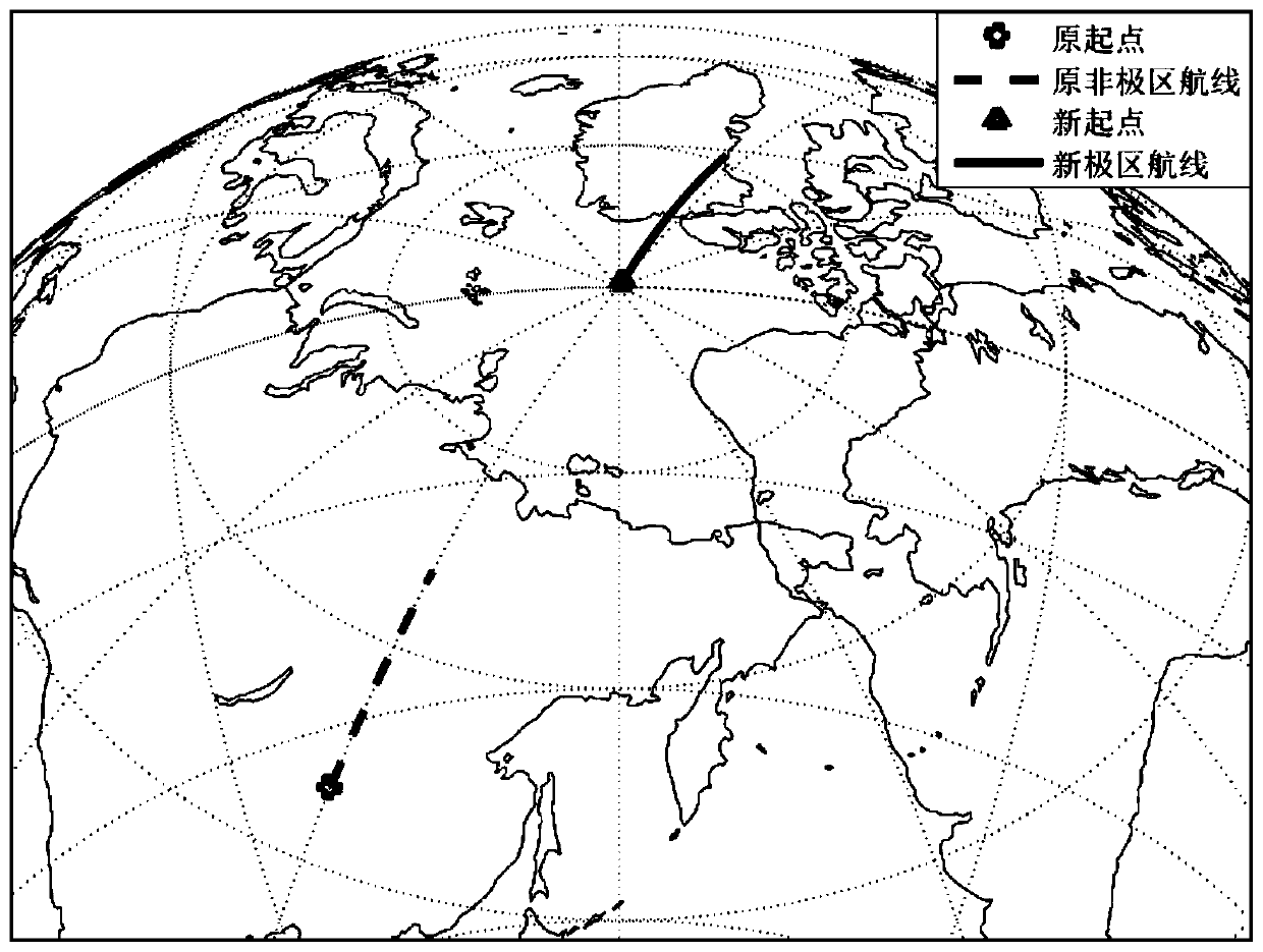
[0031] 1. Reconstruction of polar trajectory data.

[0032] Define b as the carrier coordinate system, and the coordinate axis points to the right front and upper direction of the carrier; the i and e systems are the traditional inertial coordinate system and the earth coordinate system; g is the geographic coordinate system, and the coordinate axis points to the northeast sky direction of the local position. The position coordinates under are p g =[λ L h] T express. define e t It is the horizontal earth coordinate system, and the e system revolves around ox e Axis rotation -90°, then around oz e Obtained after turning -90°; g t It is a horizontal geographic coordinate system, and the coordinate axes point to the northeast sky direction of the horizontal pseudo-grid at the current position ...


PUM


Abstract

The invention discloses a virtual polar region method based on a transverse geographic coordinate system. The method is used for solving the technical problem that an existing virtual polar region method is poor in applicability. According to the technical scheme, an attitude matrix, speed and height information under a transverse geologic system are kept unchanged, and a polar region position track is reconstructed through transverse speed integration after ellipsoid correction coefficient compensation. The local earth rotation angular rate and the gravitational acceleration from gyroscope and accelerometer data obtained by the non-polar region test are deducted under a transverse geographic coordinate system, and superposing the earth rotation angular rate and the gravitational vector ofthe virtual polar region to complete polar region reconstruction of the inertial sensor data. Polar region trajectory data and inertial sensor data are reconstructed in a transverse geographic coordinate system, so that the motion characteristics of a carrier relative to a local horizontal plane are kept unchanged, the application area is expanded, and the system can be suitable for any position,except for a transverse pole, of the earth surface. Ball approximation is avoided through the ellipsoid correction coefficient, and the modeling precision is improved.

Description

technical field [0001] The invention relates to a virtual polar region method, in particular to a virtual polar region method based on a horizontal geographic coordinate system. Background technique [0002] Due to the unique geographical location of the two poles of the earth, it is difficult for navigation algorithm researchers to have the opportunity to conduct actual experimental verification in the polar regions, and it is difficult for pure mathematical simulation methods to truly reflect the motion characteristics of the carrier and the errors of inertial sensors. Therefore, it is of great significance to study the virtual polar region technology based on real test data, which can convert the test data in the middle and low latitude regions to the polar region through mathematical methods for equivalent navigation test verification. [0003] The document "Research on the Method of Verification of Polar Navigation Algorithm Based on Virtual Pole, IEEE China Guidance, N...

Claims


Application Information

Patent Timeline
Patent Type & Authority Applications(China)
IPC IPC(8): G06F17/50G06F17/16
CPCG06F17/16
Inventor 付强文李四海严恭敏刘士明朱帅魏栋
Owner NORTHWESTERN POLYTECHNICAL UNIV
Why Eureka
Try Eureka