
Automatic extraction method of high-resolution remote sensing geological hazard information based on deep learning

A geological disaster, high-resolution technology, applied in the direction of instruments, biological neural network models, scene recognition, etc., can solve the problem of low precision of geological disaster information, and achieve the effect of intelligent extraction

Active Publication Date: 2021-10-22
CHENGDU UNIVERSITY OF TECHNOLOGY
View PDF3 Cites 0 Cited by
  • Summary
  • Abstract
  • Description
  • Claims
  • Application Information

AI Technical Summary

Problems solved by technology

[0007] Aiming at the above-mentioned deficiencies in the prior art, the present invention provides a method for automatic extraction of high-resolution remote sensing geological disaster information based on deep learning, which solves the problem of low precision of geological disaster information

Method used


Image

  • Automatic extraction method of high-resolution remote sensing geological hazard information based on deep learning

Examples


Embodiment Construction

[0028] The specific embodiments of the present invention are described below so that those skilled in the art can understand the present invention, but it should be clear that the present invention is not limited to the scope of the specific embodiments. For those of ordinary skill in the art, as long as various changes Within the spirit and scope of the present invention defined and determined by the appended claims, these changes are obvious, and all inventions and creations using the concept of the present invention are included in the protection list.

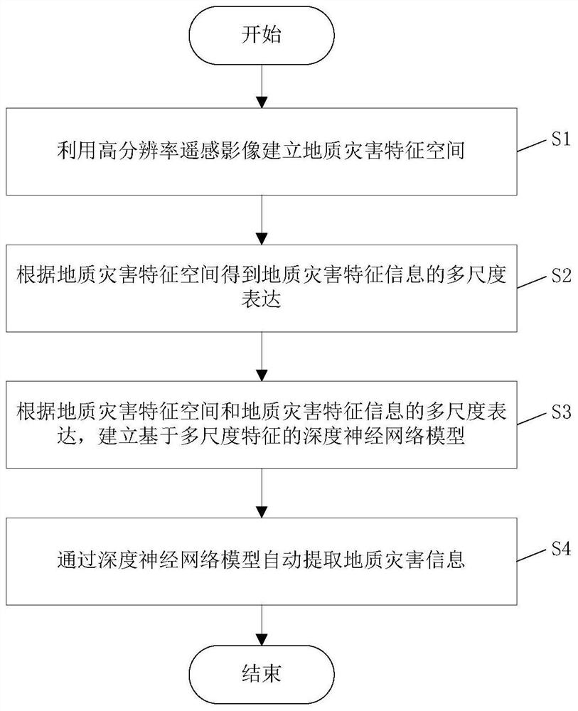
[0029] Such as figure 1 As shown, an automatic extraction method of high-resolution remote sensing geological hazard information based on deep learning includes the following steps:

[0030] S1. Using high-resolution remote sensing images to establish the feature space of geological hazards; the specific steps are:

[0031] S11. Combining digital elevation model data, using image change detection technology and object-orie...


PUM


Abstract

The invention discloses a method for automatically extracting high-resolution remote sensing geological disaster information based on deep learning. On the basis of the unified space-time benchmark representation theory, the present invention obtains a multi-layer geological disaster information automatic extraction model based on deep learning technology, in which the key point is to use a deep neural network model to design quantitative characteristic parameters in units of geological disaster objects. The multi-scale description method establishes the geological disaster information expression method, designs and develops the deep neural network model based on the multi-scale geological disaster feature space, and realizes the intelligent extraction of geological disaster information in layers.

Description

technical field [0001] The invention relates to the technical field of geological disaster identification, in particular to an automatic extraction method for high-resolution remote sensing geological disaster information based on deep learning. Background technique [0002] Sichuan Province is one of the provinces with severe geological disasters due to complex geological environment conditions and changeable climate. After the "5.12" Wenchuan earthquake, the geological environment conditions in the vast mountainous areas of Sichuan Province, especially in the earthquake-stricken areas, deteriorated sharply. In addition, local heavy rainfall and various extreme climates frequently occurred in recent years, and the area was affected by human engineering activities in recent years. Geological disasters are on the rise. As of 2017, a total of 5,397 geological disasters (risks) occurred in Sichuan Province. Including 3,130 landslides, 1,507 collapses, 699 debris flows, and 61...

Claims


Application Information

Patent Timeline
Patent Type & Authority Patents(China)
IPC IPC(8): G06K9/00G06K9/46G06K9/62G06N3/04
CPCG06V20/13G06V20/194G06V10/40G06N3/045G06F18/241
Inventor 谭力
Owner CHENGDU UNIVERSITY OF TECHNOLOGY
Learn More