Region regulating method of electronic map, region regulating device of electronic map and electronic equipment

An electronic map and direction adjustment technology, which is applied in the computer field, can solve problems such as low area coverage of electronic maps and inaccurate GPS coordinates, and achieve the effects of improving area coverage, shielding GPS drift, and expanding coverage

Active Publication Date: 2020-02-18
ALIPAY (HANGZHOU) INFORMATION TECH CO LTD
View PDF11 Cites 5 Cited by
  • Summary
  • Abstract
  • Description
  • Claims
  • Application Information

AI Technical Summary

Problems solved by technology

[0003] However, in the above scenario, if the user's GPS coordinates drift due to building occlusion, bad weather, etc., the user's GPS coordinates will be inaccurate
In this case, the actual geographical location of one or more users corresponding to the GPS coordinate points contained in a certain polygonal area may not be in the polygonal area, which will lead to a relatively low coverage rate of the electronic map area mined. Low

Method used


Image

  • Region regulating method of electronic map, region regulating device of electronic map and electronic equipment
  • Region regulating method of electronic map, region regulating device of electronic map and electronic equipment
  • Region regulating method of electronic map, region regulating device of electronic map and electronic equipment

Examples


Embodiment Construction

[0039] In order to make the purpose, technical solution and advantages of this specification clearer, the technical solution of this specification will be clearly and completely described below in conjunction with specific embodiments of this specification and corresponding drawings. Apparently, the described embodiments are only some of the embodiments in this specification, not all of them. Based on the embodiments in this specification, all other embodiments obtained by persons of ordinary skill in the art without creative efforts fall within the protection scope of this document.

[0040] The technical solutions provided by each embodiment of this specification will be described in detail below in conjunction with the accompanying drawings.

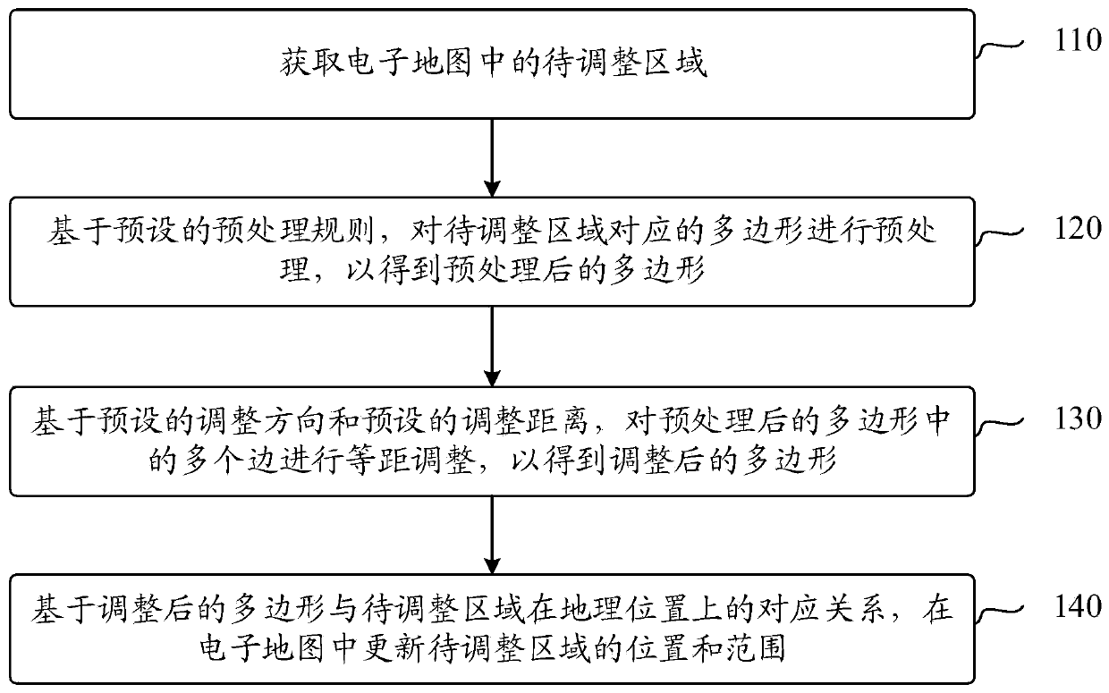
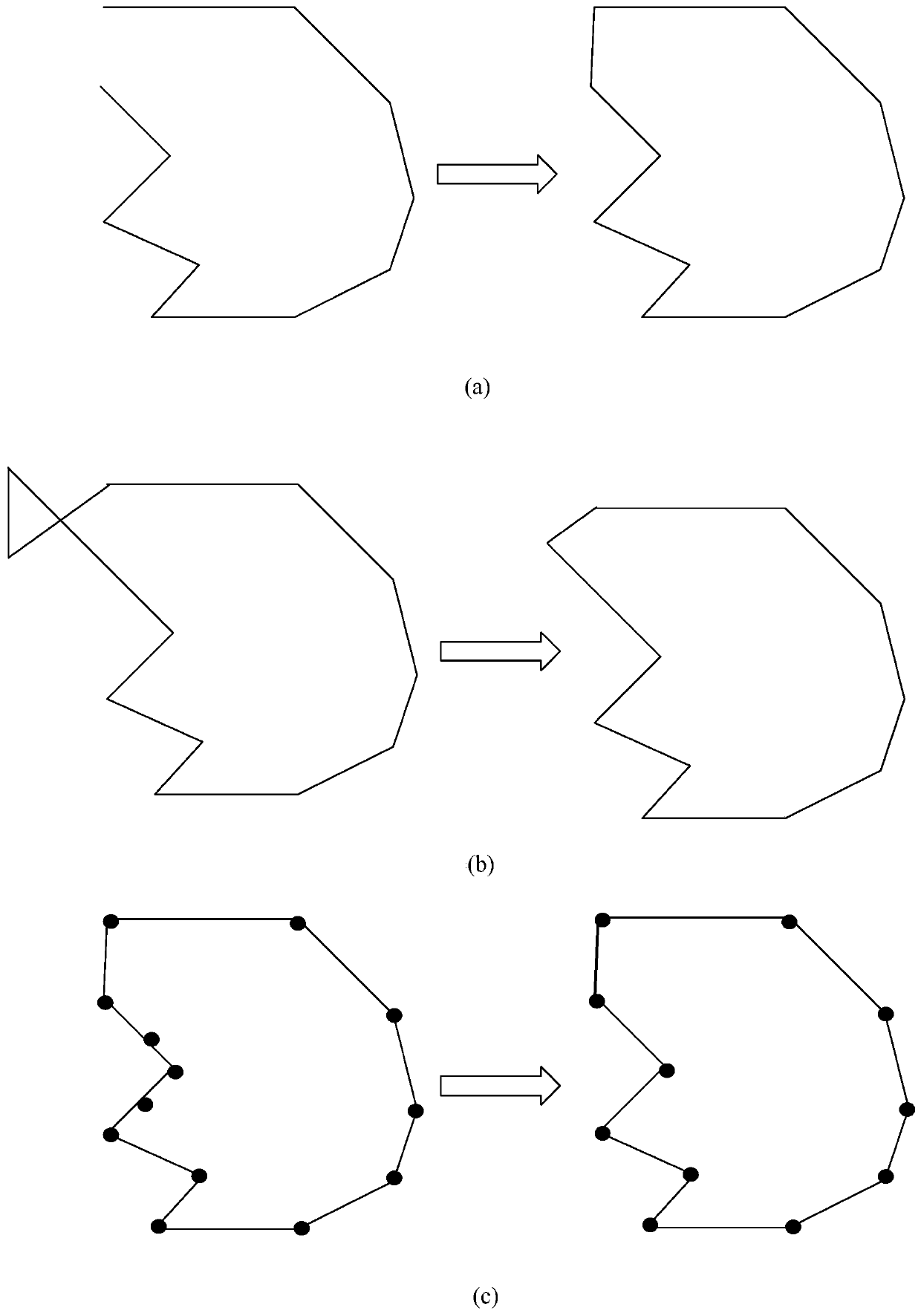
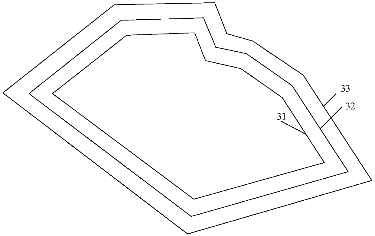
[0041] In order to solve the problem that in the existing business expansion process, the excavated business expansion area often has a low coverage rate of the electronic map corresponding to the business expansion area due to GPS dr...


PUM


Abstract

The invention discloses a region regulating method of an electronic map, a region regulating device of the electronic map and electronic equipment. The method comprises the following steps of obtaining a region to be regulated in the electronic map; preprocessing a polygon corresponding to the region to be regulated on the basis of preset preprocessing rules so as to obtain the preprocessed polygon, wherein the preset preprocessing rules are used for removing abnormal regions in the polygon corresponding to the region to be regulated; performing equidistance regulation on a plurality of edgesin the preprocessed polygon on the basis of a preset regulating direction and a preset regulating distance so as to obtain the regulated polygon, wherein the equidistance regulation includes one regulation mode of expansion regulation and zooming regulation; and updating the position and the range of the region to be regulated in the electronic map according to the corresponding relationship of the regulated polygon and the region to be regulated in the geographic position.

Description

technical field [0001] This document relates to the field of computer technology, in particular to an area adjustment method, device and electronic equipment for an electronic map. Background technique [0002] At present, when conducting business development for offline merchants, areas with more traffic are often preferred as target areas for business development. The electronic fences corresponding to these target areas can be excavated by machine learning to form corresponding polygonal areas, wherein a polygonal area contains multiple GPS coordinate points, and one GPS coordinate point corresponds to a user's location. [0003] However, in the above scenario, if the user's GPS coordinate point drifts due to factors such as building occlusion, bad weather, etc., the user's GPS coordinate point will be inaccurate. In this case, the actual geographical location of one or more users corresponding to the GPS coordinate points contained in a certain polygonal area may not be...

Claims


Application Information

Patent Timeline
Patent Type & Authority Applications(China)
IPC IPC(8): G09B29/00
CPCG09B29/005
Inventor 宁朝阳
Owner ALIPAY (HANGZHOU) INFORMATION TECH CO LTD
Why Eureka
Try Eureka