

Urban water map and manufacturing and displaying method thereof
A display method and water map technology, applied in image data processing, 2D image generation, instruments, etc., can solve the problems of small monitoring range and lack of visualization
- Summary
- Abstract
- Description
- Claims
- Application Information
AI Technical Summary
Problems solved by technology
Method used
Image

Examples
Embodiment Construction
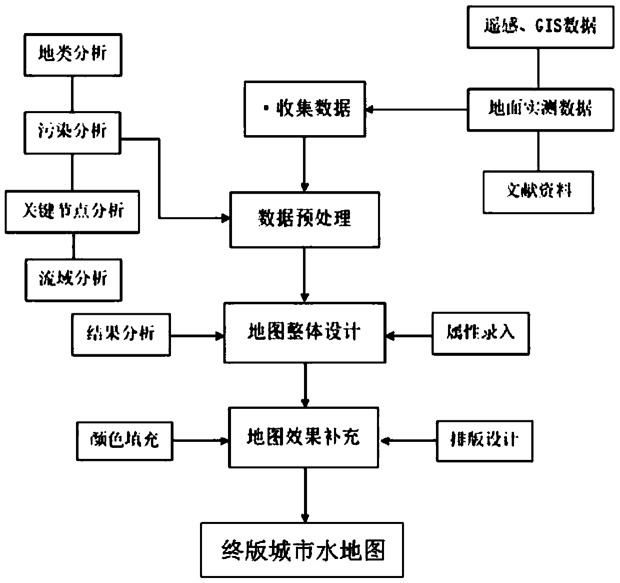
[0031] In order to be able to understand the technical means of the present invention more clearly and implement it according to the contents of the description, the specific implementation of the present invention will be further described in detail below in conjunction with the accompanying drawings and examples. The following examples are used to illustrate the present invention, but not to limit the scope of the present invention.
[0032] The method for making and displaying the city water map will be described below with a specific embodiment. The method mainly includes but is not limited to the following steps.
[0033] S1. Data collection: Obtain basic data in the study area through remote sensing technology, GIS technology, data information platform download, on-site survey and step-by-step, and combined with literature.
[0034] The basic data to be collected includes:
[0035] (1) Plane information of river channels and watersheds: including the geographic location...
PUM
 Abstract
Description
Claims
Application Information