Marine gravity strip-shaped measurement method based on unmanned platform

A technology of unmanned platform and measurement method, which can be used in measurement devices, measurement of gravitational fields, geophysical measurement, etc., and can solve problems such as difficult problems

Inactive Publication Date: 2020-04-17
PLA NO 63686 CORPS
View PDF3 Cites 2 Cited by
  • Summary
  • Abstract
  • Description
  • Claims
  • Application Information

AI Technical Summary

Problems solved by technology

[0002] With the development of marine technology, the means of human beings to study, understand and detect the ocean are undergoing substantial changes. Satellite gravity measurement can provide global gravity field information, which can make the gravity field accurate to several milligals and the resolution to 100 km, but in the middle and high-resolution gravity field

Method used


Image

  • Marine gravity strip-shaped measurement method based on unmanned platform

Examples


Embodiment Construction

[0025] The specific implementation manners of the present invention will be further described below in conjunction with the drawings and examples. The following examples are only used to illustrate the technical solution of the present invention more clearly, but not to limit the protection scope of the present invention.

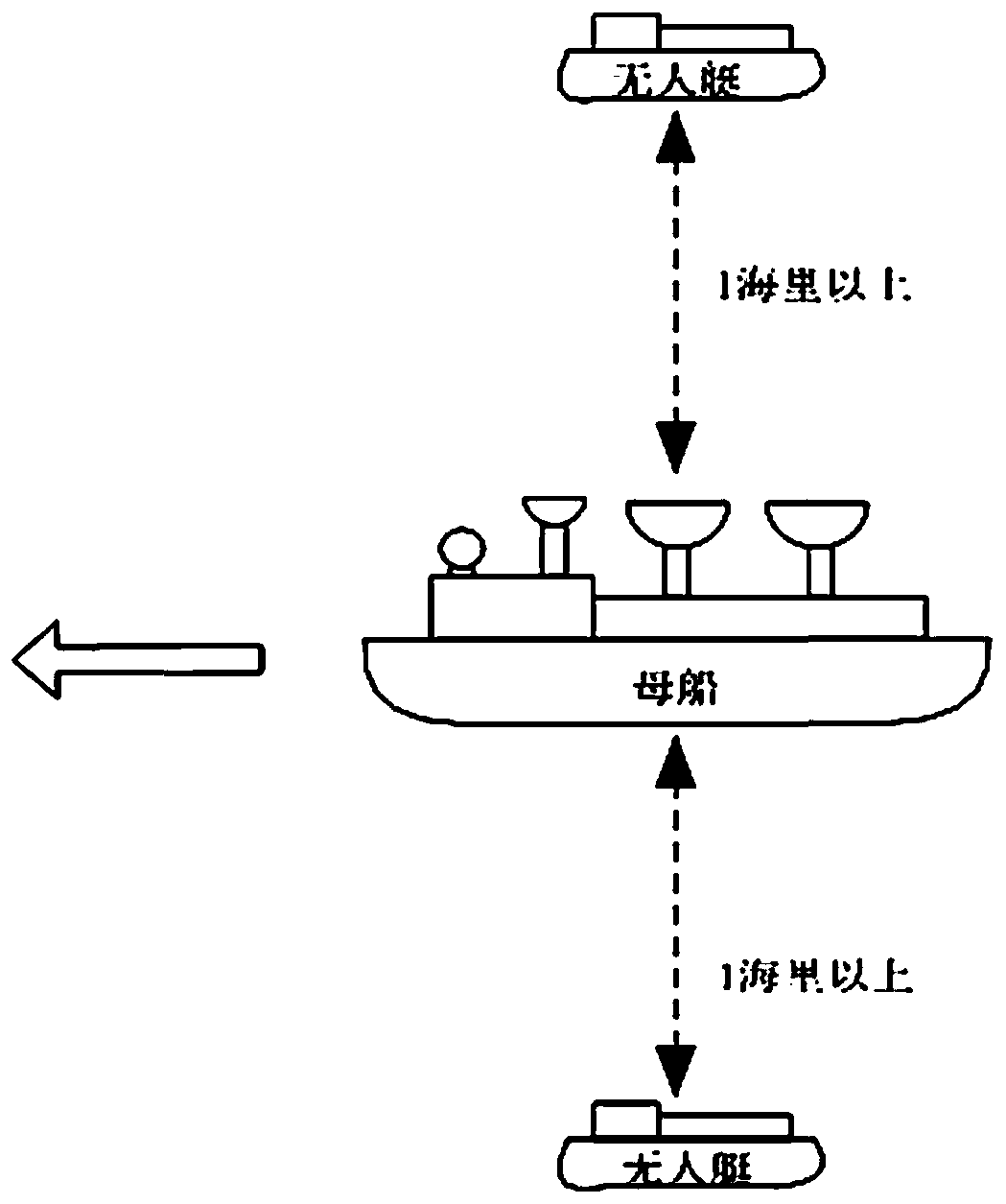
[0026] The basic principle of the marine gravity belt measurement method based on the unmanned platform of the present invention is: use the mother ship to carry and release the unmanned boat, realize one measurement and obtain multiple survey lines, thereby realize the belt measurement, and then obtain gridded area data, for Preparation for mapping. Therefore, the present invention can improve efficiency, reduce deviation, and complete ocean gravity field measurement and mapping through the designed measurement mode.

[0027] The present invention is based on the marine gravity belt measurement method of unmanned platform, comprises following profile step...


PUM


Abstract

The invention belongs to the field of geophysical measurement, and particularly discloses a marine gravity strip-shaped measurement method based on an unmanned platform. The invention discloses a method for carrying out strip-shaped measurement by utilizing the unmanned platform to obtain a gridding gravity/gravity anomaly graph in view of the problems of low efficiency, long time period and existence of time deviation which can affect the drawing of a global or regional gravity/gravity anomaly graph when a ship is designed to run a plurality of navigation routes for parallel measurement in common ship load gravity measurement, so that the drawing efficiency and precision are greatly improved, and the efficiency-cost ratio can also be improved to a certain extent. Through a designed instrument installation mode and a ship measurement and arrangement method, the purpose of acquiring a plurality of measuring lines and a plurality of cross points at one time can be achieved by being equivalent to a plurality of geophysical measurement ships sailing in parallel on the sea, and the determination of the marine gravity field is completed.

Description

technical field [0001] The invention belongs to the technical field of geophysical measurement and measurement, and is used for the measurement of ship-borne gravity, position, speed, water depth, magnetic force and other elements. Background technique [0002] With the development of marine technology, the means of human beings to study, understand and detect the ocean are undergoing substantial changes. Satellite gravity measurement can provide global gravity field information, which can make the gravity field accurate to several milligals and the resolution to 100 km, but in the middle and high-resolution gravity field measurement, the gravity field information provided is far from meeting the requirements of resource exploration, geophysical research and other fields. For the vast ocean, in addition to improving the measurement accuracy in instrument research and development, how to improve the resolution is also important. It has become a difficult problem in the field ...

Claims


Application Information

Patent Timeline
IPC IPC(8): G01V7/16
CPCG01V7/16
Inventor 冯鸿奎赵文华傅敏辉马颖亮金栋赵李健陈嘉鸿康德勇钟德安仇晓静
Owner PLA NO 63686 CORPS
Why Eureka
Try Eureka