A Method of Searching and Identifying Ships by Active Remote Sensing Satellites
An active remote sensing and satellite technology, applied in artificial satellites, transportation and packaging, and services based on location information, etc., can solve problems such as inconvenient maintenance and complex systems in the later stage, and achieve the effects of simple methods, improved search probability, and wide range of applications
- Summary
- Abstract
- Description
- Claims
- Application Information
AI Technical Summary
Problems solved by technology
Method used
Image

Examples
Embodiment
[0030] Embodiments of the present invention provide a method for active remote sensing satellites to search and identify ships, including the following steps:
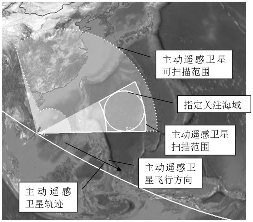
[0031] Step 1, the active remote sensing satellite searches the designated sea area of interest;
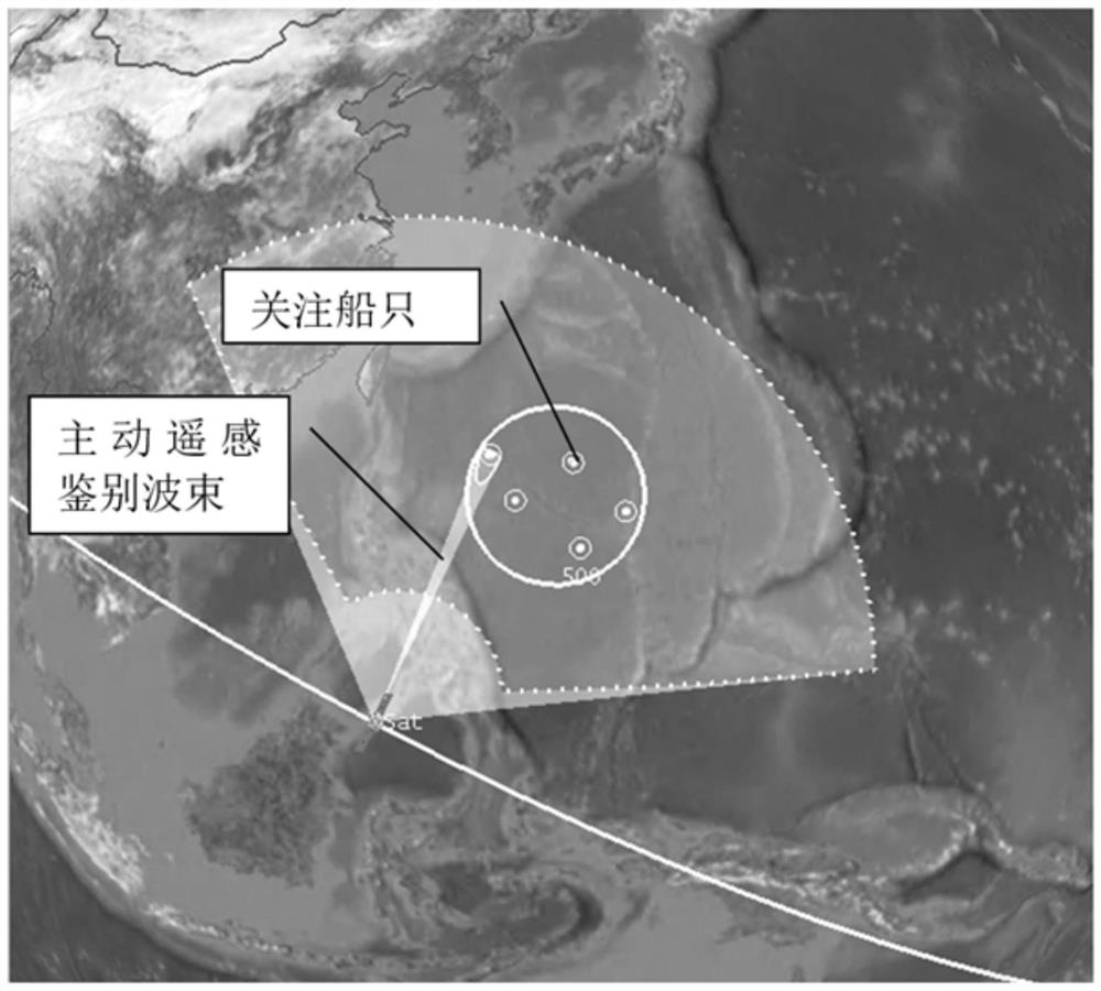
[0032] Step 2, on-board processing of active remote sensing satellites to give the order of attention of ships;
[0033] Step 3, active remote sensing satellite on-board autonomous mission planning, beam scheduling and working mode switching, and active remote sensing identification of ships of interest;
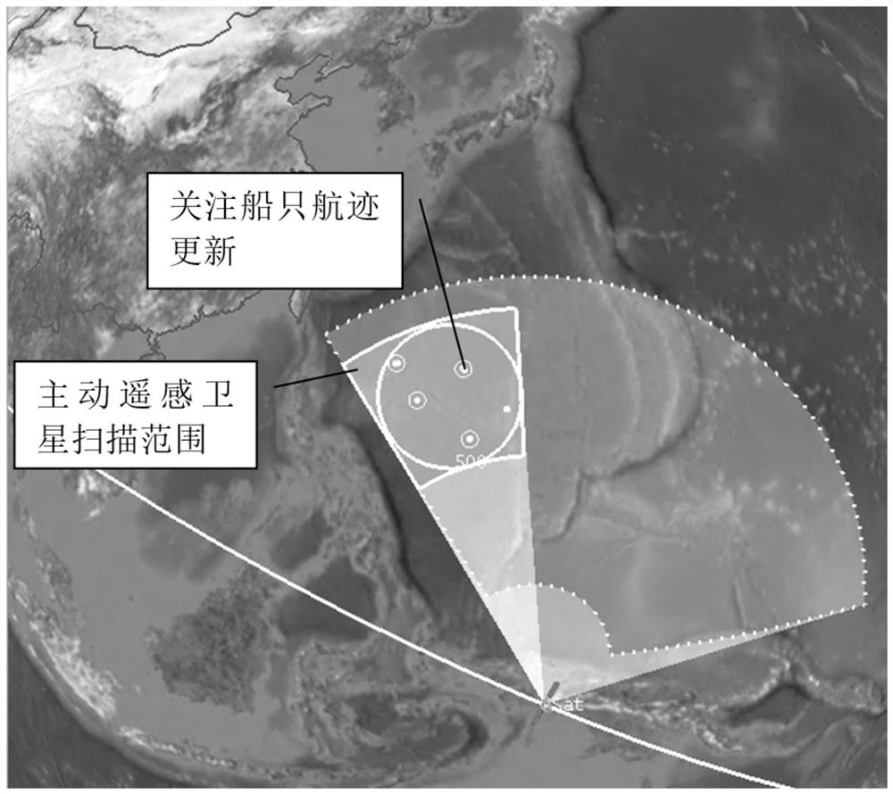
[0034] Step 4. After the identification is completed, the active remote sensing satellite continues to search the designated sea area of interest.
[0035] In the step 1, the active remote sensing satellite is capable of two-dimensional large-angle search, and can search the designated sea area of interest, and the active remote sensing satellite superimposes the number of scans. The active remote sensing satell...
PUM
 Abstract
Description
Claims
Application Information
 - R&D
- Intellectual Property
- Life Sciences
- Materials
- Tech Scout
- Unparalleled Data Quality
- Higher Quality Content
- 60% Fewer Hallucinations
Browse by: Latest US Patents, China's latest patents, Technical Efficacy Thesaurus, Application Domain, Technology Topic, Popular Technical Reports.
© 2025 PatSnap. All rights reserved.Legal|Privacy policy|Modern Slavery Act Transparency Statement|Sitemap|About US| Contact US: help@patsnap.com