Method for identifying and positioning ancient riverway under basalt coverage
A technology for identifying and positioning basalts, applied in the field of uranium mineralization prediction, can solve problems such as the inability to identify and locate ancient river channels, and achieve the effects of environmental protection identification and positioning, high accuracy, and a high starting point
- Summary
- Abstract
- Description
- Claims
- Application Information
AI Technical Summary
Problems solved by technology
Method used
Image
Examples
Embodiment
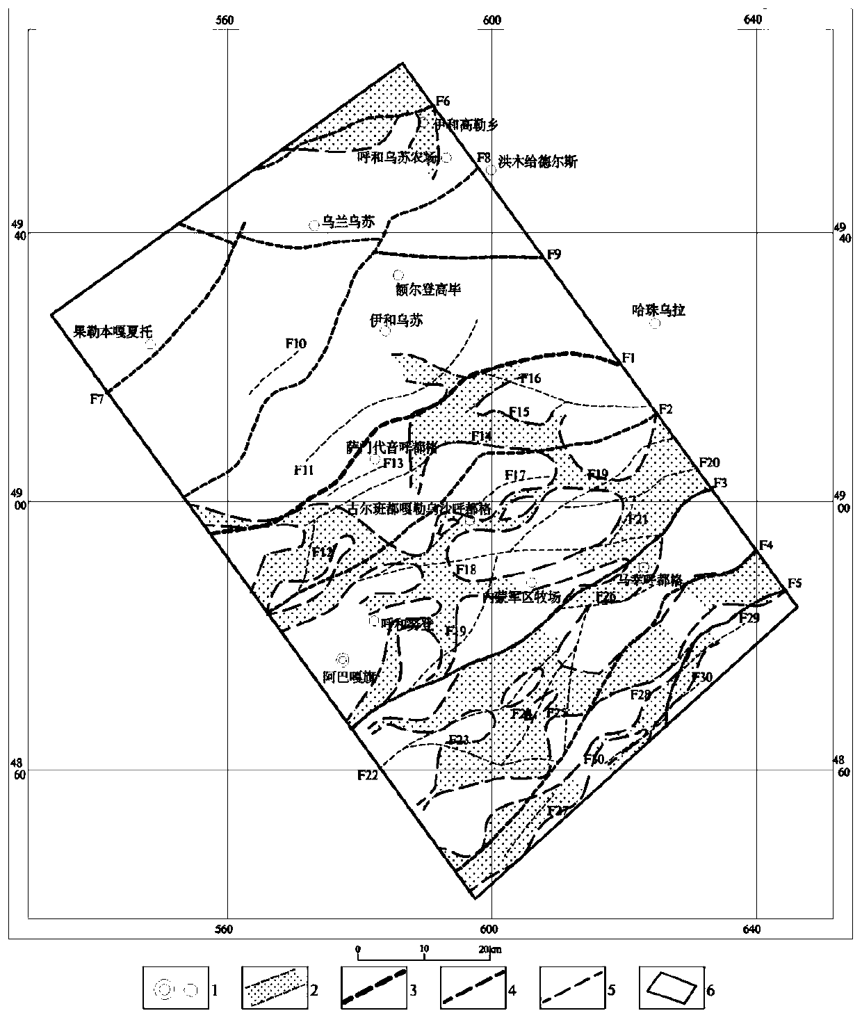
[0067] Step 1: Find out the temporal and spatial distribution characteristics of surface basalts, and determine the possible distribution direction of paleo-channels
[0068] Step 1.1: Identify the temporal and spatial distribution characteristics of surface basalts
[0069] Collect a 1:200,000 geological and mineral map of the study area, delineate the area covered by surface basalt on the map; determine the age of basalt eruption on the comprehensive stratigraphic columnar profile; comprehensively find out the temporal and spatial distribution characteristics of surface basalt.
[0070] Step 1.2: Determine the possible distribution direction of paleochannels under basalt cover
[0071] On the 1:200,000 geological and mineral map, find out the distribution characteristics of the eruptive basalt craters, and combine the temporal and spatial distribution characteristics of the surface basalts found in step 1.1 to determine the distribution trend of the craters and the main axis...
PUM
 Abstract
Description
Claims
Application Information
 - R&D
- Intellectual Property
- Life Sciences
- Materials
- Tech Scout
- Unparalleled Data Quality
- Higher Quality Content
- 60% Fewer Hallucinations
Browse by: Latest US Patents, China's latest patents, Technical Efficacy Thesaurus, Application Domain, Technology Topic, Popular Technical Reports.
© 2025 PatSnap. All rights reserved.Legal|Privacy policy|Modern Slavery Act Transparency Statement|Sitemap|About US| Contact US: help@patsnap.com

