Satellite map segmentation building recombining method

A technology of recombination and satellite map, applied in the direction of editing/combining graphics or text, special data processing applications, biological neural network models, etc., can solve the problems of lack of accuracy, error, and low efficiency of contour data, and achieve good commercial value , the effect of precise contour data

Pending Publication Date: 2020-08-04
广东融合通信股份有限公司
View PDF4 Cites 2 Cited by
  • Summary
  • Abstract
  • Description
  • Claims
  • Application Information

AI Technical Summary

Problems solved by technology

Although the complete outline information of the building can be obtained through this method, the number of tile images that need to be processed is often very large, the resource requireme

Method used


Image

  • Satellite map segmentation building recombining method
  • Satellite map segmentation building recombining method

Examples


Embodiment

[0019] The embodiments of the present invention will be described in detail below in conjunction with the accompanying drawings. Apparently, the described embodiments are only some of the embodiments of the present invention, not all of them.

[0020] In describing the present invention, it should be understood that the terms "upper", "lower", "front", "rear", "left", "right", "top", "bottom", "inner", " The orientation or position or sequence relationship indicated by "outer", "first", "second", etc. are based on the orientation or position or sequence relationship shown in the drawings, and are only for the convenience of describing the present invention and simplifying the description, rather than indicating or It should not be construed as limiting the invention by implying that a referenced device or element must have a particular orientation, be constructed, and operate in a particular orientation.

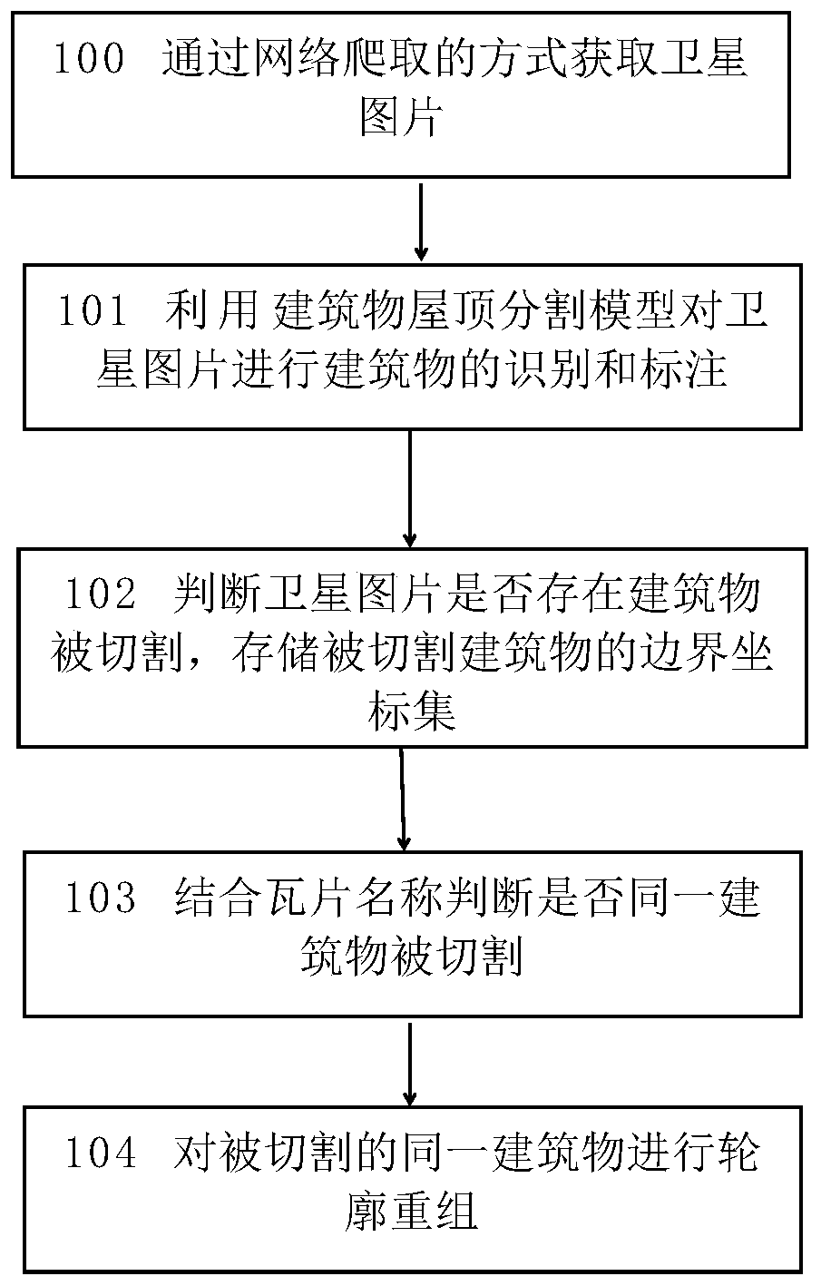
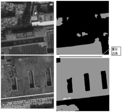
[0021] See attached figure 1 The flow chart of the present invention, ...


PUM


Abstract

The invention discloses a satellite map segmentation building recombining method. The method comprises the steps of acquiring satellite pictures , wherein the satellite pictures are acquired in a network crawling mode; performing building identification and labeling on the acquired satellite pictures through a building roof segmentation model; judging whether a building is cut in the satellite picture or not, and storing a boundary coordinate set of the cut building; and comparing the boundary coordinate set of the cut building of each satellite picture, and carrying out contour recombinationon the same cut building. The method is used for recombining the segmented buildings of the satellite map, and through recombining the buildings, the obtained contour data of the buildings is more accurate; the method is mainly applied to identification processing of the photovoltaic roof satellite remote sensing tile map to form complete and accurate contour data of a map building, map data withgood reference value is provided for photovoltaic business personnel, market analysis, potential customer discovery and great help for business expansion are facilitated, and the method has good commercial value.

Description

technical field [0001] The invention relates to the technical field of image intelligent processing, in particular to a method for recombining buildings by segmenting satellite maps. When the identified buildings in two adjacent satellite pictures appear on the edge of the splicing of the two pictures at the same time, the complete outline data of the building can be recombined through this technology. Background technique [0002] At present, the satellite layers of each map platform are based on the form of tile maps. Segmentation of the tile map is inevitable. If you need the outline data of a certain building and the building is cut on multiple tile images, you need to obtain the outline data of the building. The tile images related to the building are spliced ​​to show the complete outline of the building. Although the complete outline information of the building can be obtained through this method, the number of tile images that need to be processed is often very lar...

Claims


Application Information

Patent Timeline
IPC IPC(8): G06T11/60G06F16/951G06N3/04
CPCG06T11/60G06F16/951G06N3/045
Inventor 许健彰沈翀梁世耀邓前陈香如
Owner 广东融合通信股份有限公司
Why Eureka
Try Eureka