

Standardized basic geographic data making method and system
A technology of geographic data and production method, applied in geographic information database, structured data retrieval, electronic digital data processing, etc., can solve the problems of ambiguity of geographic entities, and the different coverage of coverage and actual surface geographic entities.
- Summary
- Abstract
- Description
- Claims
- Application Information
AI Technical Summary
Problems solved by technology
Method used
Image

Examples
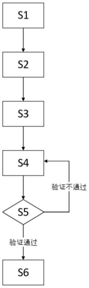
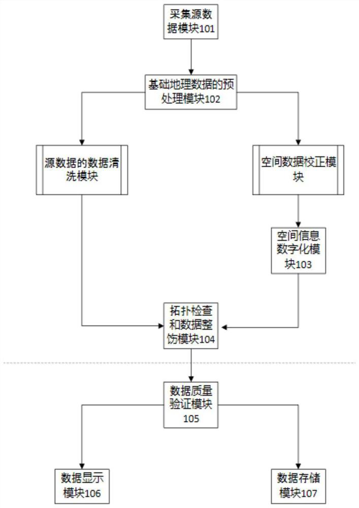
Embodiment
[0030] Analysis of mobile signaling data: Since mobile signaling data contains a large amount of location information of users, firstly, through the analysis and mining of historical sequence data, rich personal characteristic information and group behavior characteristics are obtained.
[0031] Mobile signaling data analysis is mainly oriented to needs:
[0032] Aggregation characteristics of group activities: Mobile signaling data has a wide coverage of users and high timeliness. It can conduct overall analysis of population activities in a large area, understand the changes in the spatial distribution of population, and grasp the dynamic changes of group flow and aggregation. .
[0033] Long-term population flow trends: Mobile signaling data also has the advantage of comprehensive historical data. Generally, signaling data within half a year to one year can be traced back. Therefore, we can observe the situation of population flow over a long period of time and analyze and ...
PUM
 Abstract
Description
Claims
Application Information