Supercharge Your Innovation With Domain-Expert AI Agents!

UWB positioning system and base station surveying and mapping method and device

A technology of positioning system and base station, applied in the field of navigation

Pending Publication Date: 2020-10-23
黄珊
View PDF5 Cites 1 Cited by
  • Summary
  • Abstract
  • Description
  • Claims
  • Application Information

AI Technical Summary

Problems solved by technology

[0005] Embodiments of the present invention provide a UWB positioning system, base station surveying and mapping method and device, to at least solve a series of problems in the related art when the UWB positioning system performs surveying and mapping of base stations

Method used


Image

  • UWB positioning system and base station surveying and mapping method and device
  • UWB positioning system and base station surveying and mapping method and device
  • UWB positioning system and base station surveying and mapping method and device

Examples


Embodiment 1

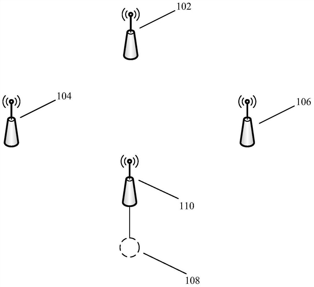
[0031] An embodiment of the present invention provides a UWB positioning system, figure 1 is a system schematic diagram of a UWB positioning system provided according to an embodiment of the present invention, such as figure 1 As shown, the UWB positioning system in the embodiment of the present invention includes:

[0032] The first base station 102 is configured to broadcast a first positioning signal at a first sending moment;

[0033] The second base station 104 is configured to broadcast a second positioning signal at a second sending moment;

[0034] The third base station 106 is configured to broadcast a third positioning signal at a third sending moment;

[0035] The calculating unit 108 is configured to determine the position of the target base station 110 at least according to the first positioning signal, the second positioning signal, and the third positioning signal.

[0036] It should be noted that the UWB positioning system in the embodiment of the present in...

Embodiment 2

[0209] An embodiment of the present invention provides a base station surveying and mapping method, Figure 6 is a flowchart of a base station surveying and mapping method provided according to an embodiment of the present invention, such as Figure 6 As shown, the base station surveying and mapping method in the embodiment of the present invention includes:

[0210] S202. Broadcast the first positioning signal at the first sending moment through the first base station, broadcast the second positioning signal at the second sending moment through the second base station, and broadcast the third positioning signal at the third sending moment through the third base station;

[0211] S204. Determine the location of the target base station at least according to the first positioning signal, the second positioning signal, and the third positioning signal.

[0212] In an optional embodiment, the base station surveying and mapping method in the embodiment of the present invention fur...

Embodiment 3

[0305]The embodiment of the present invention also provides a base station surveying and mapping device, which is used to implement the above-mentioned embodiments and preferred implementation modes, and what has already been described will not be repeated. As used below, the term "module" may be a combination of software and / or hardware that realizes a predetermined function. Although the devices described in the following embodiments are preferably implemented in software, implementations in hardware, or a combination of software and hardware are also possible and contemplated.

[0306] Figure 7 is a structural block diagram of a base station surveying and mapping device provided according to an embodiment of the present invention, such as Figure 7 As shown, the base station surveying and mapping device in the embodiment of the present invention includes:

[0307] The broadcast module 302 is configured to broadcast the first positioning signal at the first sending moment...


PUM


Abstract

The embodiment of the invention provides a UWB positioning system and a base station surveying and mapping method and device, and the system comprises a first base station which is configured to broadcast a first positioning signal at a first transmitting moment; a second base station configured to broadcast a second positioning signal at a second transmission time; a third base station configuredto broadcast a third positioning signal at a third transmission time; and a resolving unit configured to determine the position of the target base station at least according to the first positioningsignal, the second positioning signal and the third positioning signal. Through the embodiment of the invention, a series of problems existing when the UWB positioning system maps the base station inthe related art can be solved, so that the effect of efficiently realizing accurate mapping of the base station can be achieved.

Description

technical field [0001] The present invention relates to the field of navigation, in particular to a UWB positioning system, a base station surveying and mapping method and device. Background technique [0002] The ultra-wideband (Ultra Wide Band, UWB) positioning system in the related art realizes the positioning process through the communication interaction between multiple base stations in the system and the tags performing positioning; specifically, the base station sends data frames to the tags After positioning, the tag needs to return a data frame to the base station, so that the base station can know the relative position of the tag and the base station, and perform the above operations through multiple base stations with known positions, and then realize the positioning of the tag. [0003] In order to realize the above-mentioned positioning operation, the position of the base station needs to be determined in advance. Therefore, in the related art, after the deploym...

Claims


Application Information

Patent Timeline
IPC IPC(8): H04W4/02H04W4/024H04W4/06H04W64/00
CPCH04W4/024H04W4/023H04W4/06H04W64/00Y02D30/70
Inventor 黄珊
Owner 黄珊
Features
  • R&D
  • Intellectual Property
  • Life Sciences
  • Materials
  • Tech Scout
  • Unparalleled Data Quality
  • Higher Quality Content
  • 60% Fewer Hallucinations
Learn More