An Analysis Method for Multi-satellite-to-Multiple Demand Planning Imaging
- Summary
- Abstract
- Description
- Claims
- Application Information
AI Technical Summary
Problems solved by technology
Method used
Image
Examples
Embodiment Construction
[0053] The technical solutions of the present invention will be described in detail below in conjunction with the accompanying drawings and preferred embodiments.
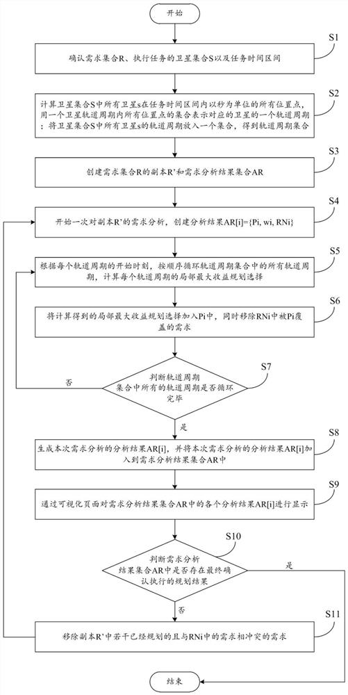
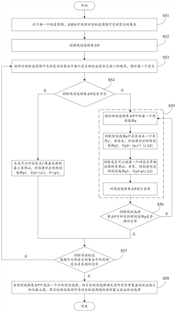
[0054] In one embodiment, such as figure 1 As shown, the present invention provides an analysis method for multi-satellite-to-multiple-demand planning imaging, which can quickly obtain a plan with "local maximum benefit" within a specified time range when multiple remote sensing satellites image multiple demand targets. selection, and after executing the planning selection, the sum of the benefit values of the requirements that can be covered. The so-called "planning selection" in the present invention refers to a set of non-conflicting imaging strips that can be executed by one or more satellites within a specified time range.
[0055] The analysis method of multi-satellite to multi-demand planning imaging in this embodiment specifically includes the following steps:
[0056] Step 1 (S1): Confirm the requireme...
PUM
 Abstract
Description
Claims
Application Information
 - R&D
- Intellectual Property
- Life Sciences
- Materials
- Tech Scout
- Unparalleled Data Quality
- Higher Quality Content
- 60% Fewer Hallucinations
Browse by: Latest US Patents, China's latest patents, Technical Efficacy Thesaurus, Application Domain, Technology Topic, Popular Technical Reports.
© 2025 PatSnap. All rights reserved.Legal|Privacy policy|Modern Slavery Act Transparency Statement|Sitemap|About US| Contact US: help@patsnap.com


