Satellite image processing method and device, electronic equipment and computer storage medium

A satellite image and processing method technology, applied in the field of image processing, can solve problems such as low processing efficiency

Pending Publication Date: 2021-02-23
TENCENT TECH (SHENZHEN) CO LTD
View PDF0 Cites 6 Cited by
  • Summary
  • Abstract
  • Description
  • Claims
  • Application Information

AI Technical Summary

Problems solved by technology

[0004] In the existing technology, the height prediction model and the offset prediction model need

Method used


Image

  • Satellite image processing method and device, electronic equipment and computer storage medium
  • Satellite image processing method and device, electronic equipment and computer storage medium
  • Satellite image processing method and device, electronic equipment and computer storage medium

Examples


Embodiment Construction

[0057] The following will clearly and completely describe the technical solutions in the embodiments of the present invention with reference to the accompanying drawings in the embodiments of the present invention. Obviously, the described embodiments are only some, not all, embodiments of the present invention. Based on the embodiments of the present invention, all other embodiments obtained by persons of ordinary skill in the art without making creative efforts belong to the protection scope of the present invention.

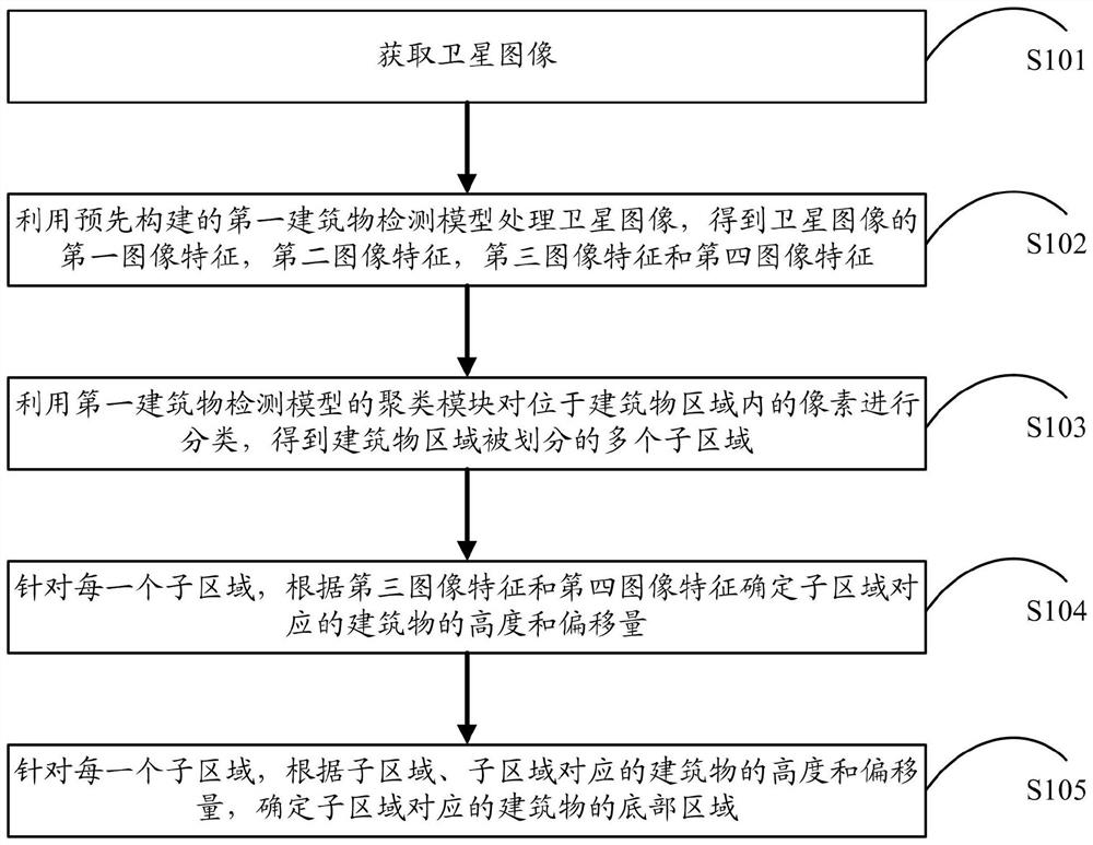
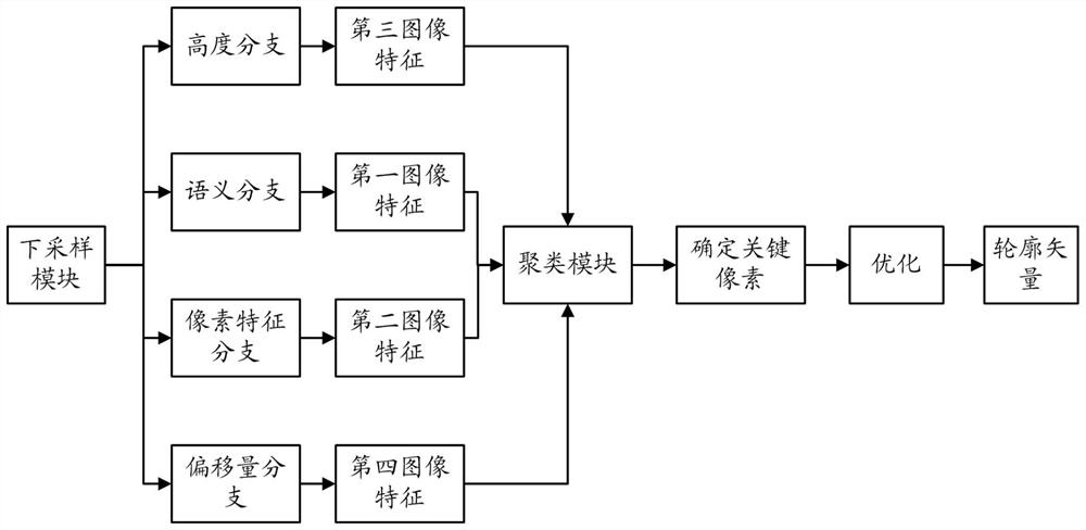
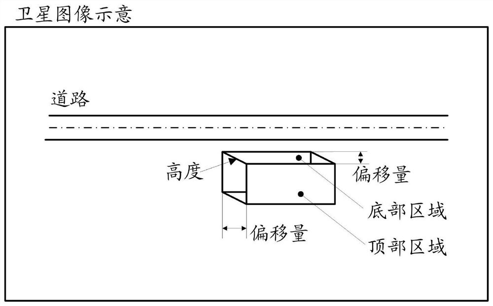
[0058] The present application provides a satellite image processing method, which is mainly used to detect the top and bottom of the building displayed on the satellite image, so as to subsequently display the corresponding three-dimensional model of the building to the user on the digital map generated based on the satellite image. In addition, in other embodiments of the present application, in order to reduce the amount of map data sent to the client, the d...


PUM


Abstract

The invention provides a satellite image processing method and device, electronic equipment and a computer storage medium, and the method comprises the steps: obtaining a satellite image; processing the satellite image by utilizing a semantic branch, a pixel feature branch, a height branch and an offset branch of the first building detection model to obtain a first image feature indicating a building area in the satellite image, a second image feature consisting of pixel features of each pixel of the satellite image; a third image feature comprising the height feature of each pixel in the satellite image, and a fourth image feature comprising the offset feature of each pixel; dividing the building area into sub-areas corresponding to the building according to the second image features; anddetermining the height and the offset of the building according to the height characteristics and the offset characteristics of the pixels in the building subareas, thereby determining the bottom area of the building. According to the scheme, the plurality of branches can perform parallel processing on the satellite image, so that the scheme has higher processing efficiency compared with the prior art.

Description

technical field [0001] The invention relates to the technical field of image processing, in particular to a satellite image processing method, device, electronic equipment and computer storage medium. Background technique [0002] At present, the digital map has become a navigation and wayfinding tool commonly used in people's daily life. In order to make it easier for users to identify buildings on the map, existing digital maps often need to show users the corresponding three-dimensional models of the buildings. For this purpose, the top and bottom of each building need to be detected on the corresponding satellite images. [0003] In the prior art, the instance detection model can be used to detect the top of each building in the satellite image, and then the height prediction model and the offset prediction model can be used to predict the height of the building according to the identified top of each building and the offset (the offset refers to the offset of the botto...

Claims


Application Information

Patent Timeline
IPC IPC(8): G06T17/10G06T7/11G06T7/194G06K9/46G06K9/62G06N3/04G06N3/08
CPCG06T17/10G06T7/11G06T7/194G06N3/08G06T2207/10032G06T2207/20081G06T2207/20084G06T2207/30184G06V10/44G06N3/045G06F18/23
Inventor 单鼎一
Owner TENCENT TECH (SHENZHEN) CO LTD
Why Eureka
Try Eureka