

High-precision vector map compression method based on polar coordinate system
A vector map and polar coordinate system technology, applied in geographic information databases, special data processing applications, structured data retrieval, etc. Data storage memory and other issues
- Summary
- Abstract
- Description
- Claims
- Application Information
AI Technical Summary
Problems solved by technology
Method used
Image

Examples
Embodiment 1
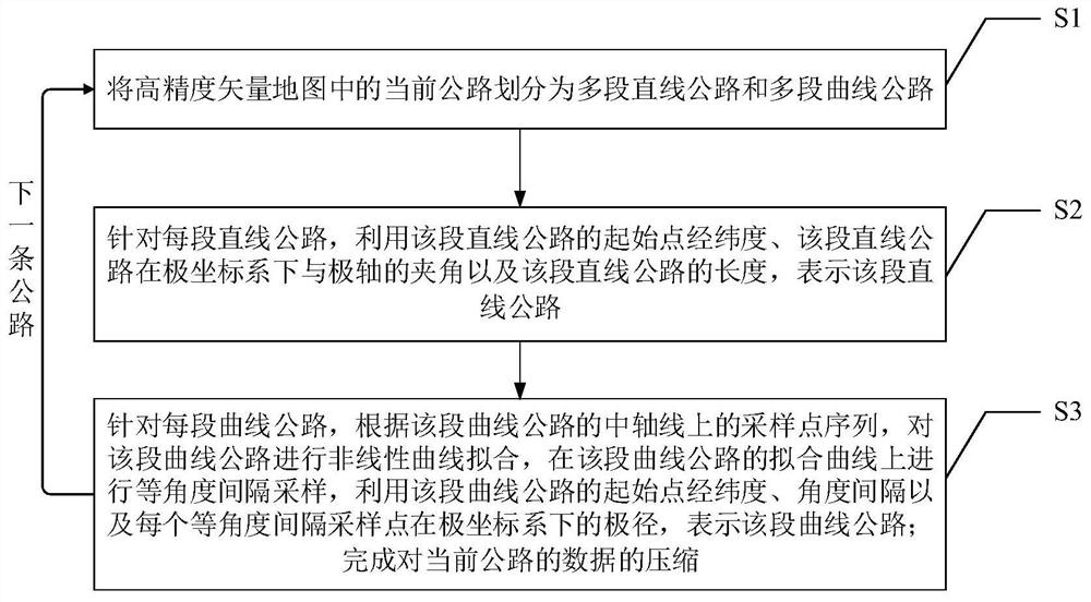
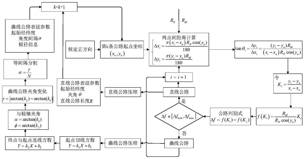
[0061] Embodiment 1: the specific flow chart is as figure 2 shown.
[0062] Step 1: Divide the current road in the high-precision vector map into multi-segment straight roads and multi-segment curved roads, that is, identify different types of road segments (straight roads or curved roads).
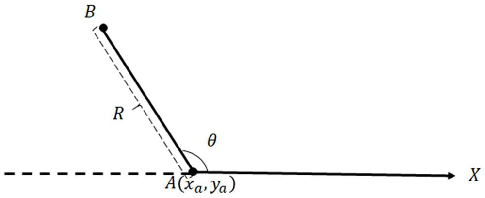
[0063] Let the geographic coordinates of the starting point A of the current road in the high-precision vector map (that is, the coordinates in the direct coordinate system) be (x a ,y a ), the geographical coordinates of any point I on the central axis of the current road except the starting point A in the high-precision vector map are (x i ,y i ), taking the starting point A of the current road as the origin of the polar coordinate system, and the true north direction in the high-precision vector map as the polar axis direction (that is, the positive direction) of the polar coordinate system, then the point I in the high-precision vector map and the starting point The distance betw...
PUM
 Abstract
Description
Claims
Application Information