Method for filtering background of roadside radar in real time based on polygon modeling
A polygon and radar technology, applied in the field of traffic image processing and traffic information, can solve the problems of differentiation and failure, and achieve the effect of low calculation load, short calculation time, and real-time background filtering.
- Summary
- Abstract
- Description
- Claims
- Application Information
AI Technical Summary
Problems solved by technology
Method used
Image
Examples
Embodiment
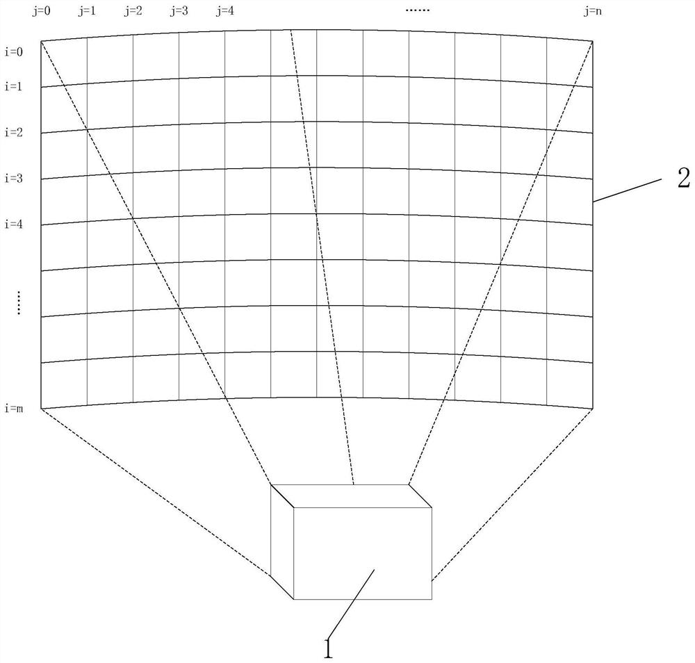
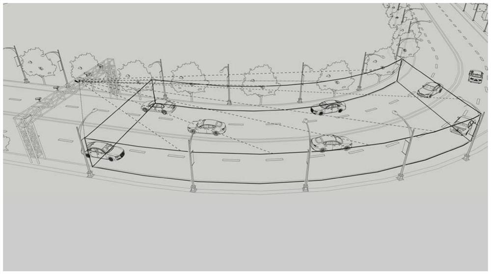
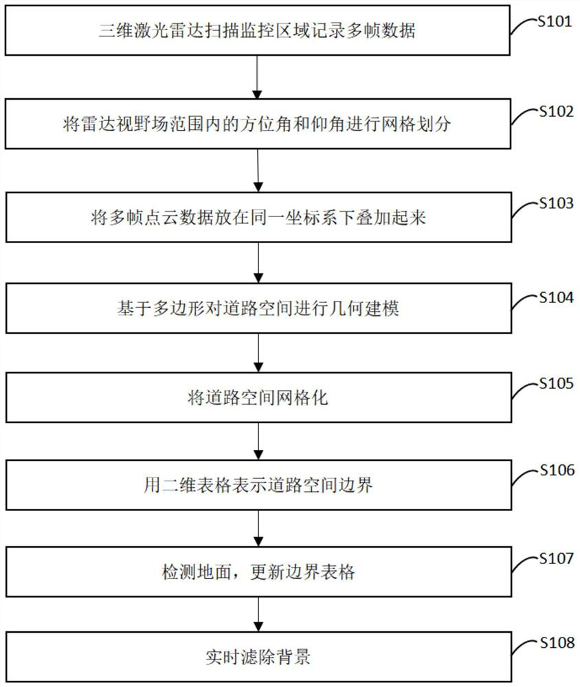
[0041] Such as Figure 1 ~ Figure 3 as shown,
[0042] As one of the purposes of the present invention,
[0043] The present invention is realized in this way. The road space is geometrically modeled based on polygons, and the road space monitored by radar is surrounded and closed with the geometric model. The point cloud located in the geometric model is reserved for the detection object, while the points outside the geometric model Clouds are filtered out as background. In order to achieve real-time background filtering, the following steps are included:
[0044] Step 1, the 3D lidar scans the monitoring area and records multiple frames of data;
[0045] Step 2, grid the field of view;
[0046] In the spherical coordinate system (r, θ, ), set the azimuth angle in the field of view of the radar and elevation angle θ for grid division, and the grid size of azimuth and elevation angles determine the appropriate value according to the resolution of radar scanning. After...
PUM
 Abstract
Description
Claims
Application Information
 - R&D
- Intellectual Property
- Life Sciences
- Materials
- Tech Scout
- Unparalleled Data Quality
- Higher Quality Content
- 60% Fewer Hallucinations
Browse by: Latest US Patents, China's latest patents, Technical Efficacy Thesaurus, Application Domain, Technology Topic, Popular Technical Reports.
© 2025 PatSnap. All rights reserved.Legal|Privacy policy|Modern Slavery Act Transparency Statement|Sitemap|About US| Contact US: help@patsnap.com


