
A method and system for identifying urban multi-level boundaries

An identification method and a multi-level technology, applied in the field of surveying and mapping and geographic information, can solve the problems of lack of global consensus and international standards for city definitions, affecting the reliability of urban comparison research results, and fuzzy spatial boundaries, etc., to achieve important market value and solve practical problems Inconvenient application and low practicability

Active Publication Date: 2022-07-19
WUHAN UNIV
View PDF10 Cites 0 Cited by
  • Summary
  • Abstract
  • Description
  • Claims
  • Application Information

AI Technical Summary

Problems solved by technology

In cross-country comparative studies of cities, the differences between different definitions of cities are often easily overlooked, which greatly affects the reliability of the results of comparative city studies
Currently, there is still a lack of global consensus and international standards for city definitions
At the same time, as capital increasingly penetrates into rural areas, industrial and mining areas, and remote areas, urban and rural landscapes are increasingly mixed, and the spatial boundaries between the two are increasingly blurred, making the traditionally commonly used dichotomy of "urban / rural" increasingly difficult and insufficient.

Method used


Image

  • A method and system for identifying urban multi-level boundaries
  • A method and system for identifying urban multi-level boundaries
  • A method and system for identifying urban multi-level boundaries

Examples


Embodiment Construction

[0058] The technical solutions of the present invention will be specifically described below with reference to the accompanying drawings and embodiments.

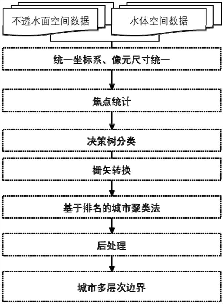
[0059] like figure 1 As shown, an automatic identification method for a city multi-level boundary provided by an embodiment of the present invention includes the following steps:

[0060] Step 1: Preprocess the spatial data of impervious surface and water body.

[0061] The process of preprocessing the spatial data of the impervious surface and the spatial data of the water body in the step 1 is as follows: first, the outliers are removed from the data, and then the two kinds of data are converted into the same spatial coordinate system, and the same pixel is generated by resampling. size of raster data.

[0062] The implementation of step 1 in the embodiment mainly includes: first, the data is firstly eliminated outliers; then, the ArcGIS software platform of ESRI company can be used to convert the two kinds of data into...


PUM


Abstract

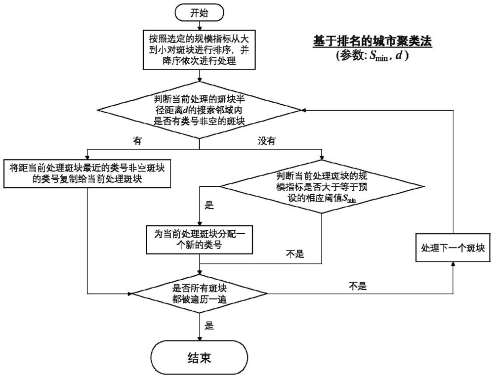
The invention discloses a method and system for identifying urban multi-level boundaries, including preprocessing impervious surface spatial data and water body spatial data, and performing focus statistics on the impervious surface spatial data and water body spatial data; The statistical results are classified to generate spatial data of urbanized patches; for the spatial data of urbanized patches, RUC clustering is performed based on the area size index of each patch; the clustering results are post-processed to generate urban multi-level boundaries . The automatic solution for city boundary identification proposed by the present invention is mainly identified based on the physical form characteristics of the city, which can not only provide a spatial data basis for multi-scale city research, but also support more application requirements.

Description

technical field [0001] The invention belongs to the field of surveying and mapping and geographic information, and particularly relates to a technical solution for city mapping and city boundary identification. Background technique [0002] In the corresponding technical research of the city, the first problem to be faced is how to define the city. Settling in the real space, this problem can be specifically expressed as: how to spatially define an urban settlement. The spatial definition of a city is also one of the basic problems that urban research needs to face. This is because most statistical indicators of a city, such as urban population and urban GDP, can only be counted when the spatial scope is clear. Although the spatial definition of the city is the basis of research and is very important, it is difficult because it can have different social, economic and cultural meanings. Some scholars divide the spatial scope of a city into three types: administrative region...

Claims


Application Information

Patent Timeline
Patent Type & Authority Patents(China)
IPC IPC(8): G06V20/10G06V10/762G06V10/764G06Q50/26
CPCG06Q50/26G06V20/182G06V20/176G06F18/23G06F18/24323
Inventor 焦利民徐智邦周正梓罗鑫芯
Owner WUHAN UNIV
Learn More