

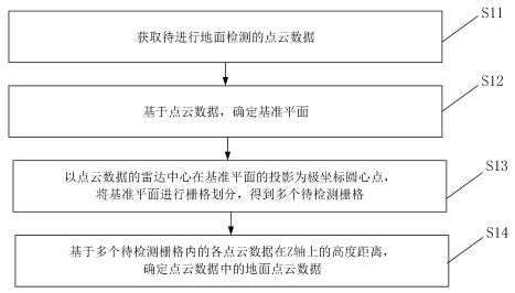
Method and device for detecting ground points in 3D radar point cloud data and medium
A technology of point cloud data and ground points, which is applied in the field of computer vision, can solve problems such as easy interference, and achieve the effect of accuracy, avoiding interference, and enhancing applicability
- Summary
- Abstract
- Description
- Claims
- Application Information
AI Technical Summary
Problems solved by technology
Method used
Image

Examples
Embodiment Construction
[0066] Reference will now be made in detail to the exemplary embodiments, examples of which are illustrated in the accompanying drawings. When the following description refers to the accompanying drawings, the same numerals in different drawings refer to the same or similar elements unless otherwise indicated. The implementations described in the following exemplary examples do not represent all implementations consistent with the present disclosure. Rather, they are merely examples of apparatuses and methods consistent with aspects of the present disclosure as recited in the appended claims.
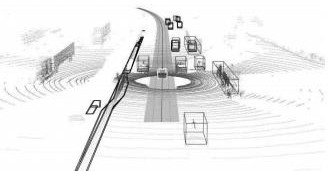
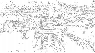
[0067] The method for detecting ground points in 3D radar point cloud data provided by the present disclosure is applicable to the usage scenario of obtaining point cloud data by vehicle-mounted lidar. In an example, a lidar device with 64 laser beams is taken as an example. When collecting point cloud data, the lidar device is the center, and 64 laser rays are emitted outward accordi...
PUM
 Abstract
Description
Claims
Application Information