Method and arrangement for creating a digital building model

A building and model technology, applied in the direction of electrical digital data processing, configuration CAD, special data processing applications, etc., can solve laborious and time-consuming problems

Pending Publication Date: 2021-09-21
SIEMENS SWITZERLAND
View PDF0 Cites 0 Cited by
  • Summary
  • Abstract
  • Description
  • Claims
  • Application Information

AI Technical Summary

Problems solved by technology

[0004] However, known methods for determining measuring points in a building and for scanning the measuring points for use in a digital building information model are laborious and time-consuming

Method used


Image

  • Method and arrangement for creating a digital building model
  • Method and arrangement for creating a digital building model
  • Method and arrangement for creating a digital building model

Examples


Embodiment Construction

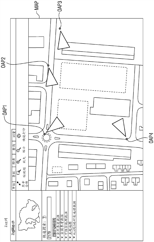
[0033] figure 1 An exemplary excerpt of a city plan with exemplary official measured anchor points OAP1-OAP4 is shown. Such anchor points OAP1-OAP4 are determined or used in the specialized field of geodesy, in particular engineering geodesy, for example for topographical surveying, cadastral surveying or architectural surveying. Anchor points OAP1-OAP4 are also called survey points or survey points. An anchor point may be set as a triangular point with corresponding coordinates, for example by triangulation. Depending on the application, anchor points are also known as elevation control points, geodetic fixed points, height marks, plane control points, etc. These anchor points OAP1-OAP4 can be defined, for example, as planar coordinates in a Gauss-Krüger coordinate system or in a UTM (Universal Transverse Mercator) coordinate system.

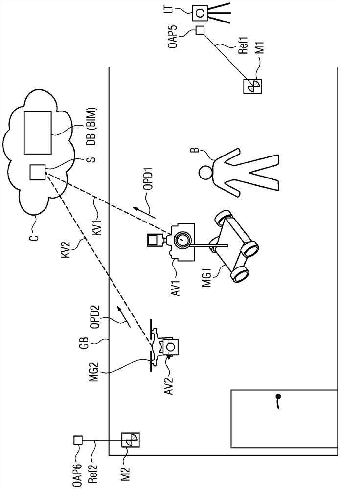
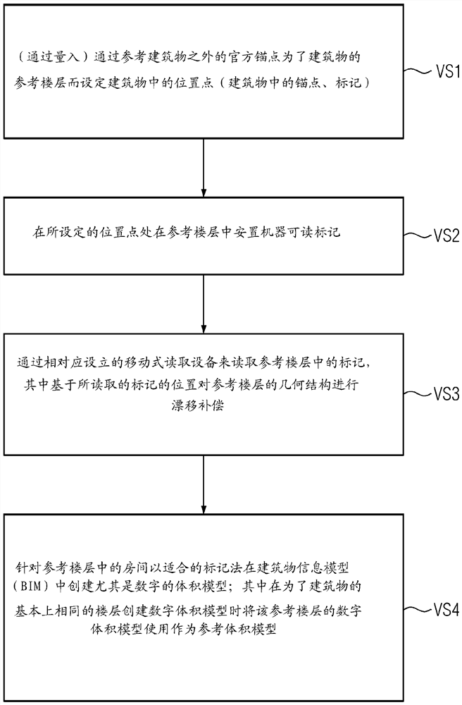
[0034] A location point (marker) is set in the building by reference to the official anchor points OAP1 - OAP4 eg by measuring the official...


PUM


Abstract

The invention relates to a method and to an arrangement for creating a digital building model for an existing building, wherein: location points in the building are defined by referencing official anchor points outside the building for a reference storey of the building; machine-readable markers in the reference storey are attached to the defined location points; the markers in the reference storey are read in by a correspondingly configured mobile reading device (scanning device), wherein on the basis of the location position of the read-in markers a drift compensation of the geometry of the reference storey is carried out; a digital volume model for the rooms in the reference storey is created in a suitable notation; and the digital volume model of the reference storey is used as the reference volume model during the creation of digital volume models for substantially identical storeys of the building.

Description

technical field [0001] The present invention relates to a method and a device for creating a digital building model for an existing building. Background technique [0002] In a preparatory phase for creating a virtual image of a building (digital twin) or a cluster of buildings, existing buildings are detected with a scanner, in particular a laser scanner. When scanning the building, the measuring points in the building are detected and processed by suitable devices. However, these measuring points must be set in advance by the surveyor and must be placed in the building in a manner suitable for scanning. [0003] In this case, the surveyor usually sets measuring points (anchor points, markers) with the aid of a tachymeter or a total station, wherein these measuring points are also detected during the scanning process. This preprocessing requires approximately as much time as the actual subsequent scanning process. By means of this measure, the location of the building is...

Claims


Application Information

Patent Timeline
IPC IPC(8): G06F30/12G06F30/13G06F111/20G06F119/20
CPCG06F30/13G06F2111/20G06F2119/20G06F30/12
Inventor O·采希林
Owner SIEMENS SWITZERLAND
Why Eureka
Try Eureka