
Multi-unmanned aerial vehicle cooperative tracking and positioning method

A tracking and positioning, multi-UAV technology, applied in three-dimensional position/course control, vehicle position/route/altitude control, instruments, etc., can solve the problem of inaccurate estimation of the target state of the node, and reduce the amount of calculation and error The effect of small mean square error and accurate estimation results

Pending Publication Date: 2021-10-22
NANJING UNIV OF SCI & TECH
View PDF1 Cites 2 Cited by
  • Summary
  • Abstract
  • Description
  • Claims
  • Application Information

AI Technical Summary

Problems solved by technology

In sensor networks, the target state may not be fully observable for some nodes, so the target state estimation of the node is not accurate enough

Method used


Image

  • Multi-unmanned aerial vehicle cooperative tracking and positioning method
  • Multi-unmanned aerial vehicle cooperative tracking and positioning method
  • Multi-unmanned aerial vehicle cooperative tracking and positioning method

Examples


Embodiment

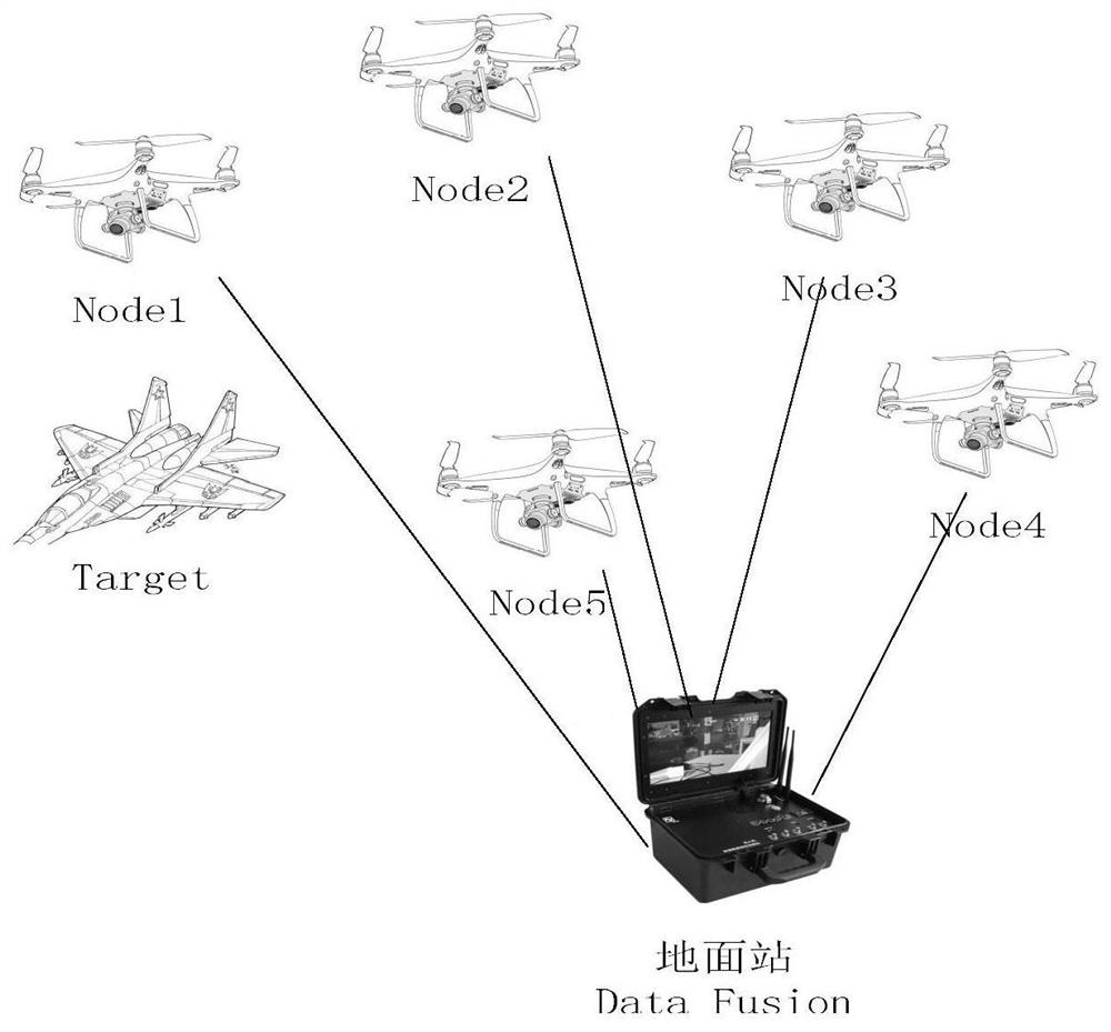
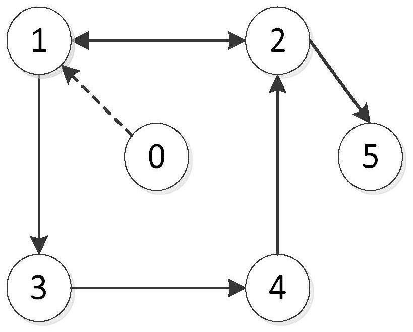
[0072] This embodiment is aimed at figure 2 The directed connected graph of the topology of the UAV is shown, and the target target0 is searched. Among them, node 1 can directly observe the target, and the new measurement value transmits state estimation information in the cyclic network for node state update.

[0073] Firstly, a connected network G={v,ε,a} is established, and the IKCF algorithm is used for filtering estimation, and finally, the SFCI algorithm is used for data fusion to obtain the uniquely determined target state information. Specific steps are as follows:

[0074] Step 1. Based on the obtained network topology diagram, a directed connected graph is established according to the method of graph theory, and the connection information between the UAV sensor node and the adjacent nodes is obtained as follows:

[0075]

[0076] Step 2. Establish a linear continuous-time system model. Here, it is assumed that the system input is 0, and the target motion state ...


PUM


Abstract

The invention discloses a multi-unmanned aerial vehicle cooperative tracking and positioning method. The method comprises the following steps of: establishing a directed connected graph based on a graph theory method according to an unmanned aerial vehicle communication network topological structure graph, and obtaining connection information of unmanned aerial vehicle sensor nodes and adjacent nodes; establishing a linear continuous time system model; estimating unknown information of a target by using an IKCF filtering algorithm; and carrying out data fusion on the estimation result of each node by adopting a sequential fast covariance cross fusion algorithm to obtain a determined target position. According to the multi-unmanned aerial vehicle cooperative tracking and positioning method of the invention, the estimation information of the adjacent unmanned aerial vehicle nodes is fully utilized, the real-time performance of the system is improved, and the target position estimation is more accurate.

Description

technical field [0001] The invention relates to the technical field of UAV control and navigation, in particular to a multi-UAV cooperative tracking and positioning method. Background technique [0002] With the development of science and technology, UAVs are widely used in military and civilian fields. Due to the limitation of the sensor angle of a single UAV, the inability to observe targets in multiple directions and weak endurance, multi-UAVs work together So as to achieve the purpose of widening the observation range and ensuring safety and reliability. [0003] When UAVs work together, their network topology often changes, and this time-varying topology is usually called a switching topology. Generally speaking, the estimation problem based on switching topology can well cope with the requirements of topology changes, and finally makes the position estimation results more accurate. For such practical situations, discrete systems often cannot fully respond to topology...

Claims


Application Information

Patent Timeline
Patent Type & Authority Applications(China)
IPC IPC(8): G05D1/10
CPCG05D1/104
Inventor 贾越戚国庆李银伢盛安冬
Owner NANJING UNIV OF SCI & TECH
Learn More