
Method, device and storage medium for determining landslide susceptibility distribution map

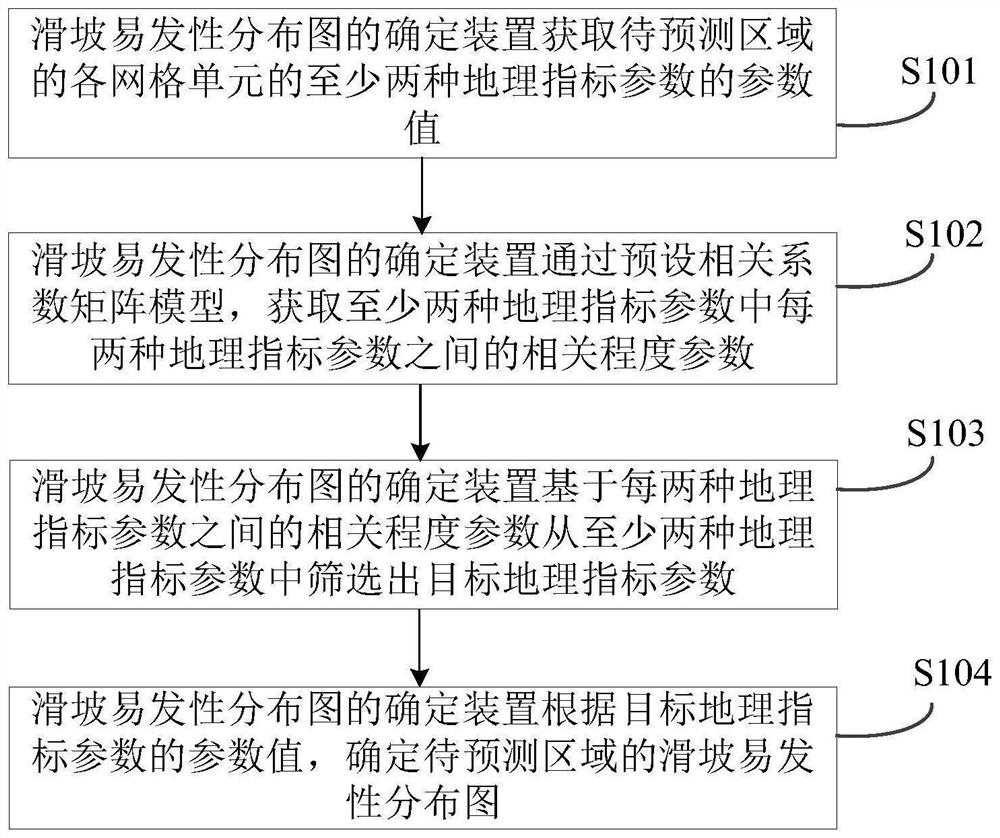
A method for determining a method and a technology for determining a device, which is applied in the field of geology and can solve problems such as the influence of the accuracy of the landslide susceptibility distribution map.

Active Publication Date: 2022-03-18
INST OF GEOGRAPHICAL SCI & NATURAL RESOURCE RES CAS
View PDF14 Cites 0 Cited by
  • Summary
  • Abstract
  • Description
  • Claims
  • Application Information

AI Technical Summary

Problems solved by technology

[0003] However, because there are many types of geographical index parameters, the correlation between various indicators has an impact on the analysis of landslide probability, so the accuracy of the obtained landslide susceptibility distribution map is also affected

Method used


Image

  • Method, device and storage medium for determining landslide susceptibility distribution map
  • Method, device and storage medium for determining landslide susceptibility distribution map
  • Method, device and storage medium for determining landslide susceptibility distribution map

Examples


Embodiment Construction

[0050] The method, device and storage medium for determining the landslide susceptibility distribution map provided by the embodiments of the present application will be described in detail below with reference to the accompanying drawings.

[0051] The term "and / or" in this article is just an association relationship describing associated objects, which means that there can be three relationships, for example, A and / or B can mean: A exists alone, A and B exist simultaneously, and there exists alone B these three situations.

[0052] The terms "first" and "second" in the specification and drawings of the present application are used to distinguish different objects, or to distinguish different processes for the same object, rather than to describe a specific sequence of objects.

[0053] In addition, the terms "including" and "having" mentioned in the description of the present application and any variations thereof are intended to cover non-exclusive inclusion. For example, ...


PUM


Abstract

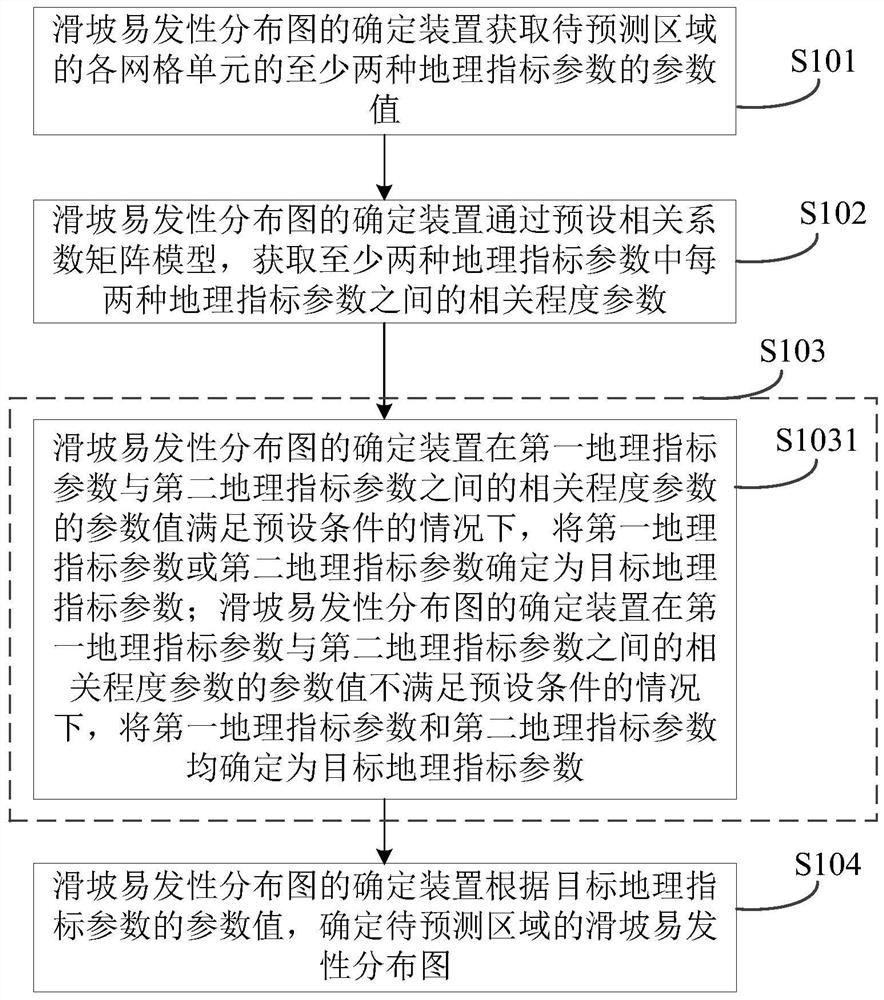
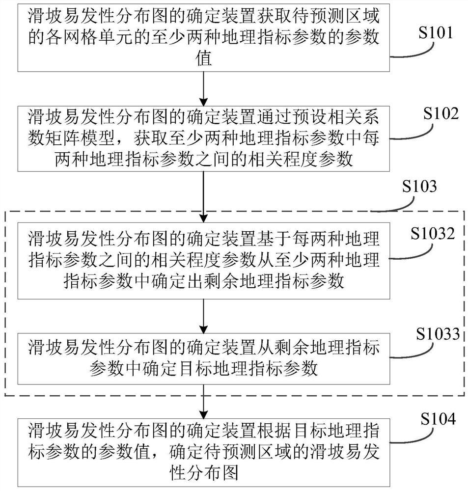
The application discloses a method, device and storage medium for determining landslide susceptibility distribution maps, which relate to the technical field of geology. The geographical index parameters are screened through the correlation between various geographical index parameters, thereby improving the determination accuracy. Accuracy of Landslide Susceptibility Maps. The method includes: obtaining the parameter values ​​of at least two geographic index parameters of each grid unit in the area to be predicted; obtaining the correlation between every two geographic index parameters in the at least two geographic index parameters through a preset correlation coefficient matrix model degree parameter; screen out the target geographic index parameter from at least two geographic index parameters based on the correlation degree parameter between every two geographic index parameters; determine the landslide susceptibility distribution of the area to be predicted according to the parameter value of the target geographic index parameter picture.

Description

technical field [0001] The embodiments of the present application relate to the technical field of geology, and in particular to a method, device and storage medium for determining a landslide susceptibility distribution map. Background technique [0002] As a common geological disaster, landslide has the characteristics of sudden outbreak, short duration and great harm, which seriously threatens the safety of human life and property. Therefore, determining the landslide susceptibility distribution map has become the key to the current disaster prevention and mitigation work. Through the landslide susceptibility distribution map, staff can quickly identify areas with high incidence of landslides. At present, the geographical index parameters in each region can be analyzed based on statistical principles to obtain the probability of landslides in each region, and then determine the landslide susceptibility distribution map based on the probability of landslides in each region...

Claims


Application Information

Patent Timeline
Patent Type & Authority Patents(China)
IPC IPC(8): G06F16/29G06F17/18G06Q10/06
CPCG06F16/29G06F17/18G06Q10/0635G06Q10/0639
Inventor 任周鹏
Owner INST OF GEOGRAPHICAL SCI & NATURAL RESOURCE RES CAS
Learn More