Geospatial data-oriented non-homogeneous digital token system

A technology of geospatial data and token system, applied in the field of non-homogeneous digital token system

Active Publication Date: 2021-12-10
重庆链图信息技术有限公司
View PDF4 Cites 0 Cited by
  • Summary
  • Abstract
  • Description
  • Claims
  • Application Information

AI Technical Summary

Problems solved by technology

[0004] Aiming at the deficiencies of the prior art, the purpose of the present invention is to provide a non-homogeneous digital token system for geospatial data, which uses consensus mechanisms, time stamps, homogenized and non-homogeneous tokens, etc. The representative block chain technology can solve the problems of current geospatial data certification, distribution authorization, arbitration evaluation, etc.

Method used


Image

  • Geospatial data-oriented non-homogeneous digital token system
  • Geospatial data-oriented non-homogeneous digital token system
  • Geospatial data-oriented non-homogeneous digital token system

Examples


Embodiment Construction

[0058] The specific implementation manner and working principle of the present invention will be further described in detail below in conjunction with the accompanying drawings.

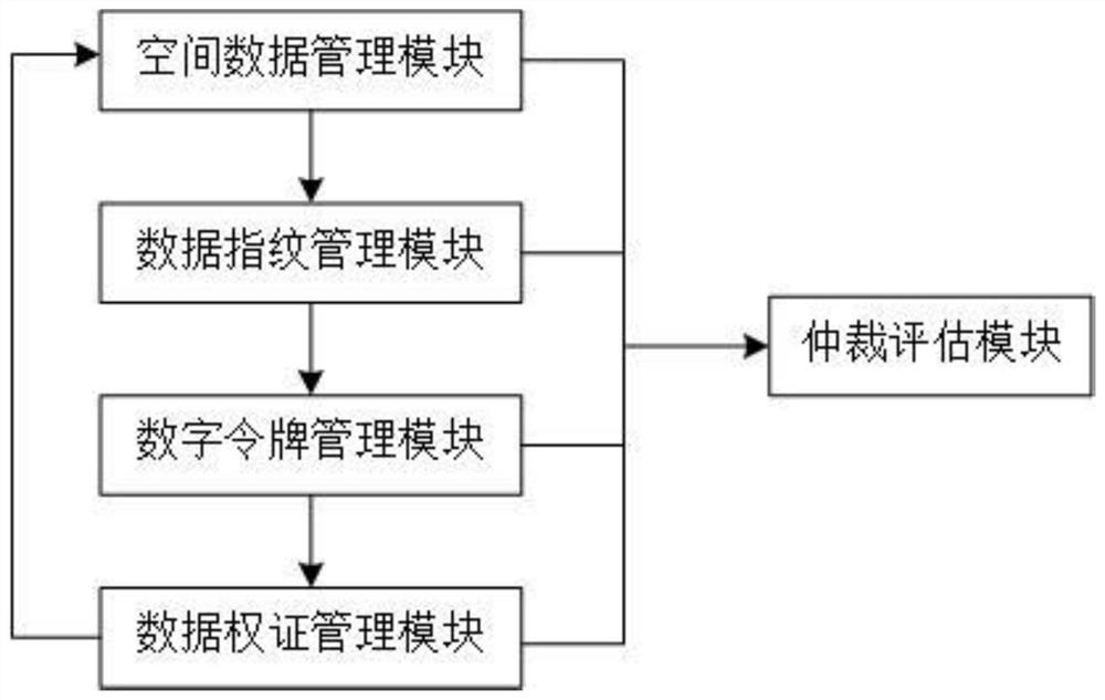
[0059] Such as figure 1 As shown, a non-homogeneous digital token system for geospatial data includes a spatial data management module, a data fingerprint management module, a digital token management module, a data warrant management module, and an arbitration evaluation module, wherein:

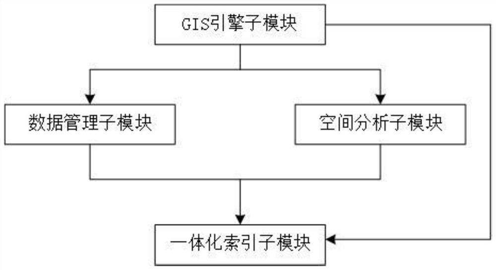
[0060] The spatial data management module mainly utilizes GIS technology to provide basic management and analysis functions for geospatial data, realize management capabilities such as import, export, storage, and indexing of geographic space, and realize various spatial analysis capabilities based on GIS;

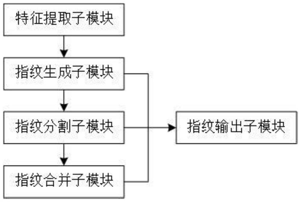
[0061] The data fingerprint management module extracts data that can uniquely identify geospatial data based on factors such as vector map data, raster map data (including remote sensing image data), and three...


PUM


Abstract

A geospatial data-oriented non-homogenized digital token system disclosed by the present invention comprises a space management module which is used for realizing the management and spatial analysis of the geospatial data; a data fingerprint management module which is used for extracting the fingerprint information capable of uniquely identifying the geospatial data and providing the corresponding management functions according to different operations in the distribution and use of the geospatial data; a digital token management module which is used for generating a digital token legal person representing the ownership and the use right of the corresponding geographic space data by adopting an asymmetric encryption mode based on the geographic space data fingerprint information generated by the data fingerprint module and by utilizing a block chain technology; and a data warrant management module which is used for providing warrant authentication for various users when the geographic space data are distributed and used. The system has the remarkable effects that the authentication management of the ownership and the use right of the geospatial data is effectively realized, the problem that the right cannot be effectively confirmed in the propagation and use of the geospatial data is solved, and the user is guided to be willing to invest in the collection, production, popularization and application of the geospatial data.

Description

technical field [0001] The invention relates to the technical field of digital authentication and management of geographical information data right confirmation, in particular to a non-homogeneous digital token system oriented to geographical space data. Background technique [0002] In the process of continuous advancement of smart city construction, the role of geospatial data and technology is becoming more and more prominent. Geospatial information is used as a carrier to integrate all-round data such as urban planning, construction, management, and operation, and spatial analysis methods are used to support urban intelligence. Management, analysis and decision-making prove that geographic information has become one of the core components of smart city construction. [0003] At the same time, with the dissemination and popularization of the concept of digital economy, government management departments are vigorously promoting the new social governance mechanism of "using...

Claims


Application Information

Patent Timeline
Patent Type & Authority Applications(China)
IPC IPC(8): G06F16/29G06F16/9537G06F21/45G06F21/60
CPCG06F16/29G06F16/9537G06F21/45G06F21/602
Inventor 朱俊丰
Owner 重庆链图信息技术有限公司
Why Eureka
Try Eureka