Typical galloping microtopography classification method and system based on empirical orthogonal function analysis
A technology of empirical orthogonal function and classification method, which is applied in the field of classification method and system of typical galloping micro-topography, can solve problems such as unclearness, wind direction, wind speed change, and galloping of transmission lines, and achieves strong practicability and accuracy. High, clear thinking effect
- Summary
- Abstract
- Description
- Claims
- Application Information
AI Technical Summary
Problems solved by technology
Method used
Image

Examples
Embodiment 1
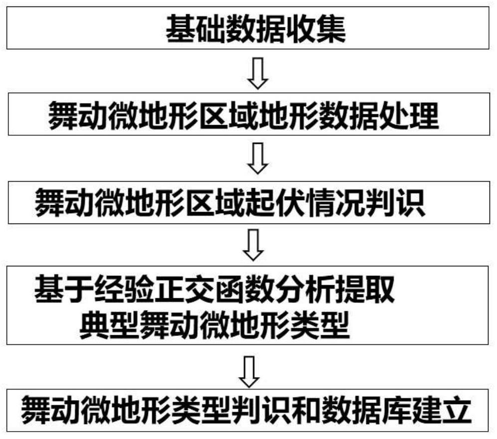
[0029] see figure 1 , the classification method of the typical galloping micro-topography based on the empirical orthogonal function analysis method of the present embodiment, comprises the following steps:
[0030] (1) Basic data collection.
[0031] Collect digital elevation data with a resolution of 30 meters in a specific area and historical transmission line galloping trip data in the area. Including the location of the dancing trip point, the number of trips and the corresponding time, and the latitude and longitude of the dancing trip point.
[0032] (2) Terrain data processing in the dancing micro-terrain area.
[0033] According to the location of the galloping trip point of the transmission line, the galloping center location data set T(t, 2) is established, where t is the number of historical galloping trip points, and 2 is the longitude and latitude of the trip point.
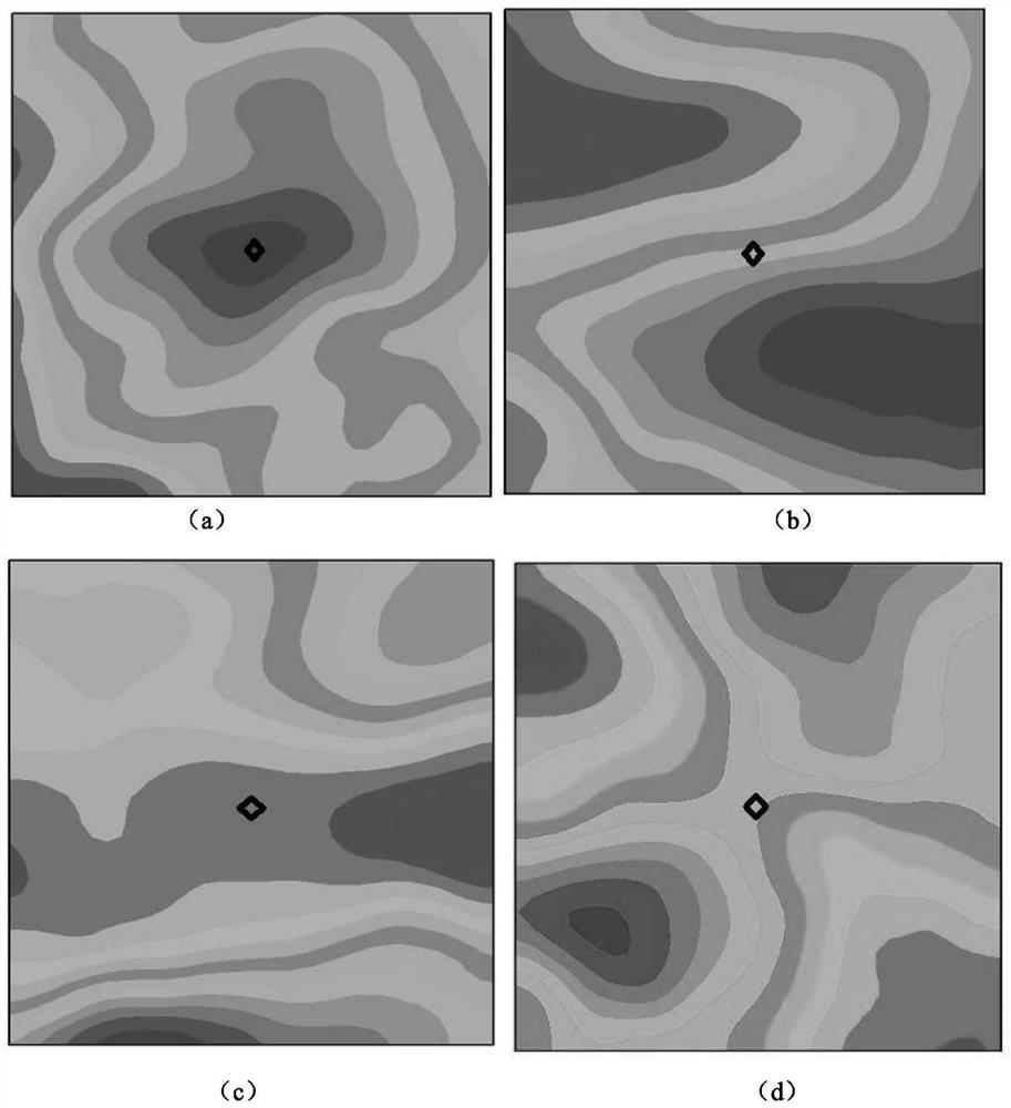
[0034] With each galloping trip point as the center, delineate a 3km×3km grid, and the axis o...
Embodiment 2
[0047] In this embodiment, a certain area in Shanxi, China is taken as an example. The typical dancing micro-terrain classification method based on the empirical orthogonal function analysis method of the present embodiment comprises the following steps:
[0048] (1) Basic data collection.
[0049]Collect digital elevation data with a resolution of 30 meters in Shanxi, China, and collect tripping data of transmission lines in Shanxi for the past ten years.
[0050] (2) Terrain data processing in the dancing micro-topography area.
[0051] According to the location of galloping trip points of transmission lines in Shanxi in the past ten years, a data set T(69,2) of the galloping center location is established, where 69 is the number of galloping trips in history, and 2 is the longitude and latitude of the trip point.
[0052] With each galloping trip point as the center, delineate a 3km×3km grid, and the axis of the grid is north-south and east-west. In this 3km×3km grid, the...
PUM
 Abstract
Description
Claims
Application Information
 - R&D Engineer
- R&D Manager
- IP Professional
- Industry Leading Data Capabilities
- Powerful AI technology
- Patent DNA Extraction
Browse by: Latest US Patents, China's latest patents, Technical Efficacy Thesaurus, Application Domain, Technology Topic.
© 2024 PatSnap. All rights reserved.Legal|Privacy policy|Modern Slavery Act Transparency Statement|Sitemap