
Clustering fusion method and device for ground elements in crowdsourcing high-precision map

A fusion method, high-precision technology, applied in geographic information databases, special data processing applications, instruments, etc., can solve problems such as reduced driving safety and comfort, inaccurate positioning of autonomous vehicles, and entering wrong lanes, and achieves convergence. Class-accurate, easy-to-execute, and robust effects

Pending Publication Date: 2022-02-11
WUHAN ZHONGHAITING DATA TECH CO LTD
View PDF0 Cites 0 Cited by
  • Summary
  • Abstract
  • Description
  • Claims
  • Application Information

AI Technical Summary

Problems solved by technology

Due to factors such as equipment in the process of ground feature collection, there are large errors in the collected data, which may lead to inaccurate positioning of the self-driving vehicle and enter the wrong lane, greatly reducing driving safety and comfort.

Method used


Image

  • Clustering fusion method and device for ground elements in crowdsourcing high-precision map
  • Clustering fusion method and device for ground elements in crowdsourcing high-precision map
  • Clustering fusion method and device for ground elements in crowdsourcing high-precision map

Examples


Embodiment Construction

[0046] The principles and features of the present invention are described below in conjunction with the accompanying drawings, and the examples given are only used to explain the present invention, and are not intended to limit the scope of the present invention.

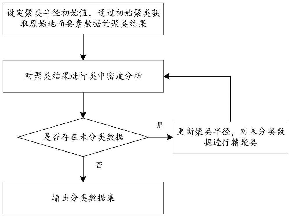
[0047] Such as figure 1 As shown, the embodiment of the present invention provides a method for clustering and fusing ground elements in a crowdsourced high-precision map, comprising the following steps:

[0048] S1, set the initial value of the clustering radius esp0, and obtain the clustering result of the original ground element data through initial clustering; the original ground element is represented by the central point coordinate p=(x, y, z) of its smallest circumscribed rectangle. In this embodiment, the initial clustering radius esp0=20.

[0049] Two data sets are defined here: unclassified data set Ω1 and classified data set Ω2.

[0050] S2. Perform cluster density analysis on the clustering results. If t...


PUM


Abstract

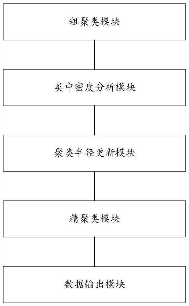
The invention relates to a clustering fusion method and device for ground elements in a crowdsourcing high-precision map. The method comprises the following steps of firstly, setting a clustering radius initial value esp0, and obtaining a clustering result of original ground element data through initial clustering, then, performing in-class density analysis on a clustering result, if the clustering result does not meet a classification condition, marking the clustering result as unclassified data, and if the clustering result meets the classification condition, putting the clustering result into a classification data set, and judging whether unclassified data exists or not, if so, updating the clustering radius, performing fine clustering on the unclassified data and performing in-class density analysis on a clustering result, and otherwise, outputting a classified data set. According to the method, the ground elements which are mixed together due to large acquisition errors in the same category are separated and clustered into different categories, a better ground element clustering result is obtained, and help is better provided for vehicle driving decision making.

Description

technical field [0001] The invention relates to the technical field of high-precision map production, in particular to a method and device for clustering and merging ground elements in a crowdsourced high-precision map. Background technique [0002] In the field of autonomous driving, in order to accurately control the driving of vehicles, it often involves the drawing of high-precision maps. In the process of drawing high-precision maps, it is necessary to cluster and fuse the collected ground element data to provide reference for driving decisions and positioning of autonomous vehicles. . When the sensors of the self-driving vehicle fail due to severe weather such as heavy fog, hail, and heavy rain, the vehicle can use the high-precision map data stored in the vehicle for subsequent driving. At the same time, high-precision maps can also allow self-driving vehicles to process road condition information beyond the normal field of vision. Due to the large errors in the col...

Claims


Application Information

Patent Timeline
Patent Type & Authority Applications(China)
IPC IPC(8): G06V10/762G06V10/80G06V10/764G06K9/62G06F16/29
CPCG06F16/29G06F18/2321G06F18/25G06F18/24
Inventor 肖德雨
Owner WUHAN ZHONGHAITING DATA TECH CO LTD
Learn More