
Real-time path generation method and device and automobile
A real-time path generation device technology, applied to measuring devices, road network navigators, instruments, etc., can solve problems such as collision risk, loss of local trajectory characteristics, and impact on vehicle ride comfort
- Summary
- Abstract
- Description
- Claims
- Application Information
AI Technical Summary
Problems solved by technology
Method used
Image

Examples
Embodiment Construction
[0041] In this patent, the specific implementation manner will be further described below in conjunction with the accompanying drawings and embodiments.
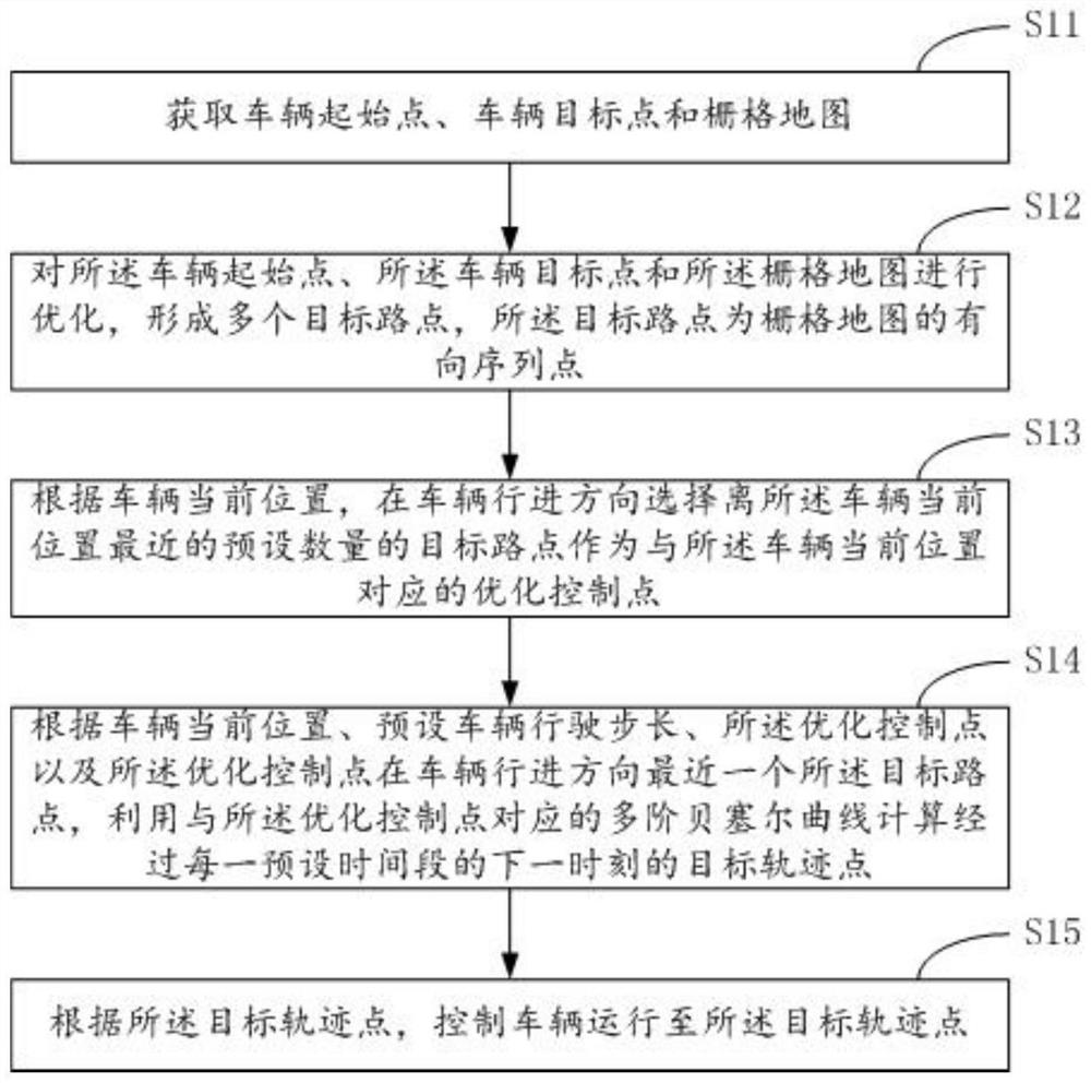
[0042] Such as figure 1As shown, the embodiment of the present invention provides a real-time path generation method, the method comprising:
[0043] Step S11, acquiring the starting point of the vehicle, the target point of the vehicle and the grid map.
[0044] It should be noted that in the route setting of unmanned driving, the target point of the vehicle is obtained through user input, the starting point of the vehicle is the starting point of the vehicle, and the grid map is mostly obtained through lidar perception, of course, it can also be obtained through cameras or other perception devices .
[0045] Step S12 , optimizing the starting point of the vehicle, the target point of the vehicle and the grid map to form a plurality of target waypoints, and the target waypoints are directed sequence points of the grid map...
PUM
 Abstract
Description
Claims
Application Information