Direct broadcast satellite imaging system and method providing real-time, continuous monitoring of earth from grostationary earth orbit

A technology for imaging satellites and synchronous orbits, which can be used in measuring devices, photographing devices, transportation and packaging, etc., and can solve problems such as unused

Inactive Publication Date: 2002-07-10
ASTROVISION INT
View PDF0 Cites 20 Cited by
  • Summary
  • Abstract
  • Description
  • Claims
  • Application Information

AI Technical Summary

Problems solved by technology

[0058] However, the HST is equipped with optics for observing celestial objects, not for Earth imaging

Method used


Image

  • Direct broadcast satellite imaging system and method providing real-time, continuous monitoring of earth from grostationary earth orbit
  • Direct broadcast satellite imaging system and method providing real-time, continuous monitoring of earth from grostationary earth orbit
  • Direct broadcast satellite imaging system and method providing real-time, continuous monitoring of earth from grostationary earth orbit

Examples


Embodiment Construction

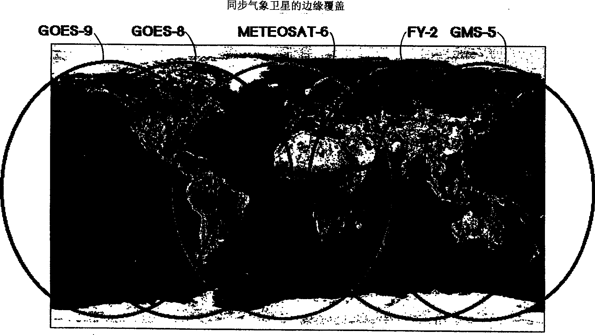
[0096]In the 40 years since the first Sputniks and the 30 years since the first weather monitoring satellites were placed in GEO, the ground has not been fully and adequately surveyed from the air. So far, there are insufficient institutions to observe and study all processes that occur during the day or night and at or near the Earth's surface that affect life on our planet. Furthermore, there is currently no capability, as a global system, to monitor the entire surface in real time and to distribute that data to all parts of the Earth in real time. The methods, devices and systems described herein aim to provide an integrated, synchronized and real-time observation platform of the Earth's global environment and to provide the information gathered from the observations to a global audience. Thus, coverage is formed at temporal spatial scales and resolutions that capture events on Earth that vary over short time periods and that can be observed by suitable electro-optical sens...


PUM


Abstract

A system, method and apparatus for collecting and distributing real-time, high resolution images of the Earth (302) from GEO include an electro-optical sensor based on multimegapixel two-dimensional charge coupled device (CCD) arrays mounted on a geostationary platform. At least four, three-axis stabilized satellites (300, 314) in Geostationary Earth orbit (GEO) provide worldwide coverage, excluding the poles. Image data that is collected at approximately 1 frame/sec, is broadcast over high-capacity communication links (306) (roughly 15 MHz bandwidth) providing real-time global coverage of the Earth at sub-kilometer resolutions directly to end users. This data may be distributed globally from each satellite through a system of space and ground telecommunication links. Each satellite carries at least two electro-optical imaging systems that operate at visible wavelengths so as to provide uninterrupted views of the Earth's full disk and coverage at sub-kilometer spatial resolutions of most or selected portions of the Earth's surface.

Description

technical field [0001] The present invention relates to methods, systems and services for global observation of the Earth at sub-kilometer spatial resolution in real-time, where real-time means that the delay in generating, updating and distributing each image does not exceed a total of two minutes. In particular, the invention aims at methods, devices and systems providing real-time coverage of at least 70% of the observable Earth's surface at a spatial resolution below 1 kilometer. The present invention also relates to meteorological warning systems and other warning systems related to light-visible information obtained from Earth and near-Earth observations that monitor short-term changes in the atmospheric, terrestrial and marine environments, caused by nature or humans, and that affect various aspects of human society. and long-term changes. Citing particularly innovative applications of data and services, including land, sea, and natural resource management, national se...

Claims


Application Information

Patent Timeline
Patent Type & Authority Applications(China)
IPC IPC(8): B64G1/66G01W1/08G01C11/02H04B7/19H04N5/225
CPCG01C11/025
Inventor 马尔科姆·A·勒孔特迈克尔·休因斯
Owner ASTROVISION INT
Why Eureka
Try Eureka