
Real time resolving method for satellite laser distance measuring multiple pulse fuzzy degree

A satellite laser ranging and multi-pulse technology, applied in the field of satellite laser ranging calculation, can solve problems such as ambiguity, achieve high observation efficiency, emit more pulses, and ensure the effect of output energy

Active Publication Date: 2006-08-23
INST OF EARTHQUAKE CHINA EARTHQUAKE ADMINISTRATION
View PDF0 Cites 5 Cited by
  • Summary
  • Abstract
  • Description
  • Claims
  • Application Information

AI Technical Summary

Problems solved by technology

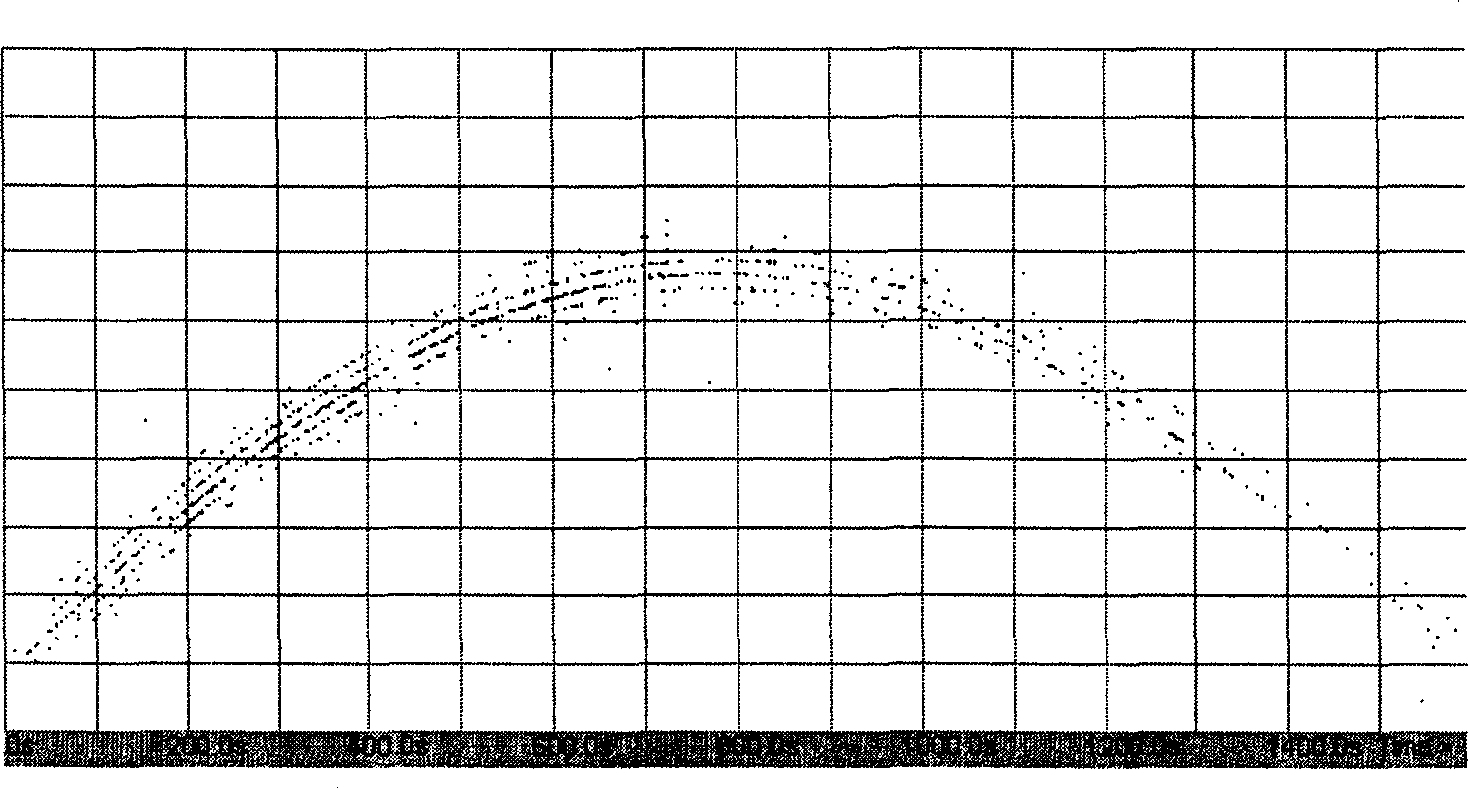
figure 1 It shows the test observation data of a lap of the Lageos satellite, there are 5 to 7 observation lines, but it is not known which observation line is correct, that is, the fuzzy problem that needs to be determined

Method used


Image

  • Real time resolving method for satellite laser distance measuring multiple pulse fuzzy degree

Examples


Embodiment Construction

[0026] 1. About the method of extrapolation calculation

[0027] The extrapolated bias increases over time and varies with the number of stations, data quality and quantity acquired from other stations.

[0028] When the elapsed time is 0 (that is, no extrapolation), when the LAGEOS satellite data of 1 / 3 stations around the world are obtained, the deviation can reach the centimeter level. Theory proves that in most cases, the deviation of 5 hours can be less than 0.2 meters. However, for different satellites and different observation data, it is really difficult to ensure that the deviation is less than 0.6 meters within 24 hours, which needs to be verified by experiments, even if this requirement cannot be met. By shortening the extrapolation time, we may obtain the latest data at any time because the observation data are online in real time, so it may only need to be extrapolated for 2 hours or even less. Or wait for a period of time (such as half a day) to solve the fuzzy ...


PUM


Abstract

This invention discloses a real time calculation method for multi-pulse fuzziness in the distance test of satellite laser, which utilizes the global information got in real time and the extrapolate satellite theory orbit to compare it with the actual test result to determine the true value from multiple fuzzy values, 1, getting observation data of part of SLR observation stations of the globe and instant star calendar from the network, 2, utilizing relative software and instant observation data to compute the satellite theory distance value of the latter period of time, 3, applying the precise orbit extrapolation method to select a correct value from the multiple values.

Description

technical field [0001] The invention relates to a method for resolving satellite laser ranging, in particular to a method for resolving multi-pulse ambiguities in real time. Background technique [0002] Satellite laser ranging (Satellite Laser Ranging, referred to as SLR) is to measure the distance by measuring the round-trip propagation time of the laser between the ground and the satellite. GPS (Global Positioning System), SAR (Synthetic Aperture Radar), etc.] SLR can calculate the absolute distance with only a single measurement, and has technical characteristics such as measurement accuracy and the measured distance are basically irrelevant. These characteristics determine its irreplaceable position in the field of space measurement technology. At present, space measurement technology based on VLBI, SLR, GPS and SAR has developed rapidly, and using it to monitor crustal movement is currently an active research field in geodynamics, earth's gravity field, ionospheric ra...

Claims


Application Information

Patent Timeline
IPC IPC(8): G01S17/08
Inventor 郭唐永乔学军杜瑞林李欣王培源
Owner INST OF EARTHQUAKE CHINA EARTHQUAKE ADMINISTRATION
Learn More