Method for confirming one-way distance in satellite laser ranging (SLR)
A technology for satellite laser ranging and laser ranging, which is applied in directions such as distance measurement, measurement device, line-of-sight measurement, etc., and can solve problems such as distance values that do not meet requirements
- Summary
- Abstract
- Description
- Claims
- Application Information
AI Technical Summary
Problems solved by technology
Method used
Image
Examples
Embodiment Construction
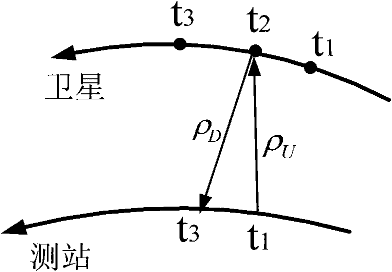
[0067] 1. Use the satellite laser ranging telescope to obtain artificial satellite SLR data, that is, a series of (t 3 , t 1 )Observations.
[0068] 2. For the observed value (t 3 , t 1 ) for data preprocessing, the data preprocessing method is as follows:
[0069] let t i The observed and calculated values of the satellite distance at each moment are ρ O (t i ), ρ C (t i ), the residual is
[0070] Δρ i = ρ O (t i )-ρ C (t i )
[0071] First, a polynomial with time as the independent variable is fitted to Δρ i (t), namely
[0072] Δ ρ i ( t ) = a 0 + a 1 t i + a 2 t i 2 + . . .
[0073] The undetermined coef...
PUM
 Abstract
Description
Claims
Application Information
 - R&D
- Intellectual Property
- Life Sciences
- Materials
- Tech Scout
- Unparalleled Data Quality
- Higher Quality Content
- 60% Fewer Hallucinations
Browse by: Latest US Patents, China's latest patents, Technical Efficacy Thesaurus, Application Domain, Technology Topic, Popular Technical Reports.
© 2025 PatSnap. All rights reserved.Legal|Privacy policy|Modern Slavery Act Transparency Statement|Sitemap|About US| Contact US: help@patsnap.com


