

Object identification and labeling tool for training autonomous vehicle controllers
a technology for autonomous vehicles and objects, applied in the field of autonomous vehicles, can solve the problems of inability to accurately identify the boundaries, suffer from human errors, inaccuracy, inconsistencies, etc., and achieve the effects of accurate visual ascertaining, discerning and/or identifying, and accurate identification of the overall boundaries
- Summary
- Abstract
- Description
- Claims
- Application Information
AI Technical Summary
Benefits of technology
Problems solved by technology
Method used
Image

Examples
Embodiment Construction
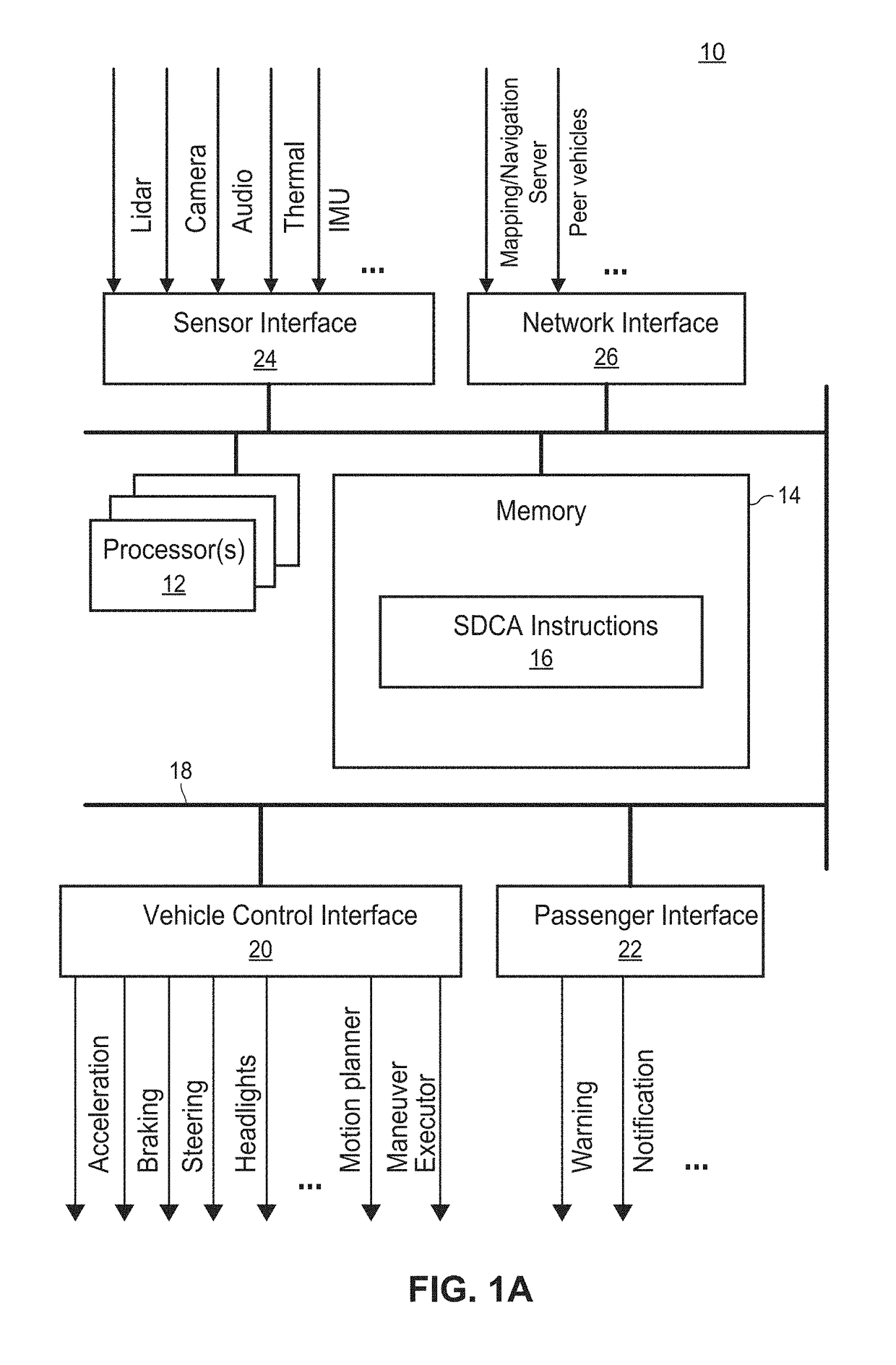
[0041]As previously noted, for ease of reading herein, and not for limitation purposes, the term “autonomous vehicle,” as used herein, may refer to a vehicle that is controlled and / or operated in a fully-autonomous manner, that is, a vehicle that is entirely self-driving. Additionally or alternatively, the term “autonomous vehicle” as used herein, may refer to a vehicle that is controlled and / or operated in a semi-autonomous manner or that is partially self-driving. Accordingly, the term “autonomous vehicle,” as used herein, is applicable to vehicles that operate at Level 1, Level 2, Level 3, Level 4, or Level 5 of SAE (Society of Automotive Engineers) International Standard J3016. As such, the term “autonomous,” as used herein, generally may be interpreted as “fully-autonomous and / or partially-autonomous” and / or as “entirely self-driving and / or partially self-driving.”
[0042]Example Self-Driving Control Architecture for Autonomous Vehicles
[0043]FIG. 1A includes a block diagram of an...
PUM
 Abstract
Description
Claims
Application Information