Computer vision systems and methods for geospatial property feature detection and extraction from digital images
a computer vision and feature detection technology, applied in the field of computer vision, can solve the problems of system time-consuming and difficult use, system can only detect certain types of objects, and require a great deal of manual input by users
- Summary
- Abstract
- Description
- Claims
- Application Information
AI Technical Summary
Benefits of technology
Problems solved by technology
Method used
Image
Examples
Embodiment Construction
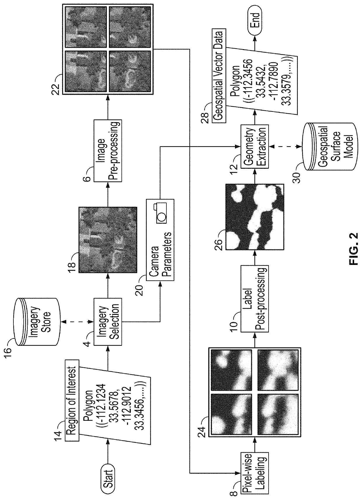
[0028]The present disclosure relates to a computer vision systems and methods for geospatial property feature detection and extraction from digital images, as discussed in detail below in connection with FIGS. 1-19. As will be discussed in greater detail below, the system can detect and extract both geometric and non-geometric features from digital images.
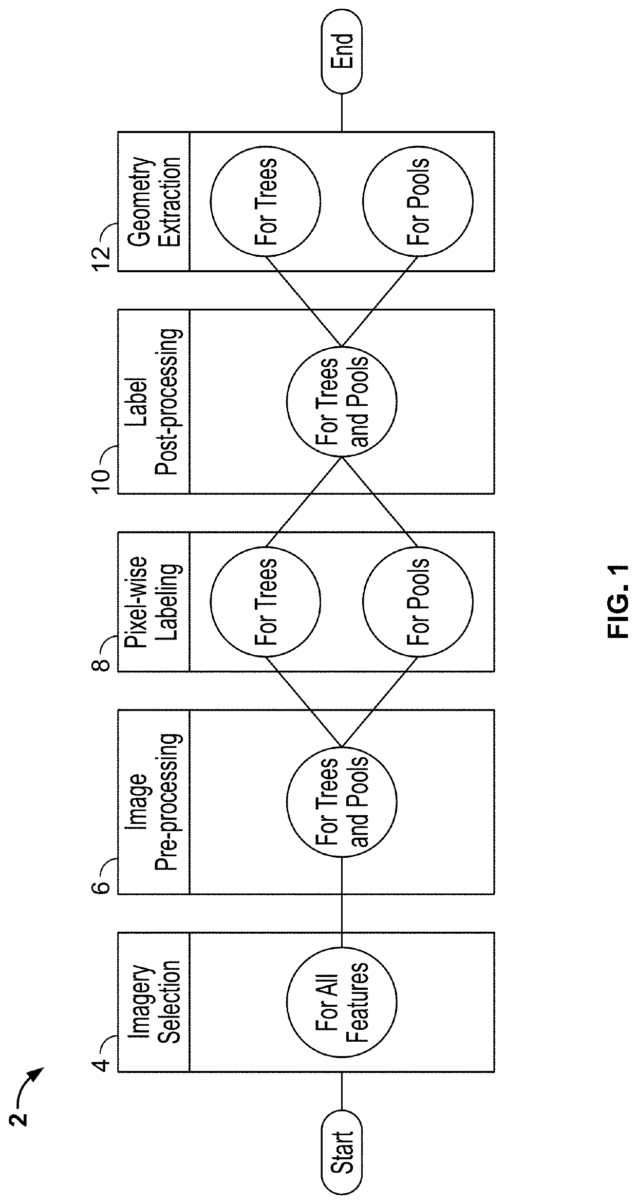
[0029]FIG. 1 is a flowchart showing processing steps 2 carried out by the geospatial property feature detection and extraction system of the present disclosure. In particular, the process flow can be thought of as a computation graph organized into a pipeline of five steps or phases. FIG. 1 shows the order of the phases: (1) imagery selection step 4, (2) image pre-processing step 6, (3) pixel-wise labeling step 8, (4) label post-processing step 10; and finally, (5) geometry extraction step 12. Each property feature which the system detects can use unique parameters or algorithms in each phase, but for efficiency, the parameters and...
PUM
 Abstract
Description
Claims
Application Information
 - R&D
- Intellectual Property
- Life Sciences
- Materials
- Tech Scout
- Unparalleled Data Quality
- Higher Quality Content
- 60% Fewer Hallucinations
Browse by: Latest US Patents, China's latest patents, Technical Efficacy Thesaurus, Application Domain, Technology Topic, Popular Technical Reports.
© 2025 PatSnap. All rights reserved.Legal|Privacy policy|Modern Slavery Act Transparency Statement|Sitemap|About US| Contact US: help@patsnap.com


