Satellite tomography of rain and motion via synthetic aperture
a satellite tomography and synthetic aperture technology, applied in the field of satellite tomography of precipitation and motion, can solve the problems of large radar instruments, large earth's surface unobserved by these radar systems, and large current space-based precipitation radar systems,
- Summary
- Abstract
- Description
- Claims
- Application Information
AI Technical Summary
Problems solved by technology
Method used
Image
Examples
Embodiment Construction
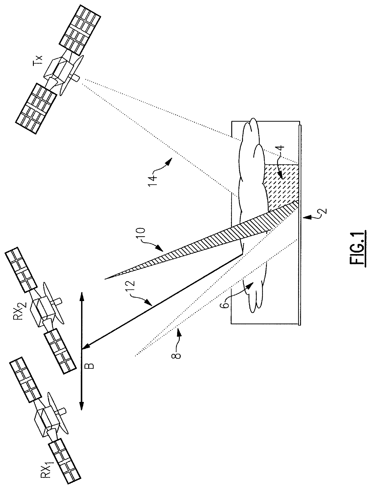
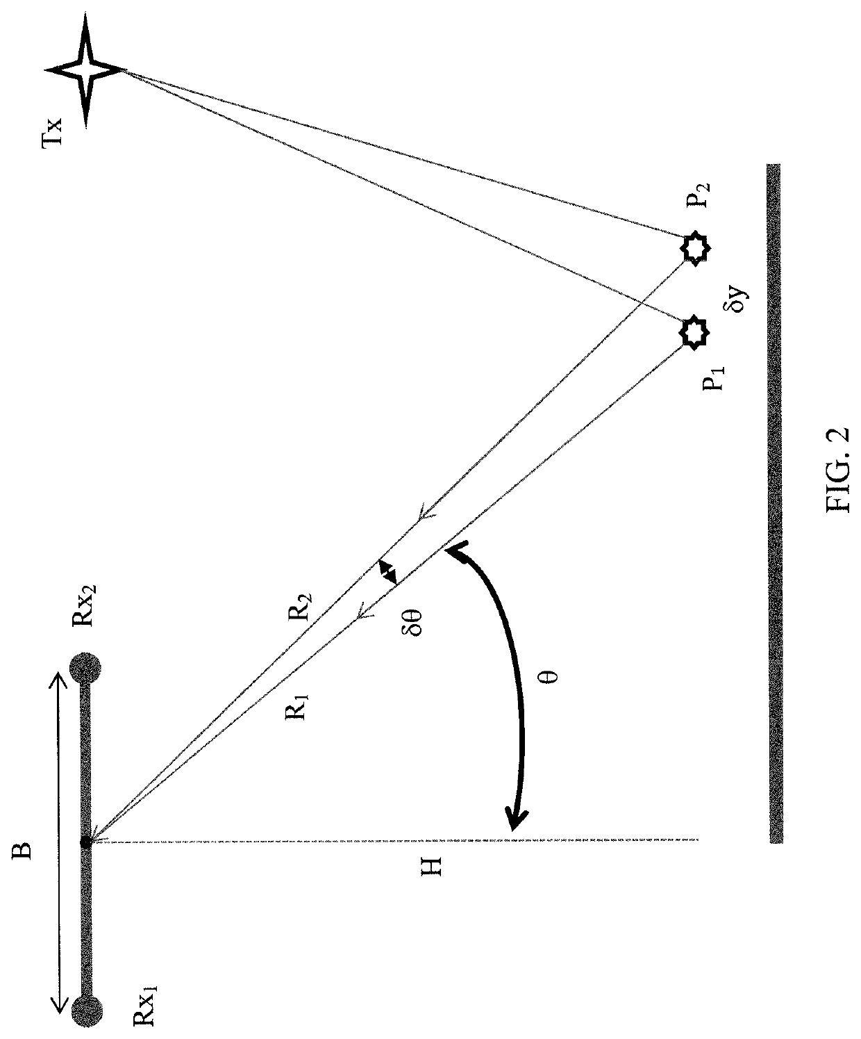
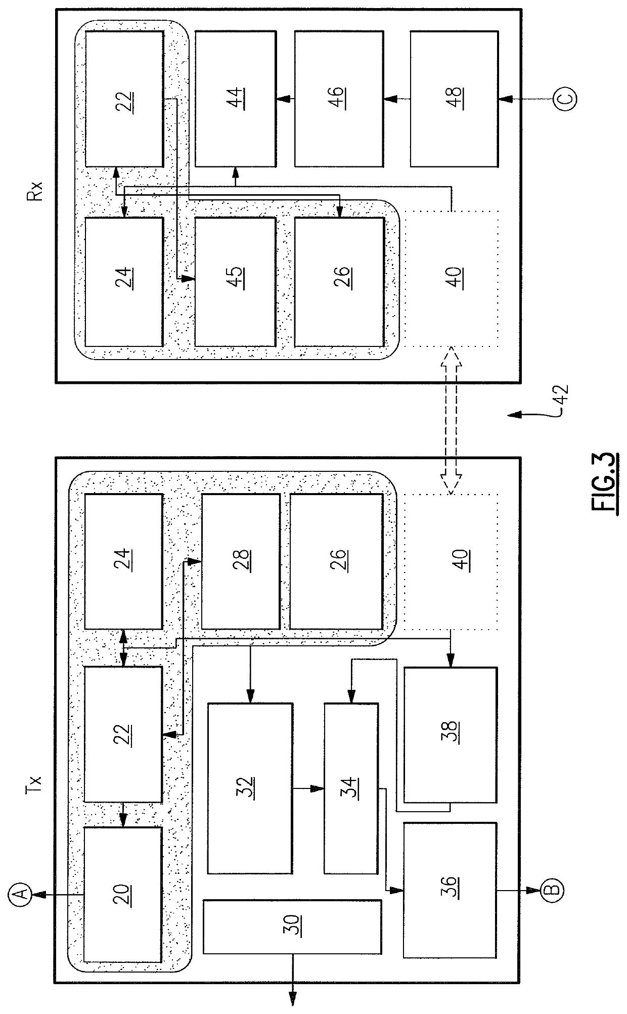
[0020]It has been recognized that the very large velocity difference between the observing platform and the observed precipitation field, when that observing platform is a spacecraft in low earth orbit, overcomes the echo decorrelation limitations previously encountered by researchers when attempting to observe the two dimensional (2D) precipitation fields using synthetic aperture RADAR from airborne platforms. Atlas, D. & Moore, R. K., 1987, “The Measurement of Precipitation with Synthetic Aperture Radar,” Journal of Atmospheric and Oceanic Technology, vol. 4, pp. 368-376. It is further recognized that multi-static synthetic aperture RADAR (SAR) observations of the precipitation fields which employ a plurality of receivers on different spacecraft at different cross-track orbital positions and which preserve phase difference information between the different receivers provides information on the cross-track precipitation field structure. When combined with the 2D SAR information gat...
PUM
 Abstract
Description
Claims
Application Information
 - R&D
- Intellectual Property
- Life Sciences
- Materials
- Tech Scout
- Unparalleled Data Quality
- Higher Quality Content
- 60% Fewer Hallucinations
Browse by: Latest US Patents, China's latest patents, Technical Efficacy Thesaurus, Application Domain, Technology Topic, Popular Technical Reports.
© 2025 PatSnap. All rights reserved.Legal|Privacy policy|Modern Slavery Act Transparency Statement|Sitemap|About US| Contact US: help@patsnap.com


