System and method for geolocation using imaging techniques
a geolocation and imaging technology, applied in image analysis, still video cameras, instruments, etc., can solve the problem that gps signals may not effectively penetrate the structure of buildings
- Summary
- Abstract
- Description
- Claims
- Application Information
AI Technical Summary
Problems solved by technology
Method used
Image
Examples
Embodiment Construction
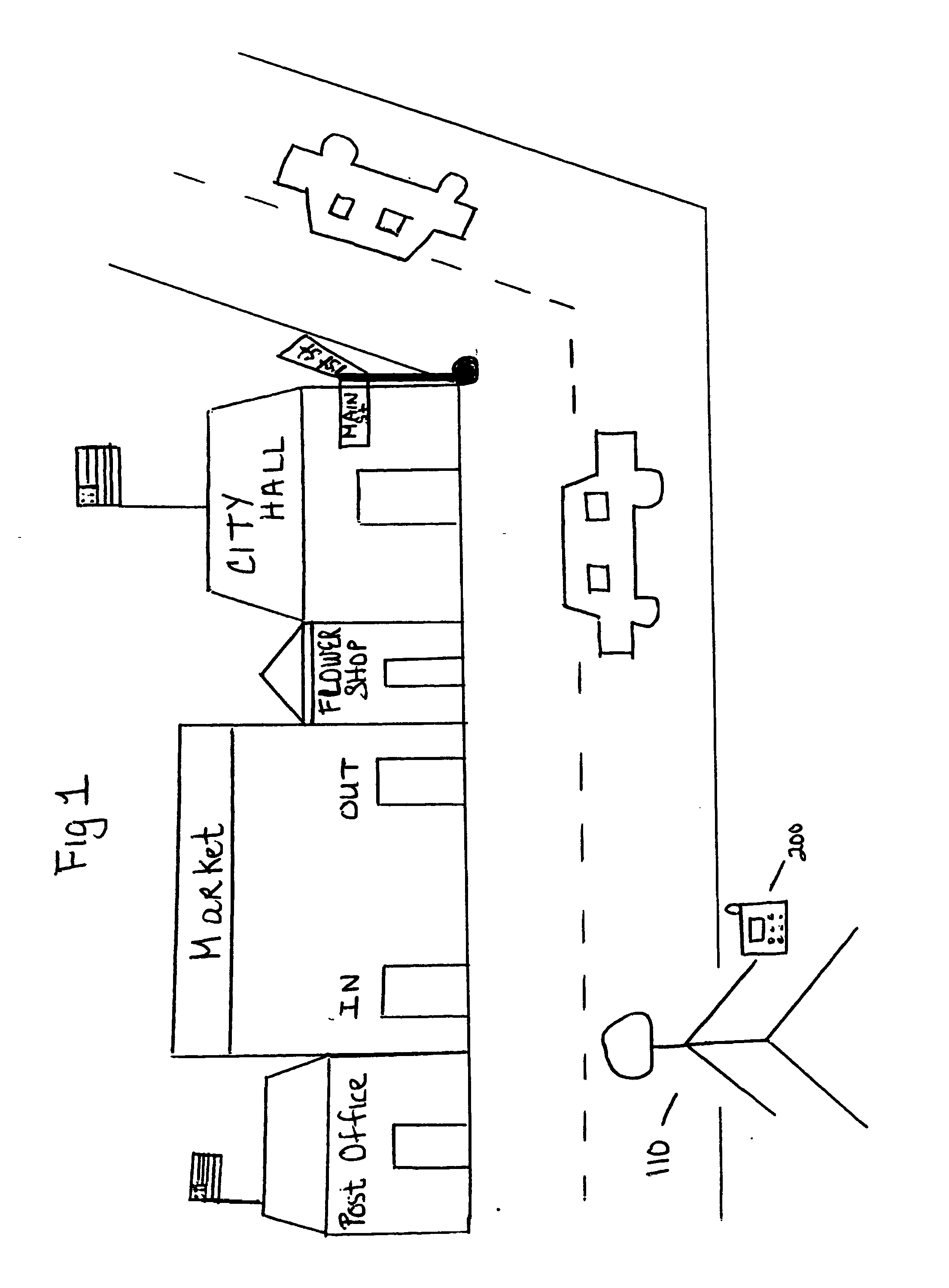
[0019]FIG. 1 illustrates a system for location determination using imaging techniques. A user 110 is at an undetermined location. The user 110 holds a wireless device 200 which is equipped with an image capturing device.
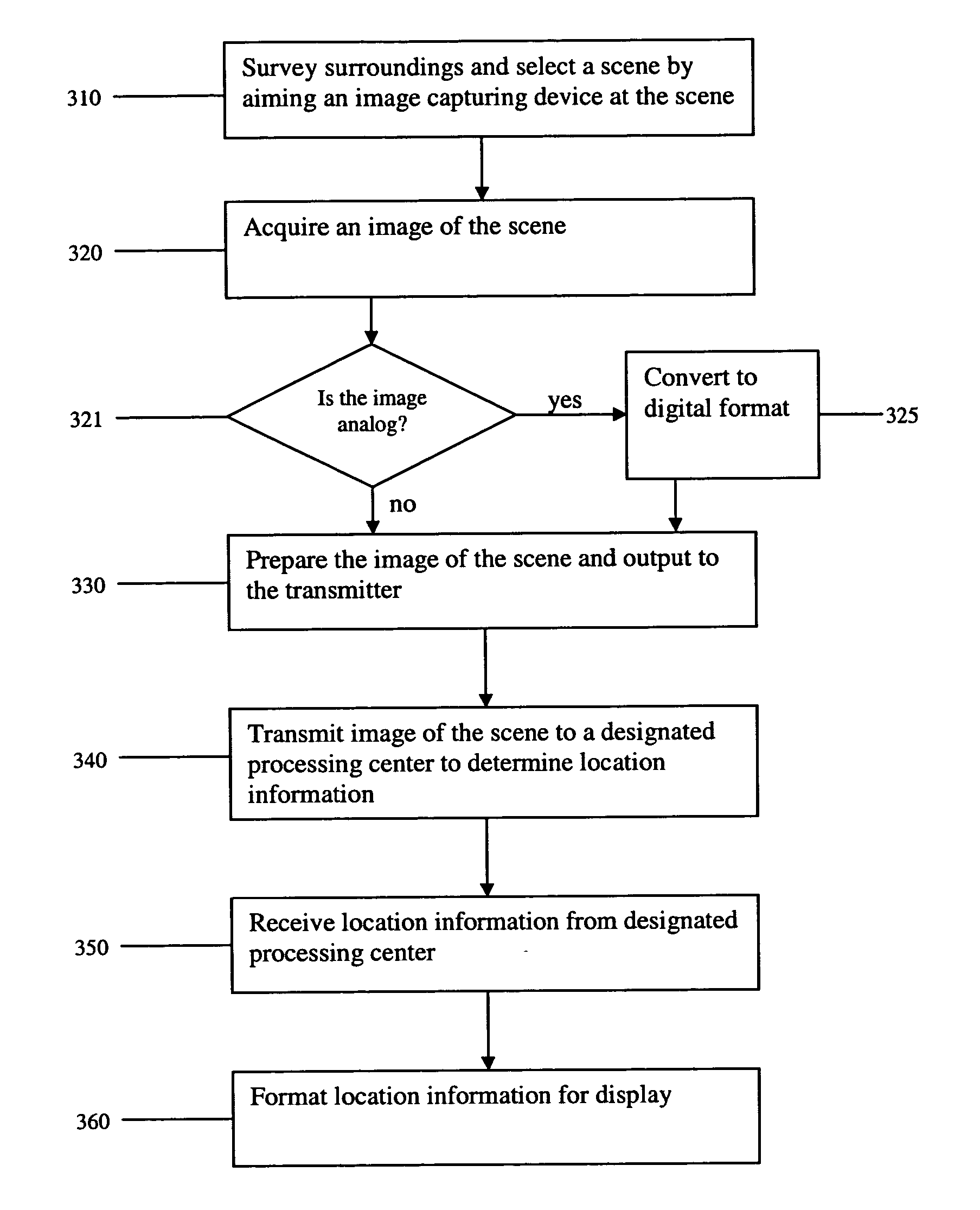
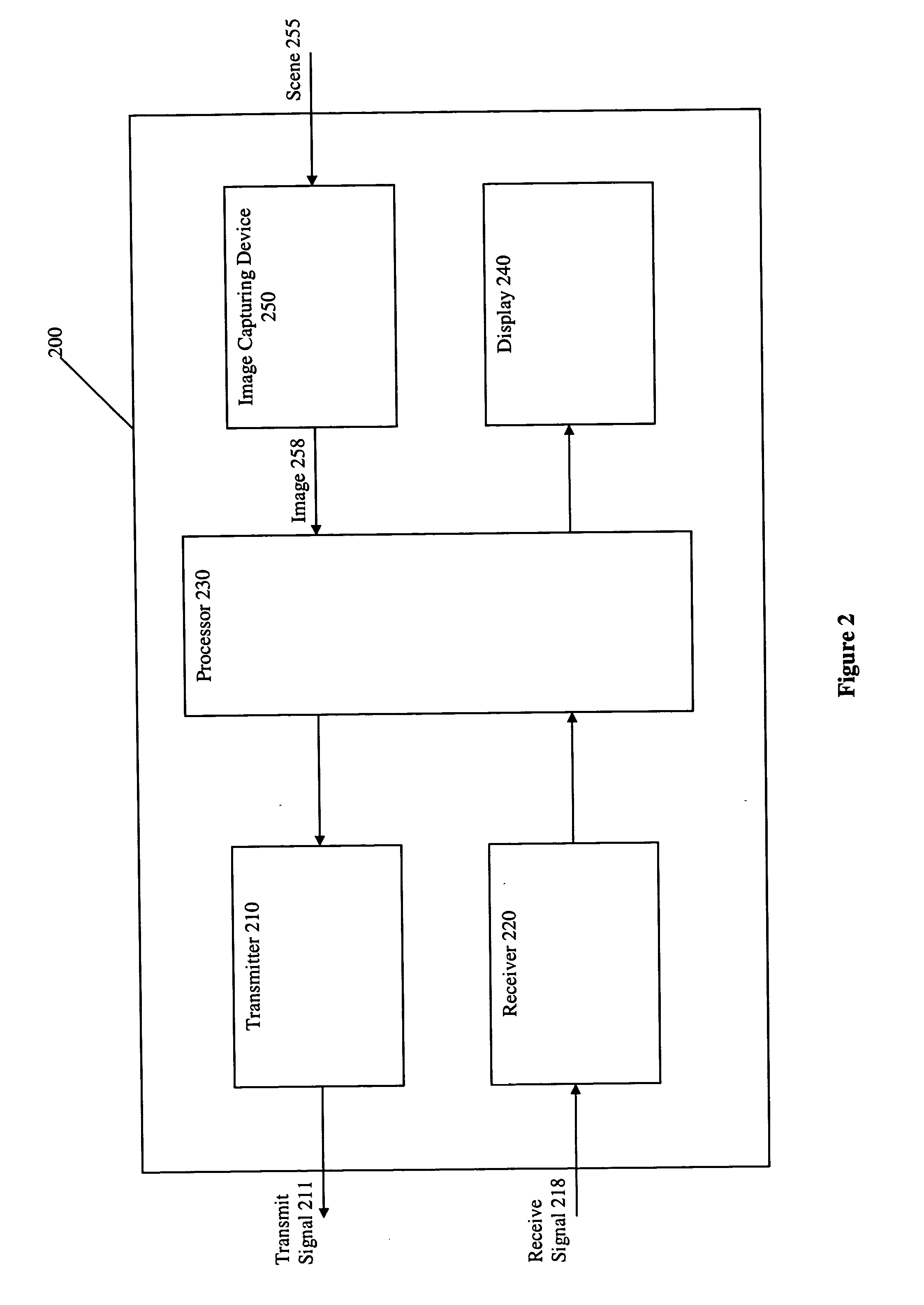
[0020]FIG. 2 is a block diagram of the wireless device 200. An image capturing device 250 may be a still camera that generates a snapshot or a video camera that generates a time-continuous picture or the like. The image capturing device 250 may generate either an analog or digital output. Additionally, the image capturing device 250 may have an adjustable, rotating and / or interchangeable reading head to allow three degrees of rotational freedom to permit better angular positioning towards a designated scene 255. The wireless device 200 also includes a transmitter 210 for transmitting a signal 211, a receiver 220 for receiving a signal 218, a processor 230 for processing an image 258 of the scene, and a display 240 for displaying information, including location coord...
PUM
 Abstract
Description
Claims
Application Information
 - R&D
- Intellectual Property
- Life Sciences
- Materials
- Tech Scout
- Unparalleled Data Quality
- Higher Quality Content
- 60% Fewer Hallucinations
Browse by: Latest US Patents, China's latest patents, Technical Efficacy Thesaurus, Application Domain, Technology Topic, Popular Technical Reports.
© 2025 PatSnap. All rights reserved.Legal|Privacy policy|Modern Slavery Act Transparency Statement|Sitemap|About US| Contact US: help@patsnap.com


