Navigation system for determining and utilizing monetary cost information

a technology of monetary cost and navigation system, applied in the field of navigation system for vehicles, can solve the problems of extra expense arising from monetary cost associated with a particular route, and achieve the effect of reducing the risk of accidents and avoiding accidents

Active Publication Date: 2005-05-19
HARMAN BECKER AUTOMOTIVE SYST
View PDF7 Cites 84 Cited by
  • Summary
  • Abstract
  • Description
  • Claims
  • Application Information

AI Technical Summary

Benefits of technology

[0006] A navigation system is provided that uses monetary cost-related information to determine one or more routes to a destination, where the monetary costs and / or travel time are associated with the routes. The navigation system may also use monetary cost-related information to navigate the vehicle. Because certain paths include tolls or other charges, the monetary costs associated with a particular route may be an important factor to a user selecting a route to a destination. A user may include anyone using the navigation system. The user may be located in the vehicle, such as the vehicle operator, driver, pilot, captain, or passenger, or may be located remotely from the vehicle, such as a manager of a fleet of vehicles. For example, if a large number of vehicles need to be controlled, such as in the case of fleet management, the extra expense arising from the monetary costs associated with a particular route may be important. However, other factors, such as the travel time associated with the route may also be important.

Problems solved by technology

Because certain paths include tolls or other charges, the monetary costs associated with a particular route may be an important factor to a user selecting a route to a destination.
For example, if a large number of vehicles need to be controlled, such as in the case of fleet management, the extra expense arising from the monetary costs associated with a particular route may be important.
First monetary costs may include monetary costs associated with a particular route or path section that do not depend on the route, but which may depend on the distance traveled, vehicle inherent costs, and other factors.
In addition, second monetary costs may depend on user-related data, such as whether the vehicle includes a route-use device needed to use or optimize the use of a route (such as a transponder or a vignette).

Method used


Image

  • Navigation system for determining and utilizing monetary cost information
  • Navigation system for determining and utilizing monetary cost information
  • Navigation system for determining and utilizing monetary cost information

Examples


Embodiment Construction

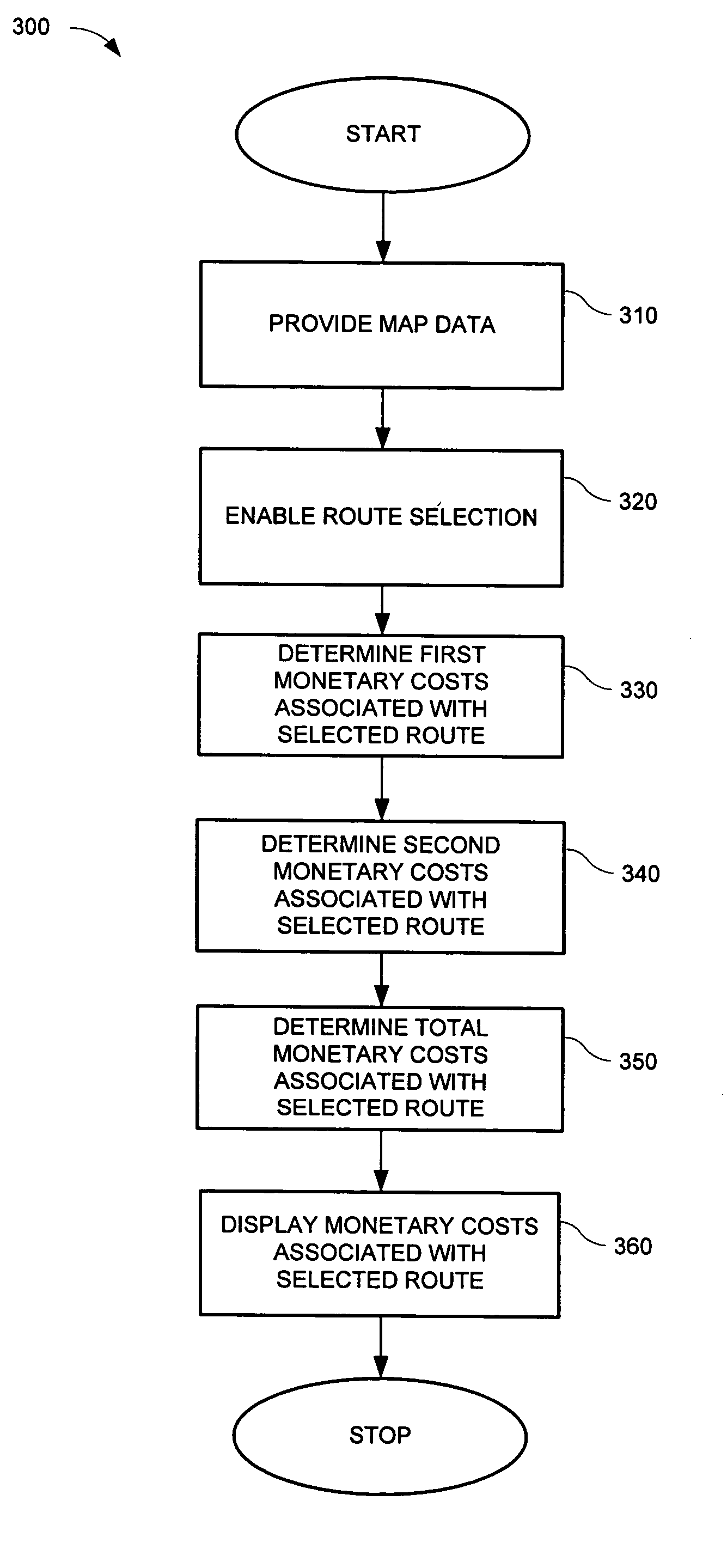
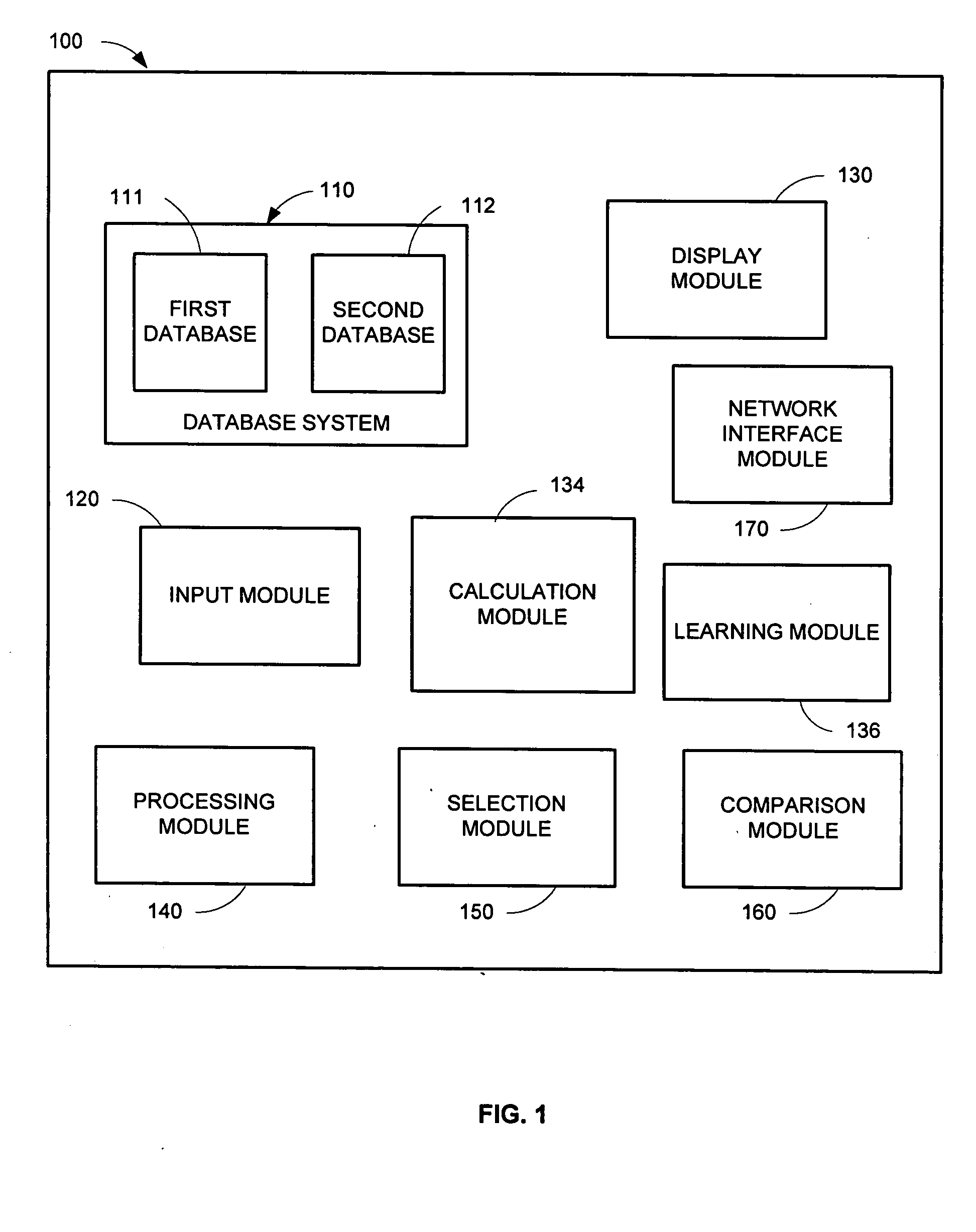
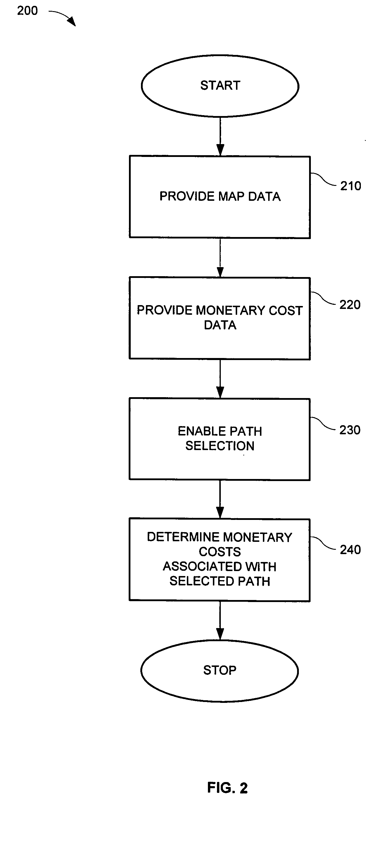
[0027]FIG. 1 shows a navigation system 100 that may be installed in a vehicle. Vehicles may include automobiles, trucks, lorries, farming equipment, mining equipment, golf carts and mobile robots. The navigation system 100 may be used for plotting waterways for ships, flight paths for planes, or with an autopilot system of an airplane or spaceship. The navigation system 100 may include a database system 110 that stores data containing map information that may be used to generate a map for the navigation system (“map data”), and information relating to the monetary costs associated with the paths and path sections used to generate the map (“monetary cost data”). The database system may further store other data containing any other items of information that may be used by the navigation system, such as information about points of interest.

[0028] The map data may be represented by one or more paths or path sections. The term “path sections” refers to paths, path sections, or a combina...


PUM


Abstract

A navigation system for a vehicle is presented that provides and utilizes monetary cost-related information. The navigation system may include a database system, calculation module, and comparison module. The database system stores path data and related monetary cost-related data, which include monetary costs that are route-depend and those that are not route-dependent. The calculation module determines routes to a destination, the monetary costs associated with the routes, and may determine the fastest, longest, and least expensive routes. The comparison module enables the determination of an optimal route based on various criteria, including monetary cost. The navigation system further includes methods for determining the monetary costs associated with a route, the travel time associated with a route, determining an optimal route, and for guiding the vehicle according to the monetary cost-related information.

Description

PRIORITY CLAIM [0001] This application claims priority based on European Patent Application No. 03019692.7, filed Sep. 9, 2003. The disclosure of the above application is incorporated herein by reference. BACKGROUND OF THE INVENTION [0002] 1. Technical Field [0003] This application relates to a navigation system for a vehicle. More particularly, the application relates to a navigation system that uses monetary cost-related information to determine one or more routes and / or travel times to a destination and / or to navigate the vehicle. [0004] 2. Related Art [0005] Vehicular navigation systems generally determine the current position of the vehicle and guide the user of the vehicle to a destination according to map information stored in the navigation system's database. A navigation system may guide the user of the system to a destination by determining one or more routes to the destination. The route may include one or more paths that are defined by the map information. A path may inc...

Claims


Application Information

Patent Timeline
Patent Type & Authority Applications(United States)
IPC IPC(8): G01C21/36G01C21/00G08G1/0968G08G1/0969
CPCG01C21/3461G08G1/0969G01C21/3697G01C21/3469G01C21/3667G01C21/387
Inventor BRULLE-DREWS, CHRISTIANSCHIRMER, HARTMUT
Owner HARMAN BECKER AUTOMOTIVE SYST
Why Eureka
Try Eureka