Map structure and method for producing

a map and structure technology, applied in the field of map structure, can solve the problems of damage to the map structure, damage to the map produced on relatively fragile materials such as paper, and other information that is particularly useful to hunters, and achieve the effects of eliminating inefficiencies, eliminating guesswork, and being easy to carry

Inactive Publication Date: 2005-08-18
KEENAN JOHN T +1
View PDF3 Cites 227 Cited by
  • Summary
  • Abstract
  • Description
  • Claims
  • Application Information

AI Technical Summary

Benefits of technology

[0016] The hunter or outdoor enthusiast might end up taping adjoining maps together, keeping various copies of different maps which presents a storage issue (many hunters claim to have so many maps for a single hunting region, it's rather cumbersome to manage them, let alone make use out of them in a consistent manner). The present invention brings an easy to use method for hunters to use only one (1) sheet of material (that is preferably placed on a rugged substrate suitable for the outdoors)—and thereby solves another problem for hunters—who may lose the benef

Problems solved by technology

Knowing where these regions are located in relation to each other and in relation to nearby cities, towns, or other known points or areas of interest poses a challenge for the everyday hunter, with respect to accurate and usable maps.
However, in the applicants' experience, hunting region information varies state by state, and maps are not generally available that uniquely express the specific boundaries of the hunting regions, and often do not provide other information that is particularly useful to hunters.
In addition, in the applicants' experience, if a hunter is provided with a map of his/her authorized hunting region, the hunter is likely to use the map in the outdoor conditions of the hunting region, and may handle the map in ways that can damage a map produced on relatively fragile material such as paper.
For example, applicants believe a map structure for use by a hunter in a hunting region is

Method used


Image

  • Map structure and method for producing
  • Map structure and method for producing
  • Map structure and method for producing

Examples


Embodiment Construction

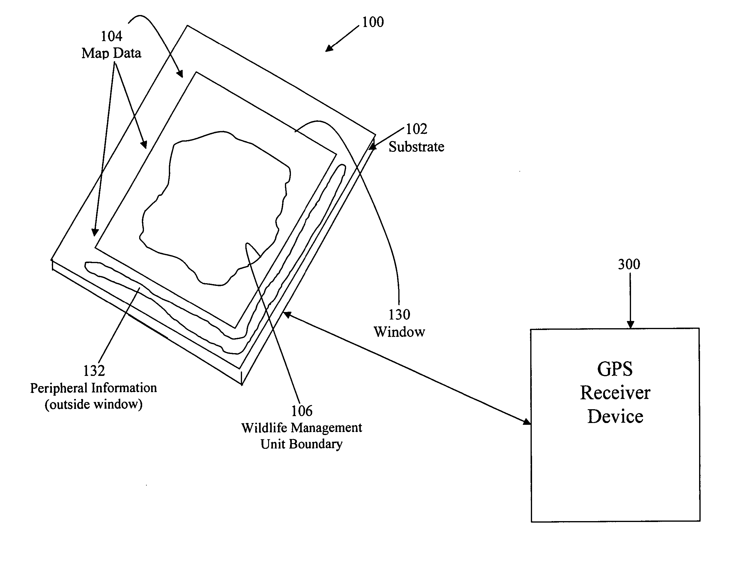
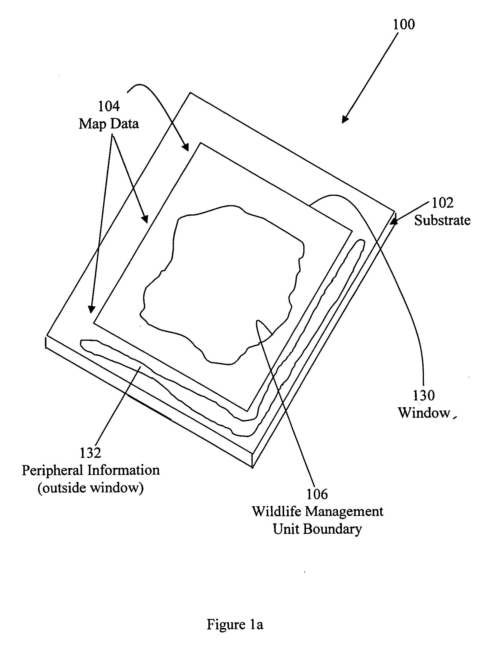
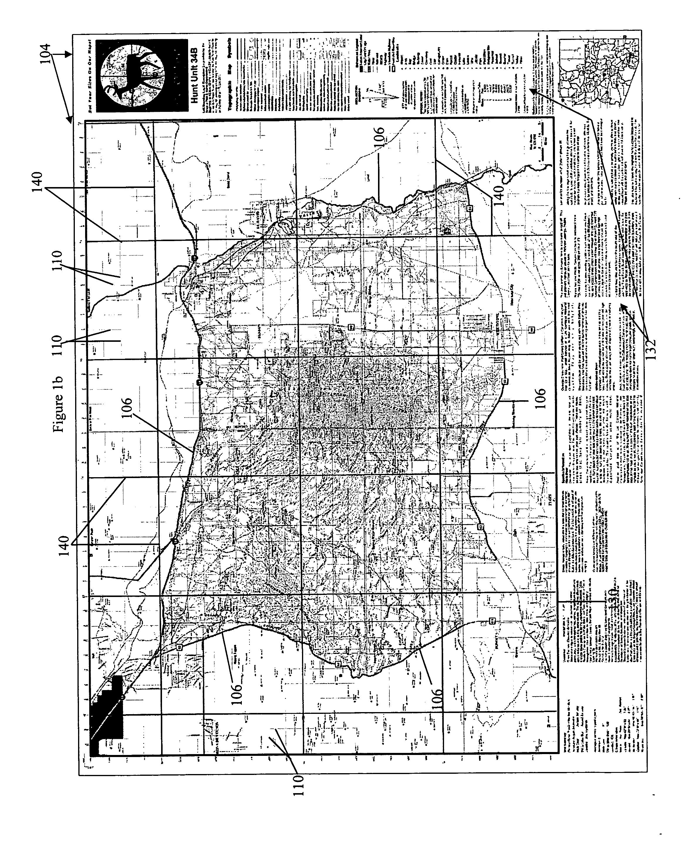
[0030] As described above, the present invention relates to a map structure, and to methods for producing the map structure, that is particularly useful as a map structure for a wildlife management unit such as a hunting region, that enables a hunter to effectively understand and efficiently function in an authorized hunting region. The principles of the invention are described below in connection with a map structure of a hunting region, and it will be apparent from that description how the principles of the invention can be used to produce and use a map structure for other types of specialized outdoor activity regions.

[0031] A map structure 100 according to the present invention comprises a substrate 102 and map data 104 produced on the substrate 102 (see FIG. 1a). The map data is produced from a data file 114 that is preferably created by the method illustrated in FIG. 2, as described more fully below.

[0032] The substrate 102 is a “single substrate” and the map data 104 is prod...


PUM


Abstract

A new and useful map structure, particularly for an activity within a special region having a geographic boundary, and a technique for creating a map structure are provided. The map and technique are particularly useful in providing a map for use by a hunter in a designated hunting region. The map structure comprises a substrate and map data produced on the substrate. The substrate is designed to withstand the conditions of the special region (e.g. an authorized hunting region), and of the type of handling it is likely to encounter in during the actively in the special region. The map data is also provided in a form that is likely to withstand the conditions of the special region, and is of a type that is particularly useful to the activity in the special region. Moreover, in producing the map structure, an electronic data file is created from which the map data can be produced on the substrate. The electronic data file is configured to produce map data that includes at a predetermined scale a boundary of a special geographic boundary of the special region in which a special outdoor activity, e.g. hunting, is authorized, and that map data includes information (e.g. water tank locations, GPS grid and coordinate information) that are particularly useful for the special outdoor activity.

Description

RELATED APPLICATION / CLAIM OF PRIORITY [0001] This application is related to and claims priority from provisional application Ser. No. 60 / 545,501, Filed: Feb. 18, 2004, which provisional application is incorporated by reference herein.BACKGROUND AND SUMMARY [0002] The present invention relates to a map structure that includes a geographic boundary of a specialized outdoor activity region, e.g. a hunting region, and to methods for producing such a map structure. [0003] Hunting regions (sometimes also referred to as hunting zones, hunting units, game or wildlife management units), are government-maintained geographic regions within a state or territory, in which special outdoor activities (e.g. hunting activities) are authorized at certain times of the year. Hunters receive authorization to hunt in specified hunting regions, and can only hunt in those specified regions, at specified times of the year. [0004] States across the U.S. have millions of square miles of land that are dedicate...

Claims


Application Information

Patent Timeline
IPC IPC(8): G06F7/00G06F17/00G09B29/00
CPCG09B29/004
Inventor KEENAN, VIKTOR M.MALONE, MARK D.
Owner KEENAN JOHN T
Why Eureka
Try Eureka